Country:
Region:
City:
Latitude and Longitude:
Time Zone:
Postal Code:
IP information under different IP Channel
ip-api
Country
Region
City
ASN
Time Zone
ISP
Blacklist
Proxy
Latitude
Longitude
Postal
Route
Luminati
Country
Region
sg
City
butschwil
ASN
Time Zone
Europe/Zurich
ISP
Bluewin
Latitude
Longitude
Postal
IPinfo
Country
Region
City
ASN
Time Zone
ISP
Blacklist
Proxy
Latitude
Longitude
Postal
Route
db-ip
Country
Region
City
ASN
Time Zone
ISP
Blacklist
Proxy
Latitude
Longitude
Postal
Route
ipdata
Country
Region
City
ASN
Time Zone
ISP
Blacklist
Proxy
Latitude
Longitude
Postal
Route
Popular places and events near this IP address

Krinau
Former municipality in St. Gallen, Switzerland
Distance: Approx. 3813 meters
Latitude and longitude: 47.33333333,9.05
Krinau is a former municipality in the Wahlkreis (constituency) of Toggenburg in the canton of St. Gallen in Switzerland. On 1 January 2013 Krinau merged into the municipality of Wattwil.
Bütschwil
Former municipality in St. Gallen, Switzerland
Distance: Approx. 1580 meters
Latitude and longitude: 47.35,9.06666667
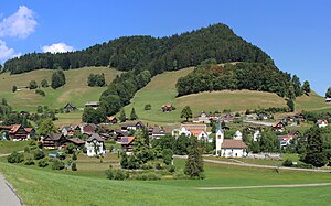
Bütschwil is a former municipality in the Wahlkreis (constituency) of Toggenburg in the canton of St. Gallen in Switzerland. On 1 January 2013 the former municipalities of Bütschwil and Ganterschwil merged to form the new municipality of Bütschwil-Ganterschwil.
Ganterschwil
Former municipality in St. Gallen, Switzerland
Distance: Approx. 2539 meters
Latitude and longitude: 47.38333333,9.08333333
Ganterschwil is a former municipality in the Wahlkreis (constituency) of Toggenburg in the canton of St. Gallen in Switzerland. On 1 January 2013 the former municipalities of Bütschwil and Ganterschwil merged to form the new municipality of Bütschwil-Ganterschwil.
Lütisburg
Municipality in St. Gallen, Switzerland
Distance: Approx. 4391 meters
Latitude and longitude: 47.4,9.08333333
Lütisburg is a municipality in the Wahlkreis (constituency) of Toggenburg in the canton of St. Gallen in Switzerland.

Mogelsberg
Former municipality in St. Gallen, Switzerland
Distance: Approx. 2802 meters
Latitude and longitude: 47.36666667,9.11666667
Mogelsberg is a municipality in the Wahlkreis (constituency) of Toggenburg in the canton of St. Gallen in Switzerland. Mogelsberg was an independent municipality until January 1, 2009, when it merged with Brunnadern and St.
Mosnang
Municipality in St. Gallen, Switzerland
Distance: Approx. 3755 meters
Latitude and longitude: 47.35,9.03333333
Mosnang is a village and municipality in the constituency (Wahlkreis) of Toggenburg in the Swiss canton of St. Gallen.
Oberhelfenschwil
Former municipality in St. Gallen, Switzerland
Distance: Approx. 1880 meters
Latitude and longitude: 47.35,9.1
Oberhelfenschwil is a former municipality in the Wahlkreis (constituency) of Toggenburg in the canton of St. Gallen in Switzerland. On 1 January 2023 the former municipalities of Hemberg and Oberhelfenschwil merged into the new municipality of Neckertal.
Bütschwil-Ganterschwil
Municipality in St. Gallen, Switzerland
Distance: Approx. 1580 meters
Latitude and longitude: 47.35,9.06666667
Bütschwil-Ganterschwil is a municipality in the Wahlkreis (constituency) of Toggenburg in the canton of St. Gallen in Switzerland. On 1 January 2013 the former municipalities of Bütschwil and Ganterschwil merged to form the new municipality of Bütschwil-Ganterschwil.
Lichtensteig railway station
Train station in Switzerland
Distance: Approx. 4523 meters
Latitude and longitude: 47.32,9.08305556
Lichtensteig railway station (German: Bahnhof Lichtensteig) is a railway station in Lichtensteig, in the Swiss canton of St. Gallen. It sits at the junction of the Bodensee–Toggenburg railway and Wil–Ebnat-Kappel railway and is served by local trains only.

Lütisburg railway station
Train station in Switzerland
Distance: Approx. 2692 meters
Latitude and longitude: 47.38382694,9.07067389
Lütisburg railway station (German: Bahnhof Lütisburg) is a railway station in Lütisburg, in the Swiss canton of St. Gallen. It is an intermediate stop on the Wil–Ebnat-Kappel line and is served by local trains only.

Bütschwil railway station
Train station in Switzerland
Distance: Approx. 427 meters
Latitude and longitude: 47.35959111,9.075135
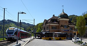
Bütschwil railway station (German: Bahnhof Bütschwil) is a railway station in Bütschwil-Ganterschwil, in the Swiss canton of St. Gallen. It is an intermediate stop on the Wil–Ebnat-Kappel line and is served by local trains only.
Dietfurt railway station
Train station in Switzerland
Distance: Approx. 1795 meters
Latitude and longitude: 47.34455,9.0783
Dietfurt railway station (German: Bahnhof Dietfurt) is a railway station in Bütschwil-Ganterschwil, in the Swiss canton of St. Gallen. It is an intermediate stop on the Wil–Ebnat-Kappel line and is served by local trains only.
Weather in this IP's area
broken clouds
10 Celsius
10 Celsius
9 Celsius
13 Celsius
1026 hPa
69 %
1026 hPa
958 hPa
10000 meters
0.91 m/s
0.85 m/s
21 degree
71 %
07:10:29
17:03:55


