Country:
 Switzerland
Region:
City:
Latitude and Longitude:
Time Zone:
Postal Code:
IP information under different IP Channel
ip-api
Country
Region
City
ASN
Time Zone
ISP
Blacklist
Proxy
Latitude
Longitude
Postal
Route
IPinfo
Country
Region
City
ASN
Time Zone
ISP
Blacklist
Proxy
Latitude
Longitude
Postal
Route
MaxMind
Country
Region
City
ASN
Time Zone
ISP
Blacklist
Proxy
Latitude
Longitude
Postal
Route
Luminati
Country
CHRegion
sg
City
lommenschwil
ASN
Time Zone
Europe/Zurich
ISP
Bluewin
Latitude
Longitude
Postal
db-ip
Country
Region
City
ASN
Time Zone
ISP
Blacklist
Proxy
Latitude
Longitude
Postal
Route
ipdata
Country
Region
City
ASN
Time Zone
ISP
Blacklist
Proxy
Latitude
Longitude
Postal
Route
Popular places and events near this IP address

Häggenschwil
Municipality in St. Gallen, Switzerland
Distance: Approx. 1746 meters
Latitude and longitude: 47.48333333,9.35
Häggenschwil is a municipality in the Wahlkreis (constituency) of St. Gallen in the canton of St. Gallen in Switzerland.

Muolen
Municipality in St. Gallen, Switzerland
Distance: Approx. 2889 meters
Latitude and longitude: 47.51666667,9.31666667
Muolen is a municipality in the Wahlkreis (constituency) of St. Gallen in the canton of St. Gallen in Switzerland.

Wittenbach
Municipality in St. Gallen, Switzerland
Distance: Approx. 3929 meters
Latitude and longitude: 47.46666667,9.36666667
Wittenbach is a municipality in the Wahlkreis (constituency) of St. Gallen in the canton of St. Gallen in Switzerland.

Sankt Pelagiberg
Village in Switzerland
Distance: Approx. 3475 meters
Latitude and longitude: 47.48805556,9.30055556
Sankt Pelagiberg is a village in the canton of Thurgau, Switzerland. The village is located in the former municipality Gottshaus. In 1996, Gottshaus municipality merged with its neighbor to form a new and larger municipality, Hauptwil-Gottshaus.

Mammertshofen Castle
Distance: Approx. 4073 meters
Latitude and longitude: 47.494611,9.397943
Mammertshofen Castle is a castle in the municipality of Roggwil of the Canton of Thurgau in Switzerland. It is a Swiss heritage site of national significance.

Bildegg Castle
Distance: Approx. 3692 meters
Latitude and longitude: 47.503478,9.295562
Bildegg Castle is a castle in the municipality of Zihlschlacht-Sitterdorf of the Canton of Thurgau in Switzerland. It is a Swiss heritage site of national significance.

Steinebrunn railway station
Train station in Switzerland
Distance: Approx. 3749 meters
Latitude and longitude: 47.53194444,9.35
Steinebrunn railway station (German: Bahnhof Steinebrunn) is a railway station in Egnach, in the Swiss canton of Thurgau. It is an intermediate stop on the Bodensee–Toggenburg line and is served by local trains only.
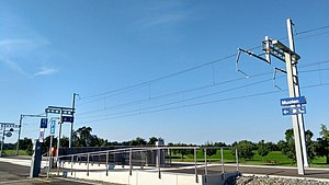
Muolen railway station
Train station in Switzerland
Distance: Approx. 2242 meters
Latitude and longitude: 47.51805556,9.33694444
Muolen railway station (German: Bahnhof Muolen) is a railway station in Muolen, in the Swiss canton of St. Gallen. It is an intermediate stop on the Bodensee–Toggenburg line and is served by local trains only.
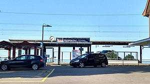
Häggenschwil-Winden railway station
Train station in Switzerland
Distance: Approx. 1264 meters
Latitude and longitude: 47.50388889,9.35888889
Häggenschwil-Winden railway station (German: Bahnhof Häggenschwil-Winden) is a railway station in Egnach, in the Swiss canton of Thurgau. The station sits just over the border from the Canton of St. Gallen, and its name comes from the St.

Roggwil-Berg railway station
Train station in Switzerland
Distance: Approx. 3854 meters
Latitude and longitude: 47.48611111,9.39194444
Roggwil-Berg railway station (German: Bahnhof Roggwil-Berg) is a railway station in Roggwil, in the Swiss canton of Thurgau. The station sits just over the border from the Canton of St. Gallen, and its name comes from the Thurgau municipality of Roggwil and the nearby St.

Dottenwil Castle
Castle in Switzerland
Distance: Approx. 3438 meters
Latitude and longitude: 47.47722,9.37722
Dottenwil Castle (German: Schloss Dottenwil) is a castle in the municipality of Wittenbach, St. Gallen. It is located on a hill 1.5 km (0.93 mi) north of Wittenbach, next to the hamlet of Dottenwil.
Ramschwag Ruins
Castle Ruins in Switzerland
Distance: Approx. 1899 meters
Latitude and longitude: 47.4899,9.3223
The Ramschwag Ruins (German: Ruine Alt-Ramschwag) are the ruins of a castle in the east of the municipality of Häggenschwil, in the Swiss canton of St. Gallen.
Weather in this IP's area
broken clouds
14 Celsius
14 Celsius
13 Celsius
17 Celsius
1012 hPa
100 %
1012 hPa
950 hPa
10000 meters
2.06 m/s
70 degree
75 %
07:45:46
18:29:20