176.126.86.238 - IP Lookup: Free IP Address Lookup, Postal Code Lookup, IP Location Lookup, IP ASN, Public IP
Country:
Region:
City:
Location:
Time Zone:
Postal Code:
ISP:
ASN:
language:
User-Agent:
Proxy IP:
Blacklist:
IP information under different IP Channel
ip-api
Country
Region
City
ASN
Time Zone
ISP
Blacklist
Proxy
Latitude
Longitude
Postal
Route
db-ip
Country
Region
City
ASN
Time Zone
ISP
Blacklist
Proxy
Latitude
Longitude
Postal
Route
IPinfo
Country
Region
City
ASN
Time Zone
ISP
Blacklist
Proxy
Latitude
Longitude
Postal
Route
IP2Location
176.126.86.238Country
Region
stockholms lan
City
nacka
Time Zone
Europe/Stockholm
ISP
Language
User-Agent
Latitude
Longitude
Postal
ipdata
Country
Region
City
ASN
Time Zone
ISP
Blacklist
Proxy
Latitude
Longitude
Postal
Route
Popular places and events near this IP address

Nacka Municipality
Municipality in Stockholm County, Sweden
Distance: Approx. 707 meters
Latitude and longitude: 59.31666667,18.16666667
Nacka Municipality (Nacka kommun) is a municipality in Stockholm County in east-central Sweden. Its seat is located at Nacka. The municipality is situated just east of the capital Stockholm and the western parts are considered a suburban part of the city of Stockholm.

Nacka
Place in Stockholm, Sweden
Distance: Approx. 57 meters
Latitude and longitude: 59.31,18.16388889
Nacka (Swedish pronunciation: [ˈnâkːa] ) is the municipal seat of Nacka Municipality and part of Stockholm urban area in Sweden. The municipality's name harks back to a 16th-century industrial operation established by the Crown at Nacka farmstead where conditions for water mills are good. However, and somewhat confusingly, that spot is not densely populated today and the municipal seat is on land that once belonged to Järla farmstead on the other side of Lake Järla.
Finntorp
Housing area in Nacka, Sweden
Distance: Approx. 1762 meters
Latitude and longitude: 59.30805556,18.13305556
Finntorp is a housing area in the municipality of Nacka, east of Stockholm, Sweden. Modern Finntorp was built from the 1940s.

Nackasändaren
Distance: Approx. 1744 meters
Latitude and longitude: 59.29611111,18.17583333
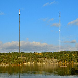
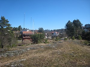
Nackasändaren is a facility for FM and TV-transmission at Nacka in Metropolitan Stockholm. It used from 1956 to 1983 two 160-metre-high (520 ft) guyed masts, which were designed as mast radiators for mediumwave transmission and therefore insulated against ground. In 1965 a further mast, a 299-metre-tall (981 ft) guyed steel lattice mast for FM and TV-transmissions was built.
Lilla Sjötullsbron
Distance: Approx. 2025 meters
Latitude and longitude: 59.32658333,18.14705556
Lilla Sjötullsbron (Swedish: "Small Sea Customs Bridge") is a concrete pedestrian bridge in central Stockholm, Sweden. Passing over Djurgårdsbrunnskanalen it connects Djurgården island to the mainland north of it. Completed in 1965, the bridge was named after the building of the canal guard, called Lilla sjötullen ("Small sea Customs"), built in the 1820s.
Isbladskärret
Distance: Approx. 2139 meters
Latitude and longitude: 59.32666667,18.14333333
Isbladskärret is a small lake on Djurgården, an island in central Stockholm, Sweden. The lake is much appreciated among bird-watchers, and, being part of the Royal National City Park, also carefully monitored by several organizations, including the World Wide Fund for Nature. The lake is one of six in Djurgården (including Northern Djurgården, north of the island), the others being Lillsjön, Uggleviken, Spegeldammen, Lappkärret, and Laduviken.
Kvarnholmen (Nacka)
Distance: Approx. 1523 meters
Latitude and longitude: 59.31657222,18.13967222
Kvarnholmen is a peninsula on the western part of the Nacka Municipality, south-east of Stockholm, Sweden. It is surrounded by the Saltsjön to the north and by the Svindersvik bay to the south. It used to only be connected in the south-west, but a permanent bridge now connects it in the south-east to the rest of Nacka.
Hästhagen, Nacka Municipality
Place in Södermanland, Sweden
Distance: Approx. 1404 meters
Latitude and longitude: 59.3,18.15
Hästhagen is a locality situated in Nacka Municipality, Stockholm County, Sweden with 499 inhabitants in 2010.

Thiel Gallery
Art museum in Stockholm, Sweden
Distance: Approx. 1561 meters
Latitude and longitude: 59.32222222,18.14861111
The Thiel Gallery (Swedish: Thielska galleriet) is an art museum in the Djurgården park area of Stockholm, Sweden. Represented are the members of the Artists Association (Konstnärsförbundet) from the early 1900s as well as one of the world's largest collections of works by Edvard Munch.

Järlasjön
Distance: Approx. 1404 meters
Latitude and longitude: 59.3,18.15
Järlasjön is a lake in Stockholm County, Södermanland, Sweden.

Källtorpssjön
Distance: Approx. 2001 meters
Latitude and longitude: 59.29252778,18.16344444
Källtorpssjön is a lake in Stockholm County, Södermanland, Sweden.

Svindersvik
Well-preserved 18th century country residence built in the 1740s, today part of Nordic Museum
Distance: Approx. 1916 meters
Latitude and longitude: 59.31,18.13
Svindersvik is a well-preserved 18th century country residence in Nacka Municipality, Sweden. Svindersvik lies just outside the city limits of Stockholm. It was built in the 1740s for Claes Grill, and today belongs to the Nordic Museum.
Weather in this IP's area
scattered clouds
2 Celsius
-1 Celsius
2 Celsius
2 Celsius
1023 hPa
95 %
1023 hPa
1018 hPa
10000 meters
2.96 m/s
8.82 m/s
256 degree
29 %


