176.126.242.92 - IP Lookup: Free IP Address Lookup, Postal Code Lookup, IP Location Lookup, IP ASN, Public IP
Country:
Region:
City:
Location:
Time Zone:
Postal Code:
ISP:
ASN:
language:
User-Agent:
Proxy IP:
Blacklist:
IP information under different IP Channel
ip-api
Country
Region
City
ASN
Time Zone
ISP
Blacklist
Proxy
Latitude
Longitude
Postal
Route
db-ip
Country
Region
City
ASN
Time Zone
ISP
Blacklist
Proxy
Latitude
Longitude
Postal
Route
IPinfo
Country
Region
City
ASN
Time Zone
ISP
Blacklist
Proxy
Latitude
Longitude
Postal
Route
IP2Location
176.126.242.92Country
Region
england
City
horningsea
Time Zone
Europe/London
ISP
Language
User-Agent
Latitude
Longitude
Postal
ipdata
Country
Region
City
ASN
Time Zone
ISP
Blacklist
Proxy
Latitude
Longitude
Postal
Route
Popular places and events near this IP address

Cambridge Business Park
Distance: Approx. 2506 meters
Latitude and longitude: 52.2281,0.1542
Cambridge Business Park is a large business complex in Cambridge, England, owned by the Crown Estate. It is home to many companies, mostly IT-related, such as Qualcomm, Autonomy, MathWorks and Red Gate Software, but also intellectual property firms such as Mewburn Ellis, Venner Shipley and Mathys and Squire. It is close to Cambridge North railway station and the Cambridgeshire Guided Busway, as well as Cambridge Science Park and St John's Innovation Centre.
Milton, Cambridgeshire
Human settlement in England
Distance: Approx. 1686 meters
Latitude and longitude: 52.24347,0.16147
Milton is a village just north of Cambridge, England, with a population for the village and greater parish of 4,400 in the 2021 census down from 4,679 at the 2011 census.
Waterbeach railway station
Railway station in Cambridgeshire, England
Distance: Approx. 2582 meters
Latitude and longitude: 52.262,0.197
Waterbeach railway station is on the Fen line in the east of England, serving the village of Waterbeach, Cambridgeshire. It is 61 miles 1 chain (98.2 km) measured from London Liverpool Street and 63 miles 29 chains (102 km) from London King's Cross; it is situated between Cambridge North and Ely stations. Its three-letter station code is WBC. The station and most trains calling are operated by Great Northern, with limited peak services being operated by Greater Anglia.
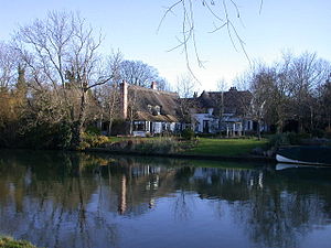
Horningsea
Village in Cambridgeshire, England
Distance: Approx. 92 meters
Latitude and longitude: 52.24051,0.18642
Horningsea is a small village north of Cambridge in Cambridgeshire in England. The parish covers an area of 2.6 square miles (6.7 km2; 1,700 acres). It lies on the east bank of the River Cam, and on the road from Cambridge to Clayhithe.

Fen Ditton
Human settlement in England
Distance: Approx. 2454 meters
Latitude and longitude: 52.22,0.17
Fen Ditton is a village and civil parish in the South Cambridgeshire district, on the northeast edge of Cambridge in Cambridgeshire, England. In 2011 the parish had a population of 760. The parish covers an area of 5.99 square kilometres (2 sq mi).
St John's Innovation Centre
Business incubator in Cambridge, United Kingdom
Distance: Approx. 2239 meters
Latitude and longitude: 52.2351,0.1536
St John's Innovation Centre (SJIC) is a business incubator in Cambridge, England. It houses a concentration of science and technology related businesses.
Redgate
British software company
Distance: Approx. 2634 meters
Latitude and longitude: 52.22944444,0.15083333
Redgate Software is a software company based in Cambridge, England. It develops tools for developers and data professionals and maintains community websites. The company describes itself as offering end-to-end Database DevOps to help organizations streamline software development and get value from their data faster.
Waterbeach Abbey
Distance: Approx. 2560 meters
Latitude and longitude: 52.2622,0.1947
Waterbeach Abbey was an abbey at Waterbeach in Cambridgeshire, England. It was established in 1294 by nuns from the Second Order of St. Francis who had come from Longchamp Abbey in France, which also at least inspired the Abbey of the Minoresses of St.

TeraView
Distance: Approx. 2383 meters
Latitude and longitude: 52.2342,0.1518
TeraView Limited, or TeraView, is a company that designs terahertz imaging and spectroscopy instruments and equipment for measurement and evaluation of pharmaceutical tablets, nanomaterials, ceramics and composites, integrated circuit chips and more. TeraView was co-founded by Michael Pepper (CSO) and Dr Don Arnone (CEO) as a spin-out of Toshiba Research Europe in April 2001. The company was set up to exploit the intellectual property and expertise developed in sourcing and detecting terahertz radiation (1 THz= 33.3 cm−1), using semiconductor technologies.

Quy Hall
Country house in Stow cum Quy, England
Distance: Approx. 2564 meters
Latitude and longitude: 52.227571,0.217274
Quy Hall is a Grade II* listed English country house at Stow cum Quy, Cambridgeshire. Originally dating from the late 15th century, it was completely remodelled in 1870. It stands in its own grounds overlooking a lake in the Quy Water.

Stow-Cum-Quy Fen
Distance: Approx. 2092 meters
Latitude and longitude: 52.242,0.216
Stow-Cum-Quy Fen is a 29.9-hectare (74-acre) biological Site of Special Scientific Interest west of Lode in Cambridgeshire. Most of it is common land. The site is calcareous loam pasture, with diverse flora and open pools which have rare aquatic plants.

Quy railway station
Disused railway station in Stow cum Quy, Cambridgeshire
Distance: Approx. 2203 meters
Latitude and longitude: 52.2327,0.2156
Quy railway station served the parish of Stow cum Quy, Cambridgeshire, England from 1884 to 1964 on the Cambridge to Mildenhall railway.
Weather in this IP's area
overcast clouds
3 Celsius
1 Celsius
3 Celsius
5 Celsius
1016 hPa
93 %
1016 hPa
1012 hPa
10000 meters
2.97 m/s
5.45 m/s
213 degree
100 %


