Country:
Region:
City:
Latitude and Longitude:
Time Zone:
Postal Code:
IP information under different IP Channel
ip-api
Country
Region
City
ASN
Time Zone
ISP
Blacklist
Proxy
Latitude
Longitude
Postal
Route
Luminati
Country
ASN
Time Zone
Europe/Warsaw
ISP
AS-GLOBALTELEHOST
Latitude
Longitude
Postal
IPinfo
Country
Region
City
ASN
Time Zone
ISP
Blacklist
Proxy
Latitude
Longitude
Postal
Route
db-ip
Country
Region
City
ASN
Time Zone
ISP
Blacklist
Proxy
Latitude
Longitude
Postal
Route
ipdata
Country
Region
City
ASN
Time Zone
ISP
Blacklist
Proxy
Latitude
Longitude
Postal
Route
Popular places and events near this IP address

La Pointe-de-l'Île
Federal electoral district in Quebec, Canada
Distance: Approx. 627 meters
Latitude and longitude: 45.651,-73.509
La Pointe-de-l'Île (French pronunciation: [la pwɛ̃t də lil]) is a federal electoral district in Quebec, Canada, that has been represented in the House of Commons of Canada since 2004. Its population in 2001 was 98,878. The riding was created in 2003 from parts of Anjou—Rivière-des-Prairies, Hochelaga—Maisonneuve, and Mercier ridings.

Montréal-Est
City in Quebec, Canada
Distance: Approx. 2891 meters
Latitude and longitude: 45.63,-73.52
Montreal East (French: Montréal-Est) is an on-island suburb in southwestern Quebec, Canada, on the island of Montreal. Montreal-Est has been home to many large oil refineries since 1915.
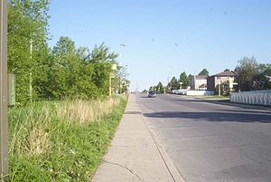
Rivière-des-Prairies–Pointe-aux-Trembles
Borough of Montreal in Quebec, Canada
Distance: Approx. 1683 meters
Latitude and longitude: 45.658903,-73.520728
Rivière-des-Prairies–Pointe-aux-Trembles (French pronunciation: [ʁivjɛʁ de pʁɛʁi pwɛ̃t o tʁɑ̃bl]) is a suburban borough (arrondissement) on the eastern tip of the city of Montreal, Quebec, Canada. It is located at the eastern end of the Island of Montreal.

Pointe-aux-Trembles station (Via Rail)
Railway station in Montreal, Quebec, Canada
Distance: Approx. 2934 meters
Latitude and longitude: 45.67833333,-73.49444444
Pointe-aux-Trembles station was a railroad station in Montreal, Quebec, Canada. It was located on the corner of Prince-Albert Street and 64th Avenue in the Rivière-des-Prairies–Pointe-aux-Trembles borough. The station has a disused station building and was an optional stop for two Via Rail routes from Montreal until January 3, 2013.
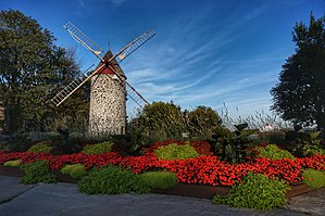
Pointe-aux-Trembles
Neighbourhood in Montreal, Quebec, Canada
Distance: Approx. 1165 meters
Latitude and longitude: 45.64233333,-73.50530556
Pointe-aux-Trembles (French pronunciation: [pwɛ̃t o tʁɑ̃bl]) was a municipality, founded in 1674, that was annexed by Montreal, Quebec, Canada, in 1982. This was the last city to be merged into Montreal until the 2002 municipal reorganization. On January 1, 2002 this neighbourhood at the far east end of the Island of Montreal became part of the borough of Rivière-des-Prairies–Pointe-aux-Trembles–Montréal-Est.
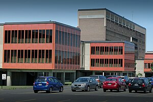
Institut Philippe-Pinel de Montréal
Hospital in Quebec, Canada
Distance: Approx. 2572 meters
Latitude and longitude: 45.655833,-73.533889
The Institut national de psychiatrie légale Philippe-Pinel is a psychiatric hospital located in Montreal, Quebec for individuals accused of crimes and found to be not criminally responsible due to mental disorder. It is located at 10905 Henri Bourassa Blvd. East in the borough of Rivière-des-Prairies–Pointe-aux-Trembles.
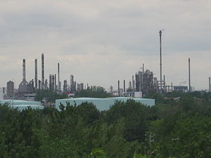
Montreal Refinery
Distance: Approx. 1907 meters
Latitude and longitude: 45.6438,-73.5224
The Montreal Refinery is an oil refinery located in the city of Montreal inside the Rivière-des-Prairies–Pointe-aux-Trembles borough. The refinery is not far from the Montreal East Refinery. This refinery is the largest Suncor Energy refinery.

Roussin Academy High School
Defunct high school in Montreal, Canada
Distance: Approx. 1546 meters
Latitude and longitude: 45.6407,-73.4905
Roussin Academy High School was located in Pointe-aux-Trembles (12085-1212, rue Notre-Dame Est), a district in the eastern part of Montreal. The school served the English-speaking Catholic population of Pointe-aux-Trembles, Montreal-Est, Anjou , and some off-island cities including Charlemagne. Roussin was amalgamated into Laurier Macdonald High School in the 1983–84 school year.

Fort Pointe-aux-Trembles
Distance: Approx. 1163 meters
Latitude and longitude: 45.6423,-73.505
Fort Pointe-aux-Trembles was a French fort built during the 17th century in New France.
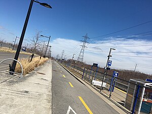
Rivière-des-Prairies station
Railway station in Quebec, Canada
Distance: Approx. 3090 meters
Latitude and longitude: 45.66055556,-73.53916667
Rivière-des-Prairies station is a commuter rail station operated by Exo in the borough of Rivière-des-Prairies–Pointe-aux-Trembles, in Montreal, Quebec, Canada. It is served by the Mascouche line. The station is located parallel to Boulevard Maurice-Duplessis at the corner of Rue Saint-Jean-Baptiste in Rivière-des-Prairies.

Pointe-aux-Trembles station
Railway station in Quebec, Canada
Distance: Approx. 2514 meters
Latitude and longitude: 45.67472222,-73.50611111
Pointe-aux-Trembles station is a commuter rail station operated by Exo in the borough of Rivière-des-Prairies–Pointe-aux-Trembles, in Montreal, Quebec, Canada. It is served by the Mascouche line. The station is located adjacent to Rue Sherbrooke Est in Pointe-aux-Trembles.

Pointe-aux-Prairies Nature Park
Large nature park in Montreal, Canada
Distance: Approx. 3579 meters
Latitude and longitude: 45.6833,-73.5139
Pointe-aux-Prairies Nature Park is a large nature park in the Rivière-des-Prairies–Pointe-aux-Trembles borough of Montreal, Quebec, Canada. The park is divided into three sections. The northern part is between Gouin Boulevard East and Autoroute 40.
Weather in this IP's area
clear sky
5 Celsius
4 Celsius
5 Celsius
7 Celsius
1032 hPa
56 %
1032 hPa
1031 hPa
10000 meters
1.34 m/s
1.34 m/s
235 degree
06:37:14
16:37:50