176.126.118.119 - IP Lookup: Free IP Address Lookup, Postal Code Lookup, IP Location Lookup, IP ASN, Public IP
Country:
Region:
City:
Location:
Time Zone:
Postal Code:
IP information under different IP Channel
ip-api
Country
Region
City
ASN
Time Zone
ISP
Blacklist
Proxy
Latitude
Longitude
Postal
Route
Luminati
Country
Region
04
City
nowe
ASN
Time Zone
Europe/Warsaw
ISP
Geckonet Sp. z o. o.
Latitude
Longitude
Postal
IPinfo
Country
Region
City
ASN
Time Zone
ISP
Blacklist
Proxy
Latitude
Longitude
Postal
Route
IP2Location
176.126.118.119Country
Region
kujawsko-pomorskie
City
grudziadz
Time Zone
Europe/Warsaw
ISP
Language
User-Agent
Latitude
Longitude
Postal
db-ip
Country
Region
City
ASN
Time Zone
ISP
Blacklist
Proxy
Latitude
Longitude
Postal
Route
ipdata
Country
Region
City
ASN
Time Zone
ISP
Blacklist
Proxy
Latitude
Longitude
Postal
Route
Popular places and events near this IP address

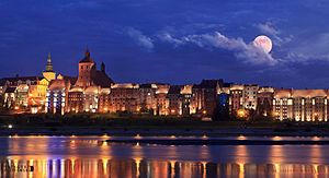
Grudziądz
Place in Kuyavian-Pomeranian Voivodeship, Poland
Distance: Approx. 388 meters
Latitude and longitude: 53.4875,18.755
Grudziądz [ˈɡrud͡ʑɔnt͡s] (Latin: Graudentum, Graudentium, German: Graudenz) is a city in northern Poland, with 92,552 inhabitants (2021). Located on the Vistula River, it lies within the Kuyavian-Pomeranian Voivodeship and is the fourth-largest city in its province. The Old Town of Grudziądz and 14th-century granaries were declared National Historic Monuments of Poland.

Grudziądz County
County in Kuyavian-Pomeranian Voivodeship, Poland
Distance: Approx. 1754 meters
Latitude and longitude: 53.4925,18.77611111
Grudziądz County (Polish: powiat grudziądzki) is a unit of territorial administration and local government (powiat) in Kuyavian-Pomeranian Voivodeship, north-central Poland. It came into being on January 1, 1999, as a result of the Polish local government reforms passed in 1998. Its administrative seat is the city of Grudziądz, although the city is not part of the county (it constitutes a separate city county).
Gmina Grudziądz
Gmina in Kuyavian-Pomeranian Voivodeship, Poland
Distance: Approx. 1754 meters
Latitude and longitude: 53.4925,18.77611111
Gmina Grudziądz is a rural gmina (administrative district) in Grudziądz County, Kuyavian-Pomeranian Voivodeship, in north-central Poland. Its seat is the town of Grudziądz, although the town is not part of the territory of the gmina. Meer of the Gmina Grudziądz is Jan Tesmer.

Gmina Dragacz
Gmina in Kuyavian-Pomeranian Voivodeship, Poland
Distance: Approx. 2406 meters
Latitude and longitude: 53.50222222,18.73388889
Gmina Dragacz is a rural gmina (administrative district) in Świecie County, Kuyavian-Pomeranian Voivodeship, in north-central Poland. Its seat is the village of Dragacz, which lies approximately 23 kilometres (14 mi) north-east of Świecie and 53 km (33 mi) north of Toruń. The gmina covers an area of 111.14 square kilometres (42.9 sq mi), and as of 2006 its total population is 6,884.
Gać, Kuyavian-Pomeranian Voivodeship
Village in Kuyavian-Pomeranian Voivodeship, Poland
Distance: Approx. 3630 meters
Latitude and longitude: 53.46666667,18.8
Gać (Polish: [ɡat͡ɕ]) is a village in the administrative district of Gmina Grudziądz, within Grudziądz County, Kuyavian-Pomeranian Voivodeship, in north-central Poland. It lies approximately 4 kilometres (2 mi) south-east of Grudziądz and 50 km (31 mi) north of Toruń.
Węgrowo
Village in Kuyavian-Pomeranian Voivodeship, Poland
Distance: Approx. 4377 meters
Latitude and longitude: 53.47027778,18.81555556
Węgrowo [vɛŋˈɡrɔvɔ] is a village in the administrative district of Gmina Grudziądz, within Grudziądz County, Kuyavian-Pomeranian Voivodeship, in north-central Poland. It lies approximately 4 kilometres (2 mi) south-east of Grudziądz and 51 km (32 mi) north of Toruń.
Bratwin
Village in Kociewie
Distance: Approx. 4053 meters
Latitude and longitude: 53.46666667,18.7
Bratwin [ˈbratfin] is a village in the administrative district of Gmina Dragacz, within Świecie County, Kuyavian-Pomeranian Voivodeship, in north-central Poland. It lies approximately 5 kilometres (3 mi) south-west of Dragacz, 19 km (12 mi) east of Świecie, and 49 km (30 mi) north of Toruń. Bratwin is located within the ethnocultural region of Kociewie.
Dolna Grupa
Village in Kociewie
Distance: Approx. 5035 meters
Latitude and longitude: 53.49583333,18.68027778
Dolna Grupa (Polish pronunciation: [ˈdɔlna ˈɡrupa]) is a village in the administrative district of Gmina Dragacz, within Świecie County, Kuyavian-Pomeranian Voivodeship, in north-central Poland. It lies approximately 4 kilometres (2 mi) west of Dragacz, 19 km (12 mi) north-east of Świecie, 7 kilometres (4 mi) west of Grudziadz and 52 km (32 mi) north of Toruń. The village is located within the ethnocultural region of Kociewie.
Dragacz
Village in Kuyavian-Pomeranian Voivodeship, Poland
Distance: Approx. 2406 meters
Latitude and longitude: 53.50222222,18.73388889
Dragacz [ˈdraɡat͡ʂ] is a village in Świecie County, Kuyavian-Pomeranian Voivodeship, in north-central Poland. It is the seat of the gmina (administrative district) called Gmina Dragacz. It lies approximately 23 kilometres (14 mi) north-east of Świecie and 53 km (33 mi) north of Toruń.
Michale
Village in Kociewie
Distance: Approx. 1352 meters
Latitude and longitude: 53.48333333,18.73333333
For people named Michal or Michale, see Michal (disambiguation) Michale [miˈxalɛ] is a village in the administrative district of Gmina Dragacz, within Świecie County, Kuyavian-Pomeranian Voivodeship, in north-central Poland. It lies approximately 3 kilometres (2 mi) south of Dragacz, 22 km (14 mi) east of Świecie, and 51 km (32 mi) north of Toruń. Michale is located within the ethnocultural region of Kociewie.

Wielki Lubień
Village in Kociewie
Distance: Approx. 3868 meters
Latitude and longitude: 53.51666667,18.73333333
Wielki Lubień (Polish pronunciation: [ˈvjɛlkʲi ˈlubjɛj̃]) is a village in the administrative district of Gmina Dragacz, within Świecie County, Kuyavian-Pomeranian Voivodeship, in north-central Poland. It lies approximately: 2 kilometres (1 mi) north of Dragacz, 5 kilometres (3 mi) north-west of Grudziądz, 23 km (14 mi) north-east of Świecie, and 55 km (34 mi) north of Toruń. Wielki Lubień is located within the ethnocultural region of Kociewie.
Bronisław Malinowski Central Stadium
Distance: Approx. 607 meters
Latitude and longitude: 53.4879,18.76026944
The Bronisław Malinowski Central Stadium (Polish: Stadion Centralny im. Bronisława Malinowskiego), also known as the Grudziądz Municipal Stadium (Polish: Stadion Miejski w Grudziądzu), is a football stadium in Grudziądz, Poland. The stadium is used by Olimpia Grudziądz.
Weather in this IP's area
overcast clouds
-3 Celsius
-9 Celsius
-3 Celsius
-3 Celsius
1016 hPa
81 %
1016 hPa
1013 hPa
10000 meters
5.15 m/s
11.33 m/s
222 degree
100 %


