176.124.140.36 - IP Lookup: Free IP Address Lookup, Postal Code Lookup, IP Location Lookup, IP ASN, Public IP
Country:
Region:
City:
Location:
Time Zone:
Postal Code:
ISP:
ASN:
language:
User-Agent:
Proxy IP:
Blacklist:
IP information under different IP Channel
ip-api
Country
Region
City
ASN
Time Zone
ISP
Blacklist
Proxy
Latitude
Longitude
Postal
Route
db-ip
Country
Region
City
ASN
Time Zone
ISP
Blacklist
Proxy
Latitude
Longitude
Postal
Route
IPinfo
Country
Region
City
ASN
Time Zone
ISP
Blacklist
Proxy
Latitude
Longitude
Postal
Route
IP2Location
176.124.140.36Country
Region
dolnoslaskie
City
nowa ruda
Time Zone
Europe/Warsaw
ISP
Language
User-Agent
Latitude
Longitude
Postal
ipdata
Country
Region
City
ASN
Time Zone
ISP
Blacklist
Proxy
Latitude
Longitude
Postal
Route
Popular places and events near this IP address
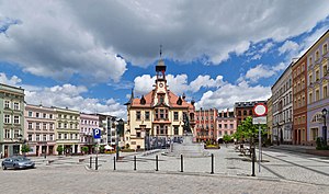
Nowa Ruda, Lower Silesian Voivodeship
Place in Lower Silesian Voivodeship, Poland
Distance: Approx. 377 meters
Latitude and longitude: 50.58333333,16.5
Nowa Ruda [ˈnɔva ˈruda] (Czech: Nová Ruda) is a town in south-western Poland near the Czech border, lying on the Włodzica river in the central Sudetes mountain range. As of 2019 it had 22,067 inhabitants. The town is located in Kłodzko County, Lower Silesian Voivodeship.
Gmina Nowa Ruda
Gmina in Lower Silesian Voivodeship, Poland
Distance: Approx. 377 meters
Latitude and longitude: 50.58333333,16.5
Gmina Nowa Ruda is a rural gmina (administrative district) in Kłodzko County, Lower Silesian Voivodeship, in south-western Poland. Its seat is the town of Nowa Ruda, although the town is not part of the territory of the gmina. The gmina covers an area of 139.66 square kilometres (53.9 sq mi), and as of 2019 its total population is 11,599.
Bieganów, Lower Silesian Voivodeship
Village in Lower Silesian Voivodeship, Poland
Distance: Approx. 2361 meters
Latitude and longitude: 50.55888889,16.50166667
Bieganów [bjɛˈɡanuf] is a village in the administrative district of Gmina Nowa Ruda, within Kłodzko County, Lower Silesian Voivodeship, in south-western Poland. It lies approximately 3 kilometres (2 mi) south of Nowa Ruda, 18 kilometres (11 mi) north-west of Kłodzko, and 74 kilometres (46 mi) south-west of the regional capital Wrocław.
Dzikowiec, Lower Silesian Voivodeship
Village in Lower Silesian Voivodeship, Poland
Distance: Approx. 5124 meters
Latitude and longitude: 50.57138889,16.57277778
Dzikowiec [d͡ʑiˈkɔvjɛt͡s] is a village in the administrative district of Gmina Nowa Ruda, within Kłodzko County, Lower Silesian Voivodeship, in south-western Poland. It lies approximately 6 kilometres (4 mi) east of Nowa Ruda, 16 kilometres (10 mi) north of Kłodzko, and 70 kilometres (43 mi) south-west of the regional capital Wrocław.
Krajanów
Village in Lower Silesian Voivodeship, Poland
Distance: Approx. 4493 meters
Latitude and longitude: 50.59777778,16.44444444
Krajanów [kraˈjanuf] is a village in the administrative district of Gmina Nowa Ruda, within Kłodzko County, Lower Silesian Voivodeship, in south-western Poland. Partly due to its location along the border between Silesia and Bohemia, Krajanów has been a part of different states over its history. As of 2011, Krajanów had a population of 120.

Ludwikowice Kłodzkie
Village in Lower Silesian Voivodeship, Poland
Distance: Approx. 4505 meters
Latitude and longitude: 50.61777778,16.47833333
Ludwikowice Kłodzkie [ludvikɔˈvit͡sɛ ˈkwɔt͡skʲɛ] is a village in the administrative district of Gmina Nowa Ruda, within Kłodzko County, Lower Silesian Voivodeship, in south-western Poland. It is situated on the Włodzica River. It lies approximately 5 kilometres (3 mi) north of Nowa Ruda, 24 kilometres (15 mi) north-west of Kłodzko, and 69 kilometres (43 mi) south-west of the regional capital Wrocław.
Sokolica, Lower Silesian Voivodeship
Village in Lower Silesian Voivodeship, Poland
Distance: Approx. 2943 meters
Latitude and longitude: 50.59333333,16.46555556
Sokolica [sɔkɔˈlit͡sa] is a village in the administrative district of Gmina Nowa Ruda, within Kłodzko County, Lower Silesian Voivodeship, in south-western Poland. It lies approximately 3 kilometres (2 mi) north-west of Nowa Ruda, 22 kilometres (14 mi) north-west of Kłodzko, and 72 kilometres (45 mi) south-west of the regional capital Wrocław.

Włodowice, Lower Silesian Voivodeship
Village in Lower Silesian Voivodeship, Poland
Distance: Approx. 2062 meters
Latitude and longitude: 50.57333333,16.47444444
Włodowice [vwɔdɔˈvit͡sɛ] is a village in the administrative district of Gmina Nowa Ruda, within Kłodzko County, Lower Silesian Voivodeship, in south-western Poland. It lies approximately 3 kilometres (2 mi) south-west of Nowa Ruda, 20 kilometres (12 mi) north-west of Kłodzko, and 74 kilometres (46 mi) south-west of the regional capital Wrocław.
Wolibórz
Village in Lower Silesian Voivodeship, Poland
Distance: Approx. 5104 meters
Latitude and longitude: 50.6,16.56666667
Wolibórz [vɔˈlibuʂ] is a village in the administrative district of Gmina Nowa Ruda, within Kłodzko County, Lower Silesian Voivodeship, in south-western Poland. It lies approximately 6 kilometres (4 mi) east of Nowa Ruda, 20 kilometres (12 mi) north of Kłodzko, and 68 kilometres (42 mi) south-west of the regional capital Wrocław.
Ścinawka Górna
Village in Lower Silesian Voivodeship, Poland
Distance: Approx. 3591 meters
Latitude and longitude: 50.55,16.48333333
Ścinawka Górna [ɕt͡ɕiˈnafka ˈɡurna] is a village in the administrative district of Gmina Radków, within Kłodzko County, Lower Silesian Voivodeship, in south-western Poland. It lies approximately 8 kilometres (5 mi) north-east of Radków, 18 kilometres (11 mi) north-west of Kłodzko, and 75 kilometres (47 mi) south-west of the regional capital Wrocław.

Sarny Palace
Distance: Approx. 4669 meters
Latitude and longitude: 50.5463,16.4625
Sarny Castle (German: Schloss Scharfeneck) is a 16th-century palace compound in Sarny, Ścinawka Górna, the administrative district of Gmina Radków, within Kłodzko County, Lower Silesian Voivodeship, in south-western Poland.
Stillfried Castle
Historic site in Lower Silesian Voivodeship, in Poland
Distance: Approx. 105 meters
Latitude and longitude: 50.57916667,16.50138889
Stillfried Castle (Polish: Zamek Stillfriedów, German: Palais Stillfried) is a historic building in Nowa Ruda, Poland.
Weather in this IP's area
overcast clouds
8 Celsius
8 Celsius
6 Celsius
9 Celsius
1004 hPa
82 %
1004 hPa
947 hPa
10000 meters
1.34 m/s
1.79 m/s
19 degree
88 %


