176.118.192.200 - IP Lookup: Free IP Address Lookup, Postal Code Lookup, IP Location Lookup, IP ASN, Public IP
Country:
Region:
City:
Location:
Time Zone:
Postal Code:
IP information under different IP Channel
ip-api
Country
Region
City
ASN
Time Zone
ISP
Blacklist
Proxy
Latitude
Longitude
Postal
Route
Luminati
Country
ASN
Time Zone
Europe/Brussels
ISP
ASBL CHU Helora
Latitude
Longitude
Postal
IPinfo
Country
Region
City
ASN
Time Zone
ISP
Blacklist
Proxy
Latitude
Longitude
Postal
Route
IP2Location
176.118.192.200Country
Region
hainaut
City
mons
Time Zone
Europe/Brussels
ISP
Language
User-Agent
Latitude
Longitude
Postal
db-ip
Country
Region
City
ASN
Time Zone
ISP
Blacklist
Proxy
Latitude
Longitude
Postal
Route
ipdata
Country
Region
City
ASN
Time Zone
ISP
Blacklist
Proxy
Latitude
Longitude
Postal
Route
Popular places and events near this IP address
Mons, Belgium
Capital of Hainaut province, Belgium
Distance: Approx. 78 meters
Latitude and longitude: 50.45472222,3.9525
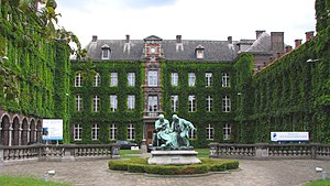
Mons (French: [mɔ̃s] ; German and Dutch: Bergen, Dutch pronunciation: [ˈbɛrɣə(n)] ; Walloon and Picard: Mont) is a city and municipality of Wallonia, and the capital of the province of Hainaut, Belgium. Mons was made into a fortified city by Count Baldwin IV of Hainaut in the 12th century. The population grew quickly, trade flourished, and several commercial buildings were erected near the Grand-Place.

Battle of Mons
1914 battle on the Western Front of World War I
Distance: Approx. 410 meters
Latitude and longitude: 50.45777778,3.95222222
The Battle of Mons was the first major action of the British Expeditionary Force (BEF) in the First World War. It was a subsidiary action of the Battle of the Frontiers, in which the Allies clashed with Germany on the French borders. At Mons, the British Army attempted to hold the line of the Mons–Condé Canal against the advancing German 1st Army.

County of Hainaut
Medieval region in current Belgium and France
Distance: Approx. 478 meters
Latitude and longitude: 50.45,3.95
The County of Hainaut (French: Comté de Hainaut; Dutch: Graafschap Henegouwen; Latin: comitatus hanoniensis), sometimes spelled Hainault, was a territorial lordship within the medieval Holy Roman Empire that straddled the present-day border of Belgium and France. Its most important towns included Mons (Dutch: Bergen), now in Belgium, and Valenciennes, now in France. The core of the county, named after the river Haine, stretched southeast to include the Avesnois region and southwest to the Selle (Scheldt tributary).

Mundaneum
Institution aimed to gather together all the world's knowledge founded in 1910
Distance: Approx. 468 meters
Latitude and longitude: 50.45768611,3.95545
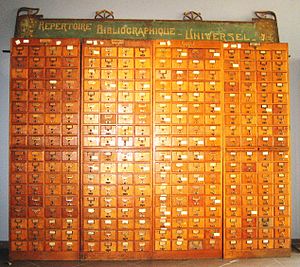
The Mundaneum was an institution which aimed to gather together all the world's knowledge and classify it according to a system called the Universal Decimal Classification. It was developed at the turn of the 20th century by Belgian lawyers Paul Otlet and Henri La Fontaine. The Mundaneum has been identified as a milestone in the history of data collection and management, and (somewhat more tenuously) as a precursor to the Internet.

Faculty of Engineering of the University of Mons
Distance: Approx. 243 meters
Latitude and longitude: 50.45194444,3.9525
The Faculty of Engineering of the University of Mons (French: Faculté Polytechnique de Mons, pronounced [fakylte pɔlitɛknik də mɔ̃s]) is a faculty of engineering at the University of Mons in the Wallonia region in Belgium. Before the 2009 merger of the Faculté Polytechnique de Mons and the University of Mons-Hainaut, the FPMs was the oldest university of the city of Mons and the first civil Engineering school in Belgium (1836). Its first name was École des Mines (Mining School).

Siege of Mons (1691)
1691 battle of the Nine Years' War
Distance: Approx. 478 meters
Latitude and longitude: 50.45,3.95
The siege of Mons, 15 March – 10 April 1691, was a major operation fought during the Nine Years' War, and was the main French objective for the 1691 campaign in the Spanish Netherlands. The city was besieged and captured before the normal commencement of the campaigning season with minimal losses. The outcome was not in doubt, but in a conflict dominated by siege warfare, neither the French army of King Louis XIV, nor the forces of the Grand Alliance under King William III, could bring about a decisive battle.
Museum François Duesberg
Museum in Belgium
Distance: Approx. 417 meters
Latitude and longitude: 50.45416667,3.94611111
Museum François Duesberg was opened on 21 September 1994 and is devoted to decorative arts from the period 1775 to 1825. The museum is located in Mons (Hainaut) opposite the collegiate Saint Waltrude Church in the former buildings of the National Bank of Belgium. It houses a large collection of objects in perfect condition: it has a prestigious collection of clocks and mantel clocks, exceptional gilded French bronzes, porcelain (mainly from Paris and Brussels), pottery, jewelry (including the famous Mons-punch), and numerous items of similar quality.

Siege of Mons (1572)
Siege during the Eighty Years' War and the Anglo-Spanish War
Distance: Approx. 478 meters
Latitude and longitude: 50.45,3.95
The siege of Mons of 1572 took place at Mons, capital of the County of Hainaut, Spanish Netherlands (present-day Belgium), between 23 June and 19 September 1572, as part of the Eighty Years' War, the Anglo-Spanish War (1585–1604), and the French Wars of Religion. In the spring of 1572, after the capture of Valenciennes by a Protestant force under Louis of Nassau, the Dutch commander continued with his offensive and took Mons by surprise on 24 May. After three months of siege, and the defeats of the armies of Jean de Hangest, seigneur d'Yvoy and Genlis, and William the Silent, Prince of Orange (Dutch: Willem van Oranje), by the Spanish army led by Don Fernando Álvarez de Toledo, Duke of Alba ("The Iron Duke"), Governor-General of the Spanish Netherlands, and his son, Don Fadrique de Toledo, Louis of Nassau's forces, isolated and without any hope of help, surrendered Mons to the Duke of Alba on 19 September.

Belfry of Mons
Medieval bell tower and UNESCO World Heritage Site in Mons, Belgium
Distance: Approx. 134 meters
Latitude and longitude: 50.45416667,3.95011111
The Belfry of Mons (French: Beffroi de Mons) is one of the more recent among the belfries of Belgium and France. At a height of 87 metres (285 ft), it dominates the city of Mons, Belgium, which is itself constructed on a hill. This belfry, classified in Belgium since 15 January 1936, belongs to the major cultural patrimony of Wallonia.

Saint Waltrude Collegiate Church
Church in Mons, Belgium
Distance: Approx. 330 meters
Latitude and longitude: 50.45333333,3.9475
Saint Waltrude Collegiate Church (French: Collégiale Sainte-Waudru) is a Roman Catholic parish church in Mons, Belgium, named in honour of Saint Waltrude. The church is a notable example of Gothic architecture, and is protected by the heritage register of Wallonia.
Maison Losseau
Private house in Mons, Belgium
Distance: Approx. 288 meters
Latitude and longitude: 50.45627222,3.95420278
The Maison Losseau is an Art Nouveau private house located in Mons, Belgium. Dating from the 18th century, it was renovated in Art Nouveau style in the early 1900s at the request of Léon Losseau by Paul Saintenoy. It is listed on the list of the exceptional heritage site of Wallonia and since 2015 houses a center for the interpretation of Léon Losseau's collections and regional literature.
Collège Saint-Stanislas
Secondary school in Belgium
Distance: Approx. 412 meters
Latitude and longitude: 50.457647,3.950342
Collège Saint-Stanislas is a mixed Catholic secondary school in Mons, Belgium. It was founded in 1851 by the Jesuits. It is located on Rue des Dominicains in the centre of Mons.
Weather in this IP's area
broken clouds
2 Celsius
-2 Celsius
1 Celsius
2 Celsius
1005 hPa
51 %
1005 hPa
994 hPa
10000 meters
3.6 m/s
210 degree
75 %


