176.114.42.46 - IP Lookup: Free IP Address Lookup, Postal Code Lookup, IP Location Lookup, IP ASN, Public IP
Country:
Region:
City:
Location:
Time Zone:
Postal Code:
IP information under different IP Channel
ip-api
Country
Region
City
ASN
Time Zone
ISP
Blacklist
Proxy
Latitude
Longitude
Postal
Route
Luminati
Country
Region
kda
City
taman
ASN
Time Zone
Europe/Moscow
ISP
Telecommunication company FEONET+ LLC
Latitude
Longitude
Postal
IPinfo
Country
Region
City
ASN
Time Zone
ISP
Blacklist
Proxy
Latitude
Longitude
Postal
Route
IP2Location
176.114.42.46Country
Region
krasnodarskiy kray
City
taman'
Time Zone
Europe/Moscow
ISP
Language
User-Agent
Latitude
Longitude
Postal
db-ip
Country
Region
City
ASN
Time Zone
ISP
Blacklist
Proxy
Latitude
Longitude
Postal
Route
ipdata
Country
Region
City
ASN
Time Zone
ISP
Blacklist
Proxy
Latitude
Longitude
Postal
Route
Popular places and events near this IP address
Tmutarakan
Former human settlement
Distance: Approx. 845 meters
Latitude and longitude: 45.21916667,36.71416667
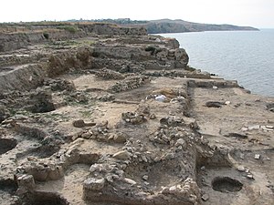
Tmutarakan (Russian: Тмутарака́нь, romanized: Tmutarakán', IPA: [tmʊtərɐˈkanʲ]; Old East Slavic: Тъмуторокань, romanized: Tǔmutorokanǐ) was a medieval principality of Kievan Rus' and trading town that controlled the Cimmerian Bosporus, the passage from the Black Sea to the Sea of Azov, between the late 10th and 11th centuries. Its site was the ancient Greek colony of Hermonassa (Ancient Greek: Ἑρμώνασσα) founded in the mid 6th century BCE, by Mytilene (Lesbos), situated on the Taman peninsula, in present-day Krasnodar Krai, Russia, roughly opposite Kerch. The Khazar fortress of Tamantarkhan (from which the Byzantine name for the city, Tamatarcha, is derived) was built on the site in the 7th century, and became known as Tmutarakan when it came under the control of Kievan Rus'.

Taman, Russia
Place in Krasnodar Krai, Russia
Distance: Approx. 555 meters
Latitude and longitude: 45.21666667,36.71666667
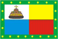
Taman (Russian: Тамань) is a stanitsa (village) in the Temryuksky District of Krasnodar Krai, Russia. It is on the Taman Peninsula and on the coast of Taman Bay, an inlet off Kerch Strait. It is the administrative center of the Taman rural settlement, which also contains the much smaller village of Volna, on the southern side of the peninsula, where the Port of Taman is.

Taman Bay
Distance: Approx. 8687 meters
Latitude and longitude: 45.27388889,36.78305556
The Taman Bay (Russian: Таманский залив) is a shallow bay or gulf on the east coast of the Strait of Kerch shaped on the southern side by the Tuzla Spit and to the north by the Chushka Spit. It dips into the Taman Peninsula of Krasnodar Krai, Russia for about 16 km. The bay is 8 km wide at its mouth and is up to 5 metres deep.

Kostyrine
Village in Crimea
Distance: Approx. 8887 meters
Latitude and longitude: 45.25527778,36.62111111
Kostyrine (Russian: Костырино, Ukrainian: Костиріне, Crimean Tatar: Çöñgelek) is a village in the district of Lenine Raion in Crimea.
Zavitne
Village in Crimea
Distance: Approx. 5187 meters
Latitude and longitude: 45.19166667,36.65638889
Zavitne (Ukrainian: Zavitne, Russian: Заветное, Crimean Tatar: Yanış Taqıl) is a village in the district of Lenine Raion in Crimea.

Naberezhne, Crimea
Village in Crimea
Distance: Approx. 3099 meters
Latitude and longitude: 45.23666667,36.69861111
Naberezhne (Ukrainian: Набережне, Russian: Набережное), is a village in the district of Lenine Raion in Crimea.

Mar'ivka
Village in Crimea
Distance: Approx. 3099 meters
Latitude and longitude: 45.23666667,36.69861111
Mar'ivka (Ukrainian:Мар'ївка; Russian:Марьевка), is a village in the district of Lenine Raion in Crimea.
Weather in this IP's area
clear sky
9 Celsius
6 Celsius
9 Celsius
9 Celsius
1016 hPa
77 %
1016 hPa
1014 hPa
10000 meters
6.98 m/s
9.88 m/s
170 degree

