Country:
 Ukraine
Region:
City:
Latitude and Longitude:
Time Zone:
Postal Code:
IP information under different IP Channel
ip-api
Country
Region
City
ASN
Time Zone
ISP
Blacklist
Proxy
Latitude
Longitude
Postal
Route
IPinfo
Country
Region
City
ASN
Time Zone
ISP
Blacklist
Proxy
Latitude
Longitude
Postal
Route
MaxMind
Country
Region
City
ASN
Time Zone
ISP
Blacklist
Proxy
Latitude
Longitude
Postal
Route
Luminati
Country
UARegion
09
City
luhansk
ASN
Time Zone
Europe/Kyiv
ISP
Dovecom LLC
Latitude
Longitude
Postal
db-ip
Country
Region
City
ASN
Time Zone
ISP
Blacklist
Proxy
Latitude
Longitude
Postal
Route
ipdata
Country
Region
City
ASN
Time Zone
ISP
Blacklist
Proxy
Latitude
Longitude
Postal
Route
Popular places and events near this IP address
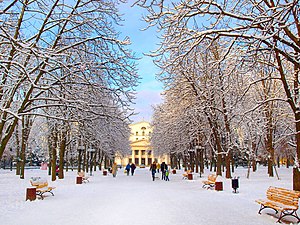
Luhansk
Russian-occupied city in Ukraine
Distance: Approx. 1674 meters
Latitude and longitude: 48.56777778,39.30305556
Luhansk (UK: , US: ; Ukrainian: Луганськ, IPA: [lʊˈɦɑnʲsʲk] ), also known as Lugansk (UK: , US: ; Russian: Луганск, IPA: [lʊˈɡansk]), is a city in the Donbas region, eastern Ukraine. As of 2022, the population was estimated to be 397,677 (2022 estimate), making Luhansk the 12th-largest city in Ukraine. Luhansk served as the administrative center of Luhansk Oblast, before pro-Russian separatists seized control of the city in 2014 and made it the capital of the self-proclaimed Luhansk People's Republic.

Avanhard Stadium (Luhansk)
Multi-purpose stadium in Luhansk, Ukraine
Distance: Approx. 203 meters
Latitude and longitude: 48.55944444,39.32111111
Avanhard Stadium is a multi-purpose stadium in Luhansk, Ukraine. The stadium has a capacity of 22,288 spectators.
University of Luhansk
University in Ukraine
Distance: Approx. 674 meters
Latitude and longitude: 48.565,39.31666667
The University of Luhansk, officially the Taras Shevchenko National University of Luhansk (Ukrainian: Луганський національний університет імені Тараса Шевченка, romanized: Luhansʹkyy natsionalʹnyy universytet imeni Tarasa Shevchenka, Russian: Луганский национальный университет имени Тараса Шевченко, romanized: Luganskiy natsional'nyy universitet imeni Tarasa Shevchenko, lit. 'Luhansk National University named after Taras Shevchenko'; often referred to as LNU), is the oldest university in Donbas region and has a reputation as one of Ukraine's most prestigious universities. Following the 2014 pro-Russian unrest in Ukraine and the establishment of the Luhansk People's Republic (LPR), this university was partitioned into two universities. One continues to operate in the same campus as before in Luhansk, and was later renamed to the Luhansk State Pedagogical University (Russian: Луганский государственный педагогический университет, romanized: Luganskyi gosudarstvennyy pedagogicheskiy universitet, LGPU) in 2020.
Luhansk State Medical University
University in Luhansk, Ukraine
Distance: Approx. 6286 meters
Latitude and longitude: 48.51111111,39.36388889
Luhansk State Medical University (Ukrainian: Луганський державний медичний університет; , Ukraine. Initially known as Voroshilovgrad State Medical Institute (Ворошиловградский государственный медицинский институт), it received university status in 1994. In 1979 the then institute began offering postgraduate training, and from 1983 it began training foreign students in paediatrics, recruiting students from Middle Eastern countries (Iran, Iraq); Africa (Ghana, Nigeria, Egypt, Libya, Morocco); and Asia (India, Malaysia, Singapore).

East Ukrainian National University
National university in Luhansk, Ukraine
Distance: Approx. 4129 meters
Latitude and longitude: 48.5654,39.3787
Volodymyr Dahl East Ukrainian National University (Ukrainian: Східноукраїнський національний університет імені Володимира Даля) is a public university in Ukraine. It was founded in 1920, and in 1991 it was named after Volodymyr Dahl. It was the first higher educational establishment in which specialists in machine-building were trained.
Memorial for the victims killed by OUN-UPA (Luhansk)
World War II memorial in Ukraine
Distance: Approx. 1635 meters
Latitude and longitude: 48.57166667,39.30833333
The monument dedicated to the "Luhansk victims of the OUN-UPA" is a statue located in Luhansk, Ukraine. The monument was unveiled in 2010 under the direction of city deputy Arsen Klinchaev and in association with the Party of Regions in a park in the center of Luhansk. The monument is adjacent to the Soviet memorial to the World War II underground resistance group, The Young Guard.

Lugcentrokuz
Distance: Approx. 2423 meters
Latitude and longitude: 48.58138889,39.33333333
Lugcentrokuz (Ukrainian: Лугцентрокуз, lit. Lugansk Central Forging Factory) is a Ukrainian rail transport industrial company headquartered in Luhansk. It was established as an independent company, based on the separated press forging department of Luhanskteplovoz locomotive factory in 1991.
Metalist, Luhansk Raion, Luhansk Oblast
Distance: Approx. 8014 meters
Latitude and longitude: 48.62527778,39.275
Metalist (Ukrainian: Металіст) is a rural settlement in Luhansk urban hromada, Luhansk Raion, Luhansk Oblast (region), Ukraine. Population 2197 people (2001); the village was incorporated in 1932. On June 17, 2014, a camera crew of Russian state television came under mortar fire at a checkpoint in the vicinity of Metalist.

Luhansk railway station
Railway station in Luhansk
Distance: Approx. 3084 meters
Latitude and longitude: 48.5757,39.2879
Luhansk (Ukrainian: Луганськ) is a junction railway station in Luhansk, Ukraine.
Khriashchuvate
Rural-type settlement in Luhansk Oblast, Ukraine
Distance: Approx. 8747 meters
Latitude and longitude: 48.51666667,39.42138889
Khriashchuvate (Ukrainian: Хрящувате; Russian: Хрящеватое, romanized: Khryashchevatoye) is a rural settlement in Molodohvardiisk urban hromada, Luhansk Raion, Luhansk Oblast (region), Ukraine, located 39 kilometres (24 mi) from Sorokyne. Khriashchuvate has been under the control of the Lugansk People's Republic (LPR / LNR) from autumn 2014, in the war in Donbas. Following their 2022 annexation referendum, Russia claimed the entire Luhansk Oblast, including Khriashchuvate, as part of their LPR / LNR. As of 2022, the population of Khriashchuvate was 1216.
Weather in this IP's area
overcast clouds
21 Celsius
21 Celsius
21 Celsius
21 Celsius
1011 hPa
34 %
1011 hPa
999 hPa
10000 meters
2.22 m/s
2.15 m/s
107 degree
98 %
06:35:17
17:43:42