176.108.60.241 - IP Lookup: Free IP Address Lookup, Postal Code Lookup, IP Location Lookup, IP ASN, Public IP
Country:
Region:
City:
Location:
Time Zone:
Postal Code:
ISP:
ASN:
language:
User-Agent:
Proxy IP:
Blacklist:
IP information under different IP Channel
ip-api
Country
Region
City
ASN
Time Zone
ISP
Blacklist
Proxy
Latitude
Longitude
Postal
Route
db-ip
Country
Region
City
ASN
Time Zone
ISP
Blacklist
Proxy
Latitude
Longitude
Postal
Route
IPinfo
Country
Region
City
ASN
Time Zone
ISP
Blacklist
Proxy
Latitude
Longitude
Postal
Route
IP2Location
176.108.60.241Country
Region
federacija bosne i hercegovine
City
lukavica
Time Zone
Europe/Sarajevo
ISP
Language
User-Agent
Latitude
Longitude
Postal
ipdata
Country
Region
City
ASN
Time Zone
ISP
Blacklist
Proxy
Latitude
Longitude
Postal
Route
Popular places and events near this IP address

Doboj East
Village and municipality in Federation of Bosnia and Herzegovina, Bosnia and Herzegovina
Distance: Approx. 3645 meters
Latitude and longitude: 44.7333,18.1889
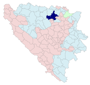
Doboj East (Serbian Cyrillic: Добој Исток) is a municipality located in the Tuzla Canton of the Federation of Bosnia and Herzegovina, an entity of Bosnia and Herzegovina. It was created in 1998, three years after the Dayton Peace Agreement by seceding from the municipality of Doboj. Today Doboj East is experiencing rapid urbanization, as well as economic and industrial growth.
Fortress of Doboj
Fort in Bosnia and Herzegovina
Distance: Approx. 7011 meters
Latitude and longitude: 44.737,18.088
Doboj Fortress (Bosnian, Croatian and Serbian: Dobojska tvrđava / Добојска тврђава) or Gradina (Градина) is located in the city of Doboj, Bosnia and Herzegovina. Throughout its turbulent history, the fortress has been burned and ransacked at least 18 times as per official records. Of note is that Doboj fortress was considered to be a royal Kotromanić property, unlike Great Bosnian Duke Hrvoje's Zvečaj fortress or Sandalj Hranić's Blagaj fortress, which were centers of their respective duchies.
Bušletić
Village in Republika Srpska, Bosnia and Herzegovina
Distance: Approx. 7084 meters
Latitude and longitude: 44.80861111,18.10666667
Bušletić (Cyrillic: Бушлетић) is a village in the municipality of Doboj, Bosnia and Herzegovina. The village has both agriculture and industry.

Grapska Donja
Village in Republika Srpska, Bosnia and Herzegovina
Distance: Approx. 7121 meters
Latitude and longitude: 44.78805556,18.08611111
Grapska Donja (Cyrillic: Грапска Доња) is a village in the municipality of Doboj, Republika Srpska, Bosnia and Herzegovina.
Kostajnica, Doboj
Village in Republika Srpska, Bosnia and Herzegovina
Distance: Approx. 5217 meters
Latitude and longitude: 44.74666667,18.10694444
Kostajnica (Cyrillic: Костајница) is a village in the municipality of Doboj, Republika Srpska, Bosnia and Herzegovina.

Lipac
Village in Republika Srpska, Bosnia and Herzegovina
Distance: Approx. 6712 meters
Latitude and longitude: 44.71722222,18.11333333
Lipac (Serbian Cyrillic: Липац) is a village in the municipality of Doboj, Republika Srpska, Bosnia and Herzegovina. It is inhabited by ethnic Serbs.
Porječje
Village in Republika Srpska, Bosnia and Herzegovina
Distance: Approx. 5319 meters
Latitude and longitude: 44.79722222,18.12222222
Porječje (Cyrillic: Порјечје) is a village in the municipality of Doboj, Bosnia and Herzegovina.
Sjenina
Village in Republika Srpska, Bosnia and Herzegovina
Distance: Approx. 4145 meters
Latitude and longitude: 44.8,18.16666667
Sjenina (Cyrillic: Сјенина) is a village in the municipality of Doboj, Republika Srpska, Bosnia and Herzegovina.
Suho Polje (Doboj)
Village in Republika Srpska, Bosnia and Herzegovina
Distance: Approx. 5339 meters
Latitude and longitude: 44.715,18.16333333
Suho Polje (Cyrillic: Сухо Поље) is a village in the municipality of Doboj, Republika Srpska, Bosnia and Herzegovina.
Svjetliča
Village in Republika Srpska, Bosnia and Herzegovina
Distance: Approx. 4457 meters
Latitude and longitude: 44.7425,18.1203
Svjetliča (Cyrillic: Свјетлича) is a village in the municipality of Doboj, Republika Srpska, Bosnia and Herzegovina.

Doboj massacre
War crimes committed against Bosniaks and Croats in the Doboj area
Distance: Approx. 4320 meters
Latitude and longitude: 44.73333333,18.13333333
The Doboj ethnic cleansing refers to war crimes, including murder, forced deportation, persecution and wanton destruction, committed against Bosniaks and Croats in the Doboj area by the Yugoslav People's Army and Serb paramilitary units from May until September 1992 during the Bosnian war. On 26 September 1997, Serb soldier Nikola Jorgić was found guilty by the Düsseldorf Oberlandesgericht (Higher Regional Court) on 11 counts of genocide involving the murder of 30 persons in the Doboj region, making it the first Bosnian Genocide prosecution. The International Criminal Tribunal for the former Yugoslavia (ICTY) classified it as a crime against humanity and sentenced seven Serb officials.
Spreča
River in Bosnia and Herzegovina
Distance: Approx. 6221 meters
Latitude and longitude: 44.7342,18.1013
The Spreča (Serbian Cyrillic: Спреча) is a river of northeastern Bosnia and Herzegovina, a tributary of the Bosna. Its source is located in the village of Snagovo in Zvornik municipality, and it reaches the Bosna at the city of Doboj. A damming of the Spreča in the municipality of Lukavac forms Modrac Lake.
Weather in this IP's area
broken clouds
-3 Celsius
-3 Celsius
-3 Celsius
-3 Celsius
1041 hPa
95 %
1041 hPa
1004 hPa
10000 meters
0.83 m/s
0.81 m/s
81 degree
77 %

