176.108.56.190 - IP Lookup: Free IP Address Lookup, Postal Code Lookup, IP Location Lookup, IP ASN, Public IP
Country:
Region:
City:
Location:
Time Zone:
Postal Code:
ISP:
ASN:
language:
User-Agent:
Proxy IP:
Blacklist:
IP information under different IP Channel
ip-api
Country
Region
City
ASN
Time Zone
ISP
Blacklist
Proxy
Latitude
Longitude
Postal
Route
db-ip
Country
Region
City
ASN
Time Zone
ISP
Blacklist
Proxy
Latitude
Longitude
Postal
Route
IPinfo
Country
Region
City
ASN
Time Zone
ISP
Blacklist
Proxy
Latitude
Longitude
Postal
Route
IP2Location
176.108.56.190Country
Region
federacija bosne i hercegovine
City
barice
Time Zone
Europe/Sarajevo
ISP
Language
User-Agent
Latitude
Longitude
Postal
ipdata
Country
Region
City
ASN
Time Zone
ISP
Blacklist
Proxy
Latitude
Longitude
Postal
Route
Popular places and events near this IP address

Lukavac
City in Federation of Bosnia and Herzegovina, Bosnia and Herzegovina
Distance: Approx. 3010 meters
Latitude and longitude: 44.55,18.51666667
Lukavac (Cyrillic: Лукавац) is a city located in the Tuzla Canton of the Federation of Bosnia and Herzegovina, an entity of Bosnia and Herzegovina. According to the 2013 census, the urban centre has a population of 12,061 inhabitants, with 44,520 inhabitants in the city.
Babice Donje
Village in Federation of Bosnia and Herzegovina, Bosnia and Herzegovina
Distance: Approx. 5093 meters
Latitude and longitude: 44.50361111,18.44333333
Babice Donje (Cyrillic: Бабице Доње) is a village in the municipality of Lukavac, Bosnia and Herzegovina.
Caparde (Lukavac)
Village in Federation of Bosnia and Herzegovina, Bosnia and Herzegovina
Distance: Approx. 2660 meters
Latitude and longitude: 44.52611111,18.45444444
Caparde is a village in the municipality of Lukavac, Bosnia and Herzegovina.
Crveno Brdo (Lukavac)
Village in Federation of Bosnia and Herzegovina, Bosnia and Herzegovina
Distance: Approx. 4169 meters
Latitude and longitude: 44.56722222,18.51805556
Crveno Brdo is a village in the municipality of Lukavac, Bosnia and Herzegovina.
Huskići
Village in Federation of Bosnia and Herzegovina, Bosnia and Herzegovina
Distance: Approx. 5330 meters
Latitude and longitude: 44.56722222,18.53694444
Huskići is a village in the municipality of Lukavac, Bosnia and Herzegovina.
Šikulje (Lukavac)
Village in Federation of Bosnia and Herzegovina, Bosnia and Herzegovina
Distance: Approx. 4602 meters
Latitude and longitude: 44.5778,18.5064
Šikulje is a village in the municipality of Lukavac, Bosnia and Herzegovina.
Tabaci
Village in Federation of Bosnia and Herzegovina, Bosnia and Herzegovina
Distance: Approx. 1402 meters
Latitude and longitude: 44.5317,18.4936
Tabaci is a village in the municipality of Lukavac, Bosnia and Herzegovina.
Turija (Lukavac)
Village in Federation of Bosnia and Herzegovina, Bosnia and Herzegovina
Distance: Approx. 5842 meters
Latitude and longitude: 44.5122,18.4192
Turija is a village in the municipality of Lukavac, Bosnia and Herzegovina.
Bistarac Lake
Lake of Bosnia and Herzegovina
Distance: Approx. 5653 meters
Latitude and longitude: 44.53361111,18.55166667
Bistarac Lake is a lake of Bosnia and Herzegovina. It is located in the municipality of Lukavac.

Modrac Lake
Artificial lake in Bosnia and Herzegovina
Distance: Approx. 4909 meters
Latitude and longitude: 44.49861111,18.5
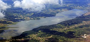
Modrac Lake (Bosnian: Jezero Modrac) is an artificial lake in Bosnia and Herzegovina. Located in the municipality of Lukavac, it is home to many species of fish and is popular with fishermen. A 2005 effort to turn it into a tourist attraction was unsuccessful because of local government neglect and inhabitants' practice of dumping garbage on the shore.
Radio Lukavac
Bosnian radio station
Distance: Approx. 3010 meters
Latitude and longitude: 44.55,18.51666667
Radio Lukavac is a Bosnian local public radio station, broadcasting from Lukavac, Bosnia and Herzegovina. It was launched during the war in Bosnia and Herzegovina on 11 January 1993 as local/municipal radio station. It broadcasts a variety of programs such as news, music, morning and talk shows.
Devetak, Lukavac
Village in Federation of Bosnia and Herzegovina, Bosnia and Herzegovina
Distance: Approx. 3344 meters
Latitude and longitude: 44.5496222,18.440895
Devetak is a village in the municipality of Lukavac, Bosnia and Herzegovina.
Weather in this IP's area
broken clouds
-3 Celsius
-3 Celsius
-3 Celsius
-3 Celsius
1041 hPa
92 %
1041 hPa
1000 hPa
10000 meters
0.27 m/s
0.37 m/s
138 degree
64 %