176.105.239.100 - IP Lookup: Free IP Address Lookup, Postal Code Lookup, IP Location Lookup, IP ASN, Public IP
Country:
Region:
City:
Location:
Time Zone:
Postal Code:
ISP:
ASN:
language:
User-Agent:
Proxy IP:
Blacklist:
IP information under different IP Channel
ip-api
Country
Region
City
ASN
Time Zone
ISP
Blacklist
Proxy
Latitude
Longitude
Postal
Route
db-ip
Country
Region
City
ASN
Time Zone
ISP
Blacklist
Proxy
Latitude
Longitude
Postal
Route
IPinfo
Country
Region
City
ASN
Time Zone
ISP
Blacklist
Proxy
Latitude
Longitude
Postal
Route
IP2Location
176.105.239.100Country
Region
salah ad din
City
balad
Time Zone
Asia/Baghdad
ISP
Language
User-Agent
Latitude
Longitude
Postal
ipdata
Country
Region
City
ASN
Time Zone
ISP
Blacklist
Proxy
Latitude
Longitude
Postal
Route
Popular places and events near this IP address

Balad, Iraq
City in Saladin, Iraq
Distance: Approx. 2 meters
Latitude and longitude: 34.01638889,44.14527778
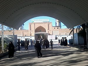
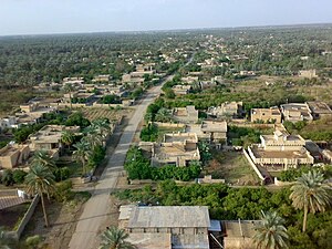
Balad (Arabic: بلد), also transliterated Beled or Belad, is a city in Saladin Governorate, Iraq, 80 kilometres (50 mi) north of the national capital, Baghdad. It is the capital of Balad District. Located in Iraq's volatile Sunni Triangle, between the towns of Al Dhuluiya, Yathrib and Ishaqi, Balad's inhabitants are primarily farmers who work mainly on grape and date farms and as citrus growers.

2007 AerianTur-M Antonov An-26 crash
Airplane incident involving an Antonov An-26 airliner
Distance: Approx. 1876 meters
Latitude and longitude: 34,44.15
The 2007 AerianTur-M Antonov An-26 crash was an aviation accident involving an Antonov An-26 airliner, which crashed on 9 January 2007 while attempting to land at the Joint Base Balad in Balad, Iraq, which was at that time operated by the United States Air Force. The crash killed 34 people aboard and left one passenger critically injured. Officials claim the crash was caused by poor weather conditions, but other sources claim that this is a cover-up and the plane was actually shot down by a missile.

Dhuluiya
Town in Salah ad-Din, Iraq
Distance: Approx. 6281 meters
Latitude and longitude: 34.05,44.2
Dhuluʿiya (Arabic: الضلوعية, romanized: aḍ-Ḍulūʿīyah) is a town in Salah ad-Din Governorate, Iraq situated on the left bank of the Tigris, near the mouth of the ʿAdhaim, some 20 miles (32 km) east of Samarra and 47 miles (76 km) north of Baghdad. The population is predominantly Sunni Arab of the Jubur tribe.
Al Kharjah, Iraq
Distance: Approx. 7545 meters
Latitude and longitude: 33.98333333,44.21666667
Al Kharjah is a town in Iraq, that is south of Samara. Al Kharjah is located at Latitude33.9833°, Longitude. 44.2167° and is near Balad, Iraq.
Weather in this IP's area
clear sky
15 Celsius
14 Celsius
15 Celsius
15 Celsius
1022 hPa
46 %
1022 hPa
1016 hPa
10000 meters
1.66 m/s
1.77 m/s
126 degree