176.100.196.91 - IP Lookup: Free IP Address Lookup, Postal Code Lookup, IP Location Lookup, IP ASN, Public IP
Country:
 Poland
Region:
City:
Location:
Time Zone:
Postal Code:
ISP:
ASN:
language:
User-Agent:
Proxy IP:
Blacklist:
IP information under different IP Channel
ip-api
Country
Region
City
ASN
Time Zone
ISP
Blacklist
Proxy
Latitude
Longitude
Postal
Route
db-ip
Country
Region
City
ASN
Time Zone
ISP
Blacklist
Proxy
Latitude
Longitude
Postal
Route
IPinfo
Country
Region
City
ASN
Time Zone
ISP
Blacklist
Proxy
Latitude
Longitude
Postal
Route
IP2Location
176.100.196.91Country
plRegion
malopolskie
City
rokiciny
Time Zone
Europe/Warsaw
ISP
Language
User-Agent
Latitude
Longitude
Postal
ipdata
Country
Region
City
ASN
Time Zone
ISP
Blacklist
Proxy
Latitude
Longitude
Postal
Route
Popular places and events near this IP address

Raba Wyżna
Village in Lesser Poland Voivodeship, Poland
Distance: Approx. 1779 meters
Latitude and longitude: 49.56666667,19.9
Raba Wyżna is a village in Poland, situated in Lesser Poland Voivodeship, Nowy Targ County. It is a seat of Raba Wyżna Commune. As of 2006, the village had 4116 inhabitants.
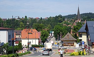
Rabka-Zdrój
Place in Lesser Poland Voivodeship, Poland
Distance: Approx. 5092 meters
Latitude and longitude: 49.60833333,19.96666667
Rabka-Zdrój (pronounced [ˈrapka ˈzdrui̯], Goral: Robka, colloquially: Rabka) is a spa town in Lesser Poland Voivodeship, Poland. It is located between Kraków and Zakopane in a valley on the northern slopes of the Gorce Mountains, where the rivers Poniczanka and Słonka join the river Raba. It has about 13,000 inhabitants.

Gmina Raba Wyżna
Gmina in Lesser Poland Voivodeship, Poland
Distance: Approx. 1779 meters
Latitude and longitude: 49.56666667,19.9
Gmina Raba Wyżna is a rural gmina (administrative district) in Nowy Targ County, Lesser Poland Voivodeship, in southern Poland. Its seat is the village of Raba Wyżna, which lies approximately 14 kilometres (9 mi) north-west of Nowy Targ and 55 km (34 mi) south of the regional capital Kraków. The gmina covers an area of 88.28 square kilometres (34.1 sq mi), and as of 2006 its total population is 13,525.

Ponice
Village in Lesser Poland Voivodeship, Poland
Distance: Approx. 4505 meters
Latitude and longitude: 49.56777778,19.985
Ponice [pɔˈnit͡sɛ] is a village on the Poniczanka River, in Nowy Targ County, by the northwestern slopes of the Gorcy mountains in Poland. It lies approximately 3 kilometres (2 mi) south-east of Rabka-Zdrój, 15 km (9 mi) north of Nowy Targ, and 52 km (32 mi) south of the regional capital Kraków. To the west it borders on Rdzawka and Rabka, to the east on Slonne, and to the south on Obidowa.

Chabówka
Place in Lesser Poland Voivodeship, Poland
Distance: Approx. 3162 meters
Latitude and longitude: 49.6,19.93333333
Chabówka [xaˈbufka] is a village located on the outskirts of the southern Polish town of Rabka, in the Nowy Targ County, Lesser Poland Voivodeship. With population of 1,600 (as for 2006), Chabówka is a popular tourist attraction because of its location near the Gorce Mountains featuring Gorce National Park. It also is an important rail junction, situated along the main line from Kraków to Zakopane, with another connection, to Nowy Sącz, beginning in Chabówka.

Pyzówka
Village in Lesser Poland Voivodeship, Poland
Distance: Approx. 4766 meters
Latitude and longitude: 49.53333333,19.95
Pyzówka [pɨˈzufka] is a village in the administrative district of Gmina Nowy Targ, within Nowy Targ County, Lesser Poland Voivodeship, in southern Poland. It lies approximately 9 kilometres (6 mi) north-west of Nowy Targ and 59 km (37 mi) south of the regional capital Kraków. The village has an approximate population of 928.

Harkabuz
Village in Lesser Poland Voivodeship, Poland
Distance: Approx. 5831 meters
Latitude and longitude: 49.55,19.85
Harkabuz [xarˈkabus] is a village in the administrative district of Gmina Raba Wyżna, within Nowy Targ County, Lesser Poland Voivodeship, in southern Poland. It lies approximately 5 kilometres (3 mi) south-west of Raba Wyżna, 16 km (10 mi) north-west of Nowy Targ, and 58 km (36 mi) south of the regional capital Kraków. The village lies in the drainage basin of the Black Sea (through Orava, Váh and Danube rivers), in the historical region of Orava (Polish: "Orawa").

Rokiciny Podhalańskie
Village in Lesser Poland Voivodeship, Poland
Distance: Approx. 785 meters
Latitude and longitude: 49.56666667,19.91666667
Rokiciny Podhalańskie [rɔkiˈt͡ɕinɨ pɔtxaˈlaɲskʲɛ] is a village in the administrative district of Gmina Raba Wyżna, within Nowy Targ County, Lesser Poland Voivodeship, in southern Poland. It lies approximately 2 kilometres (1 mi) east of Raba Wyżna, 14 km (9 mi) north-west of Nowy Targ, and 55 km (34 mi) south of the regional capital Kraków.

Sieniawa, Lesser Poland Voivodeship
Village in Lesser Poland Voivodeship, Poland
Distance: Approx. 4412 meters
Latitude and longitude: 49.53333333,19.93333333
Sieniawa (Polish pronunciation: [ɕɛˈɲava]) is a village in the administrative district of Gmina Raba Wyżna, within Nowy Targ County, Lesser Poland Voivodeship, in southern Poland. It lies approximately 5 kilometres (3 mi) south-east of Raba Wyżna, 10 km (6 mi) north-west of Nowy Targ, and 59 km (37 mi) south of the regional capital Kraków.

Skawa, Nowy Targ County
Village in Lesser Poland Voivodeship, Poland
Distance: Approx. 5200 meters
Latitude and longitude: 49.61666667,19.9
Skawa [ˈskava] is a village on the Skawa river (hence its name), in the administrative district of Gmina Raba Wyżna, within Nowy Targ County, Lesser Poland Voivodeship, in southern Poland. It lies approximately 6 kilometres (4 mi) north of Raba Wyżna, 19 km (12 mi) north-west of Nowy Targ, and 50 km (31 mi) south of the regional capital Kraków.

Rdzawka
Village in Lesser Poland Voivodeship, Poland
Distance: Approx. 4522 meters
Latitude and longitude: 49.58333333,19.98333333
Rdzawka [ˈrd͡zafka] is a village in the administrative district of Gmina Rabka-Zdrój, within Nowy Targ County, Lesser Poland Voivodeship, in southern Poland. It lies approximately 4 kilometres (2 mi) south of Rabka-Zdrój, 14 km (9 mi) north of Nowy Targ, and 54 km (34 mi) south of the regional capital Kraków.

Chabówka railway station
Railway station in Lesser Poland, Poland
Distance: Approx. 2845 meters
Latitude and longitude: 49.5968103,19.934664
Chabówka railway station is a railway station in Chabówka (Lesser Poland), Poland. As of 2022, it is served by Koleje Śląskie (Silesian Voivodeship Railways), Polregio, and PKP Intercity (EIP, InterCity, and TLK services).
Weather in this IP's area
overcast clouds
0 Celsius
0 Celsius
0 Celsius
0 Celsius
1034 hPa
64 %
1034 hPa
958 hPa
10000 meters
1.15 m/s
1.49 m/s
133 degree
100 %