Country:
Region:
City:
Latitude and Longitude:
Time Zone:
Postal Code:
IP information under different IP Channel
ip-api
Country
Region
City
ASN
Time Zone
ISP
Blacklist
Proxy
Latitude
Longitude
Postal
Route
Luminati
Country
ASN
Time Zone
Asia/Bangkok
ISP
PTT Digital Solutions Company Limited
Latitude
Longitude
Postal
IPinfo
Country
Region
City
ASN
Time Zone
ISP
Blacklist
Proxy
Latitude
Longitude
Postal
Route
db-ip
Country
Region
City
ASN
Time Zone
ISP
Blacklist
Proxy
Latitude
Longitude
Postal
Route
ipdata
Country
Region
City
ASN
Time Zone
ISP
Blacklist
Proxy
Latitude
Longitude
Postal
Route
Popular places and events near this IP address

Chatuchak district
Khet in Bangkok, Thailand
Distance: Approx. 1045 meters
Latitude and longitude: 13.82861111,100.55972222
Chatuchak (Thai: จตุจักร, pronounced [t͡ɕàʔ.tùʔ.t͡ɕàk]) is one of the 50 districts (khet) of Bangkok, Thailand. The district is bounded by seven other districts (from the north clockwise): Lak Si, Bang Khen, Lat Phrao, Huai Khwang, Din Daeng, Phaya Thai, and Bang Sue.

Union Mall
Shopping mall in Bangkok, Thailand
Distance: Approx. 850 meters
Latitude and longitude: 13.813587,100.561841
Union Mall is a shopping mall in the north of Bangkok, at the Lat Phrao junction. The mall opened in February 2006. It has eight floors with a total of 150,000 square metres (1,600,000 sq ft) of space.

Supalai Park Towers
Three Thai high-rise buildings
Distance: Approx. 870 meters
Latitude and longitude: 13.8229,100.5643
Supalai Park Towers are 3 residential high-rise buildings located on Soi Phahonyothin 21, Chatuchak district, Bangkok, Thailand. The three towers have 33 floors and were all completed in 2003. Opposite Supalai Park Towers is the Elephant Building, and next to the towers lies Index Living Mall.
Hall of Railway Heritage
Distance: Approx. 951 meters
Latitude and longitude: 13.811056,100.556938
Hall of Railway Heritage (Thai: หอเกียรติภูมิรถไฟ) used to be a museum in Bangkok, Thailand, which is now defunct. It was a museum dedicated to trains and the railway. It was located on the western side of Chatuchak Park adjacent to Kamphaeng Phet Road.
Centara Grand at Central Plaza Ladprao Bangkok
Distance: Approx. 361 meters
Latitude and longitude: 13.818,100.5599
Centara Grand at Central Plaza Ladprao Bangkok is a 607-room hotel in Bangkok, Thailand adjacent to Central Ladprao. It opened in 1982 as the Hyatt Central Plaza Bangkok. It was later managed by Central Hotel & Resorts, then rebranded to Sofitel Centara Grand Bangkok.

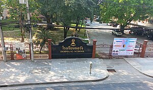
Horwang School
Government school in Bangkok, Thailand
Distance: Approx. 622 meters
Latitude and longitude: 13.8183,100.5626
Horwang School (Thai: โรงเรียนหอวัง) is a state school located in Bangkok, Thailand.

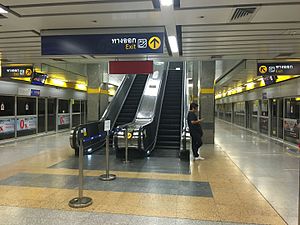
Phahon Yothin MRT station
Railway station in Bangkok, Thailand
Distance: Approx. 921 meters
Latitude and longitude: 13.8129,100.562
Phahon Yothin station (Thai: สถานีพหลโยธิน, pronounced [sā.tʰǎː.nīː pʰā.hǒn jōː.tʰīn]) is a Bangkok MRT station on the Blue Line located under Lat Phrao Road and Phahon Yothin Road, which the station is named after, near Lat Phrao Square. The station is important for people who live in Northern Bangkok such as the Don Mueang, Lak Si and Bang Khen districts. Its symbol color is yellow., and connect to the BTS Sukhumvit Line at Ha Yaek Lat Phrao station.

Wachirabenchathat Park
Park in Bangkok, Thailand
Distance: Approx. 906 meters
Latitude and longitude: 13.812,100.554
Wachirabenchathat Park, or often spelled Vachirabenjatas Park (Thai: สวนวชิรเบญจทัศ, RTGS: Suan Wachirabenchathat, pronounced [sǔan wá(ʔ).tɕʰī.rá(ʔ).bēn.tɕā.tʰát]), also popularly known as State Railway Public Park (สวนรถไฟ, RTGS: Suan Rotfai, pronounced [sǔan rót.fāj]) is a name of public park in Chatuchak district, Bangkok, Thailand. The park borders on the Queen Sirikit Park and Chatuchak Park, and it is also the largest park of the complex, bounded by Kamphaeng Phet 3 road and Kamphaeng Phet 2 road with Soi Nikhom Rotfai Sai 1 near PTT Head Office and Ministry of Energy. It is one of the most popular parks in Bangkok.

Lat Phrao Intersection
Road intersection in Bangkok, Thailand
Distance: Approx. 746 meters
Latitude and longitude: 13.81333333,100.55944444
Lat Phrao Intersection (Thai: ห้าแยกลาดพร้าว, pronounced [hâː jɛ̂ːk lâːt pʰráːw]) is a major road junction in Chatuchak District of the Thai capital Bangkok. It is where Phahonyothin and Vibhavadi Rangsit roads—the city's two main northward highways—cross each other, and is also the beginning of Lat Phrao Road, which leads eastward through its highly populated suburbs. The junction carries the second-highest amount of road traffic in the city.

Mo Chit 2 bus terminal
Bus station in Bangkok, Thailand
Distance: Approx. 1017 meters
Latitude and longitude: 13.8138609,100.5496779
The Bangkok Bus Terminal (Chatuchak), colloquially known as Mo Chit 2 (Thai: หมอชิต 2) or New Mo Chit, is one of the main long-distance bus stations serving Greater Bangkok. Managed by The Transport Company, Ltd., (TCL), it's the main spot for those who are traveling by bus to and from the northern and northeastern provinces. Replacing the old Mochit Station, Bangkok Bus Terminal (Chatuchak) was built to serve the changes of the BTS Skytrain depot and the increase in transportation.

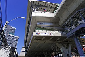
Phahon Yothin 24 BTS station
BTS Skytrain station in Bangkok
Distance: Approx. 1153 meters
Latitude and longitude: 13.8243,100.5665
Phahon Yothin 24 Station (Thai: สถานีพหลโยธิน 24, RTGS: Sathani Phahon Yothin Yi Sip Si, pronounced [sā.tʰǎː.nīː pʰā.hǒn jōː.tʰīn jîː sìp sìː]) is a BTS Skytrain station, on the Sukhumvit Line in Bangkok, Thailand. The station was planned to open in 2020 when all stations on the northern extension was completed, but the Ministry of Transport requested the station to open in phase 2 (Ha Yaek Lat Phrao-Kasetsart University) in December 2019.

Dan Neramit
Distance: Approx. 838 meters
Latitude and longitude: 13.82027778,100.56472222
Dan Neramit (Thai: แดนเนรมิต, RTGS: Daen Neramit, pronounced [dɛ̄ːn nēː.rā.mít]), sometimes translated as Magic Land, was the first amusement park in Thailand. It occupied 33 rai (5.3 ha; 13 acres) of land on Phahonyothin Road in Bangkok's Chatuchak District, and was in operation from 1976 to 2000, when its lease expired and owner Pannin Kitiparaporn moved operations to her new main property Dream World in the northern suburb of Pathum Thani Province. One of the park's most distinctive features was its fairy-tale castle, which overlooked its relatively small plot of land, and still stands today.
Weather in this IP's area
scattered clouds
26 Celsius
27 Celsius
26 Celsius
26 Celsius
1012 hPa
83 %
1012 hPa
1011 hPa
10000 meters
3.6 m/s
30 degree
40 %
06:14:02
17:48:46
