175.111.132.168 - IP Lookup: Free IP Address Lookup, Postal Code Lookup, IP Location Lookup, IP ASN, Public IP
Country:
Region:
City:
Location:
Time Zone:
Postal Code:
IP information under different IP Channel
ip-api
Country
Region
City
ASN
Time Zone
ISP
Blacklist
Proxy
Latitude
Longitude
Postal
Route
Luminati
Country
Region
dl
City
delhi
ASN
Time Zone
Asia/Kolkata
ISP
Gigantic Infotel Pvt Ltd
Latitude
Longitude
Postal
IPinfo
Country
Region
City
ASN
Time Zone
ISP
Blacklist
Proxy
Latitude
Longitude
Postal
Route
IP2Location
175.111.132.168Country
Region
himachal pradesh
City
santokhgarh
Time Zone
Asia/Kolkata
ISP
Language
User-Agent
Latitude
Longitude
Postal
db-ip
Country
Region
City
ASN
Time Zone
ISP
Blacklist
Proxy
Latitude
Longitude
Postal
Route
ipdata
Country
Region
City
ASN
Time Zone
ISP
Blacklist
Proxy
Latitude
Longitude
Postal
Route
Popular places and events near this IP address
Nangal
Town in Punjab, India
Distance: Approx. 5904 meters
Latitude and longitude: 31.385,76.375
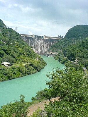
Nangal is a town, near city of Rupnagar in Rupnagar district in Punjab, India. It sits at the foot of the Shiwalik Hills where it was established after plans for a dam required the movement of previously established villages. Residential areas include Modern Avenue, Shivalik Avenue, Naya Nangal Township, BBMB Township and Nangal Basti area (Railway Road).
Mehatpur Basdehra
Place in Himachal Pradesh, India
Distance: Approx. 5231 meters
Latitude and longitude: 31.4092529,76.3400459
Mehatpur Basdehra is a town and a Nagar Parishad Sub Tehsil in the Una District of the Indian state of Himachal Pradesh.
Santokhgarh
Town in Himachal Pradesh, India
Distance: Approx. 483 meters
Latitude and longitude: 31.37,76.32
Santokhgarh is a town and a Municipal Council, nagar panchayat in Una district in the Indian state of Himachal Pradesh.
Dehlan, Himachal Pradesh
Village in Himachal Pradesh, India
Distance: Approx. 6559 meters
Latitude and longitude: 31.42366667,76.33433333
Dehlan Lower, is a village located in Una district of the Indian state of Himachal Pradesh. Recently, Dehlan was adopted by Shri Anurag Singh Thakur, the sitting Member of Parliament from the Hamirpur seat under Sansad Adarsh Gram Yojna.
Jawaharlal Navoday Vidhyalay Stadium
Distance: Approx. 5648 meters
Latitude and longitude: 31.41143056,76.28865278
Jawaharlal Navoday Vidhyalay Stadium is a cricket ground near Una, Himachal Pradesh, India. The first recorded match held on the ground came in January 1999 when Bengal Under-16s played Madhya Pradesh Under-16s. The ground later held a List A match in 1997 when Himachal Pradesh played the Services in the 1999/00 Ranji Trophy one-day competition.
Naya Nangal railway station
Railway station in Rupnagar district, India
Distance: Approx. 3405 meters
Latitude and longitude: 31.3788,76.3496
Naya Nangal railway station is a small railway station in Rupnagar district, Punjab. Its code is NNGL. It serves Naya Nangal city. The station consists of two platforms.
Nangal Dam railway station
Railway station in Punjab, India
Distance: Approx. 5418 meters
Latitude and longitude: 31.3708,76.3735
Nangal Dam railway station is a railway station in Rupnagar district, Punjab. Its code is NLDM. It serves Nangal, Nangal Township and Naya Nangal town.
Indus International University
Distance: Approx. 7067 meters
Latitude and longitude: 31.326093,76.2595602
Indus International University (IIU) is a private not-for-profit university, located near the village Bathu in Haroli Tehsil, Una district, Himachal Pradesh, India. The university was established in 2010 by the Kartha Education Society through the Indus International University (Establishment & Regulation) Act, 2009.
Jawahar Navodaya Vidyalaya, Una
School in Una district, Himachal Pradesh, India
Distance: Approx. 5680 meters
Latitude and longitude: 31.4116,76.2883
Jawahar Navodaya Vidyalaya, Una or locally known as JNV Pekhubela is a boarding, co-educational school in Una district of Himachal Pradesh state in India. Navodaya Vidyalayas are funded by the Indian Ministry of Human Resources Development and administered by Navodaya Vidyalaya Smiti, an autonomous body under the ministry.
Nangal Wildlife Sanctuary
Indian protected park
Distance: Approx. 6445 meters
Latitude and longitude: 31.4025,76.37
Nangal Wildlife Sanctuary is located in the foothills of Shiwalik in the state of Punjab. It serves as a home to various varieties of both flora and fauna. Aside from supporting varieties of flora and fauna, Nangal Wildlife Sanctuary also `houses’ some of the threatened species, such as the endangered Indian Pangolin, Egyptian Vulture, and many more.
Weather in this IP's area
clear sky
11 Celsius
9 Celsius
11 Celsius
11 Celsius
1016 hPa
35 %
1016 hPa
966 hPa
10000 meters
1.86 m/s
1.68 m/s
26 degree
