Country:
 USA
USARegion:
City:
Latitude and Longitude:
Time Zone:
Postal Code:
IP information under different IP Channel
ip-api
Country
Region
City
ASN
Time Zone
ISP
Blacklist
Proxy
Latitude
Longitude
Postal
Route
IPinfo
Country
Region
City
ASN
Time Zone
ISP
Blacklist
Proxy
Latitude
Longitude
Postal
Route
MaxMind
Country
Region
City
ASN
Time Zone
ISP
Blacklist
Proxy
Latitude
Longitude
Postal
Route
Luminati
Country
USRegion
fl
City
gainesville
ASN
Time Zone
America/New_York
ISP
ASN-CXA-ALL-CCI-22773-RDC
Latitude
Longitude
Postal
db-ip
Country
Region
City
ASN
Time Zone
ISP
Blacklist
Proxy
Latitude
Longitude
Postal
Route
ipdata
Country
Region
City
ASN
Time Zone
ISP
Blacklist
Proxy
Latitude
Longitude
Postal
Route
Popular places and events near this IP address

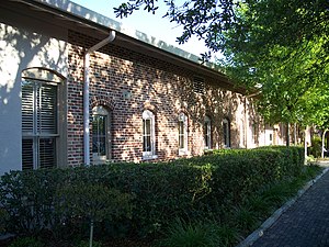
Civic Media Center
Infoshop and library in Florida, U.S.
Distance: Approx. 509 meters
Latitude and longitude: 29.64797,-82.32464
The Civic Media Center (CMC) is a nonprofit infoshop, library and reading room in Gainesville, Florida, United States. It was set up in 1993 and in 2009 received the book collection of activist Stetson Kennedy.

Hippodrome State Theatre
United States historic place
Distance: Approx. 628 meters
Latitude and longitude: 29.64916667,-82.32416667
The Hippodrome Theatre (locally known as The Hippodrome or The Hipp) is a regional professional theatre in downtown Gainesville, Florida, United States. It was founded in 1973 by local actors and was added to the U.S. National Register of Historic Places on July 10, 1979.

Southeast Gainesville Residential District
Historic district in Florida, United States
Distance: Approx. 806 meters
Latitude and longitude: 29.64916667,-82.31777778
The Southeast Gainesville Residential District is a U.S. historic district (designated as such on January 14, 1988) located in Gainesville, Florida. It encompasses approximately 335 acres (1.36 km2), bounded by East University Avenue, Southeast Ninth Street, Southeast Fifth Avenue, and Sweetwater Branch. It contains 94 historic buildings.

Baird Hardware Company Warehouse
United States historic place
Distance: Approx. 145 meters
Latitude and longitude: 29.64416667,-82.32444444
The Baird Hardware Company Warehouse (also known as the Baird Center) is a historic building in Gainesville, Florida, United States. It is located at 619 South Main Street. On November 25, 1985, it was added to the U.S. National Register of Historic Places.

Cox Furniture Warehouse
United States historic place
Distance: Approx. 322 meters
Latitude and longitude: 29.64555556,-82.32555556
The Cox Furniture Warehouse is a historic site in Gainesville, Florida, United States located at 602 South Main Street. On June 10, 1994, it was added to the U.S. National Register of Historic Places.

Gainesville station (Florida)
United States historic place
Distance: Approx. 178 meters
Latitude and longitude: 29.64519444,-82.323
The Old Gainesville Depot (also known as the Seaboard Air Line Depot or Baird Warehouse) is a historic site at 203 Southeast Depot Avenue in Gainesville, Florida. It is located along the Gainesville-Hawthorne Trail State Park. The station was added to the U.S. National Register of Historic Places on November 22, 1996.
Star Garage
United States historic place
Distance: Approx. 776 meters
Latitude and longitude: 29.65055556,-82.32361111
The Star Garage (also known as the Crawford and Davis Livery Stable or Poole-Gable Motors) is a U.S. historic building in Gainesville, Florida. It is located at 119 Southeast 1st Avenue. On December 17, 1985, it was added to the U.S. National Register of Historic Places.

Shady Grove Primitive Baptist Church
Historic church in Florida, United States
Distance: Approx. 712 meters
Latitude and longitude: 29.64638889,-82.32972222
The Shady Grove Primitive Baptist Church is a historic U.S. church in Gainesville, Florida. It is located at 804 Southwest Fifth Street. On October 5, 2005, it was added to the U.S. National Register of Historic Places.

Hogtown, Florida
Former human settlement in Florida, US
Distance: Approx. 509 meters
Latitude and longitude: 29.64797,-82.32464
Hogtown was a 19th-century settlement in and around what is now Westside Park in Gainesville, Florida, United States (in the northeast corner of the intersection of NW 8th Avenue and 34th Street) where a historical marker notes Hogtown's location at that site and is the eponymous outpost of the adjacent Hogtown Creek. Originally a village of Seminoles who raised hogs, the habitation was dubbed "Hogtown" by nearby white people who traded with the Seminoles. Indian artifacts were found at Glen Springs, which empties into Hogtown Creek.

Citizens Co-op
Distance: Approx. 443 meters
Latitude and longitude: 29.6473,-82.32479
Citizens Co-op was a food cooperative, or a community owned market located in Gainesville, Florida. It closed in 2016 due to financial issues.

Cade Museum for Creativity and Invention
Museum in Gainesville, Florida, US
Distance: Approx. 165 meters
Latitude and longitude: 29.6437,-82.3248
The Cade Museum for Creativity and Invention is a museum in Gainesville, Florida, that has a mission "to transform communities by inspiring and equipping future inventors, entrepreneurs, and visionaries." The museum is named after Robert Cade, the lead inventor of Gatorade, and reflects his view of combining science and art in a manner of "purposeful creativity".
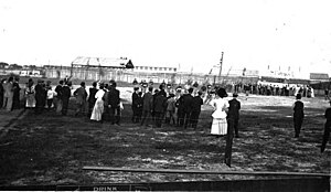
The Ballpark (Gainesville)
Ballpark in Gainesville, Florida (1883-1946)
Distance: Approx. 574 meters
Latitude and longitude: 29.646499,-82.32801
The Ballpark was a simple multi-purpose athletic field and community space near downtown Gainesville, Florida. It was laid out in the early 1880s and was used by various local amateur and semi-professional teams along with one season of spring training by the Philadelphia Phillies of Major League Baseball. The Ballpark also served as the initial home field for the University of Florida's football and baseball teams when they were established during the 1906-1907 academic year.
Weather in this IP's area
clear sky
18 Celsius
17 Celsius
17 Celsius
19 Celsius
1025 hPa
68 %
1025 hPa
1020 hPa
10000 meters
0.45 m/s
0.89 m/s
291 degree
07:34:19
18:53:21