Country:
 USA
USARegion:
City:
Latitude and Longitude:
Time Zone:
Postal Code:
IP information under different IP Channel
ip-api
Country
Region
City
ASN
Time Zone
ISP
Blacklist
Proxy
Latitude
Longitude
Postal
Route
IPinfo
Country
Region
City
ASN
Time Zone
ISP
Blacklist
Proxy
Latitude
Longitude
Postal
Route
MaxMind
Country
Region
City
ASN
Time Zone
ISP
Blacklist
Proxy
Latitude
Longitude
Postal
Route
Luminati
Country
USRegion
ny
City
newyork
ASN
Time Zone
America/New_York
ISP
IMDC-AS12025
Latitude
Longitude
Postal
db-ip
Country
Region
City
ASN
Time Zone
ISP
Blacklist
Proxy
Latitude
Longitude
Postal
Route
ipdata
Country
Region
City
ASN
Time Zone
ISP
Blacklist
Proxy
Latitude
Longitude
Postal
Route
Popular places and events near this IP address

Hell's Kitchen, Manhattan
Neighborhood in New York City
Distance: Approx. 134 meters
Latitude and longitude: 40.76416667,-73.99222222
Hell's Kitchen, formerly also known as Clinton, is a neighborhood on the West Side of Midtown Manhattan in New York City, United States. It is considered to be bordered by 34th Street (or 41st Street) to the south, 59th Street to the north, Eighth Avenue to the east, and the Hudson River to the west. Hell's Kitchen has long been a bastion of poor and working-class Irish Americans, and its gritty reputation has long held real-estate prices below those of most other areas of Manhattan.

High School of Graphic Communication Arts
School in New York, New York, United States
Distance: Approx. 180 meters
Latitude and longitude: 40.763466,-73.990561
The High School of Graphic Communication Arts (H.S.G.C.A.) is a vocational high school located in the Hell's Kitchen section of Manhattan in New York City. Founded in 1925 as the New York School of Printing, the school is divided into five academies that offer basic instruction in several fields including printing, photography, journalism, visual arts, and law enforcement.

Hallo Berlin
Restaurant in New York City, New York
Distance: Approx. 248 meters
Latitude and longitude: 40.76112,-73.99418
Hallo Berlin was a restaurant at 626 Tenth Avenue between West 44th and 45th Streets in the Hell's Kitchen neighborhood of New York City. It consisted of a beer garden restaurant and a street cart. They served authentic German beer and cuisine like frankfurters, sauerkraut, potato pancakes, red cabbage, spätzle, wursts and other foods.
50th Street station (IRT Ninth Avenue Line)
Former Manhattan Railway elevated station (closed 1940)
Distance: Approx. 311 meters
Latitude and longitude: 40.76348611,-73.98896667
The 50th Street station was a local station on the demolished IRT Ninth Avenue Line in Manhattan, New York City. It was built on January 18, 1876 and eventually had two levels. The lower level was built first and had two tracks and two side platforms that served local trains.

Church of the Sacred Heart of Jesus (New York City)
Church in New York , United States
Distance: Approx. 298 meters
Latitude and longitude: 40.76509444,-73.9904
The Church of the Sacred Heart of Jesus is a Roman Catholic parish church, located in Hell's Kitchen/Clinton, Manhattan, New York City. Founded in 1876, it is a parish of the Archdiocese of New York and is located at 457 West 51st Street. Sacred Heart of Jesus School is located at 456 West 52nd Street.

Ninth Avenue derailment
1905 New York City elevated train derailment
Distance: Approx. 309 meters
Latitude and longitude: 40.7635,-73.989
The Ninth Avenue derailment, on the Ninth Avenue Elevated in Manhattan on September 11, 1905, was the worst accident on the New York City elevated railways, resulting in 13 deaths and 48 serious injuries.

Hell's Kitchen Park
Public park in Manhattan, New York
Distance: Approx. 6 meters
Latitude and longitude: 40.76294444,-73.99258333
Hell's Kitchen Park is a 0.58-acre (0.23 ha) park in Hell's Kitchen in Manhattan, New York City.
St. Albert Church (New York City)
Building in New York City, United States of America
Distance: Approx. 129 meters
Latitude and longitude: 40.762286,-73.991391
St. Albert's Church is a former Roman Catholic parish church under the authority of the Roman Catholic Archdiocese of New York, located at 429-433 West 47th Street in Manhattan, New York City. The parish was established as the Belgian national parish in 1916 and is now closed.
Church of the Assumption (New York City)
Distance: Approx. 180 meters
Latitude and longitude: 40.76347222,-73.99055278
The Church of the Assumption is a former Roman Catholic parish church under the authority of the Roman Catholic Archdiocese of New York, located at 427 West 49th Street in Manhattan, New York City.

Saints Kyril & Metodi Bulgarian Eastern Orthodox Diocesan Cathedral
Church in Manhattan, New York
Distance: Approx. 305 meters
Latitude and longitude: 40.765461,-73.994182
Saints Kyril & Metodi Bulgarian Eastern Orthodox Diocesan Cathedral (sometimes SS. Kiril and Methodi) is the cathedral church and headquarters of the Bulgarian Orthodox Church Diocese of the United States, Canada, and Australia. The church is located at 552 West 50th Street, between Tenth and Eleventh Avenues, Hell's Kitchen / Clinton, Manhattan, New York City.: 221 The building is 100 feet long, 28 feet wide, and 25 feet high, with a yellow brick façade. In 1890 its site was occupied by a silk-ribbon factory.
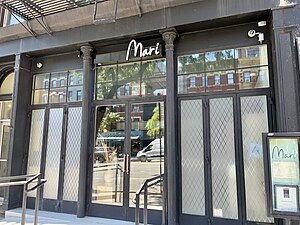
Mari (restaurant)
Korean restaurant in New York City
Distance: Approx. 232 meters
Latitude and longitude: 40.76155556,-73.99061111
Mari is a Korean restaurant in New York City. The restaurant has received a Michelin star. Time Out New York has rated Mari 5 out of 5 stars.

Kochi (restaurant)
Korean restaurant in New York City
Distance: Approx. 132 meters
Latitude and longitude: 40.76202778,-73.9935
Kochi (Korean: 꼬치) is a Korean restaurant in New York City. The restaurant has received a Michelin star.
Weather in this IP's area
clear sky
27 Celsius
28 Celsius
25 Celsius
28 Celsius
1010 hPa
53 %
1010 hPa
1008 hPa
10000 meters
7.15 m/s
8.05 m/s
47 degree
06:40:58
18:58:15