173.45.20.82 - IP Lookup: Free IP Address Lookup, Postal Code Lookup, IP Location Lookup, IP ASN, Public IP
Country:
Region:
City:
Location:
Time Zone:
Postal Code:
IP information under different IP Channel
ip-api
Country
Region
City
ASN
Time Zone
ISP
Blacklist
Proxy
Latitude
Longitude
Postal
Route
Luminati
Country
Region
va
City
sterling
ASN
Time Zone
America/New_York
ISP
AMC
Latitude
Longitude
Postal
IPinfo
Country
Region
City
ASN
Time Zone
ISP
Blacklist
Proxy
Latitude
Longitude
Postal
Route
IP2Location
173.45.20.82Country
Region
virginia
City
sterling
Time Zone
America/New_York
ISP
Language
User-Agent
Latitude
Longitude
Postal
db-ip
Country
Region
City
ASN
Time Zone
ISP
Blacklist
Proxy
Latitude
Longitude
Postal
Route
ipdata
Country
Region
City
ASN
Time Zone
ISP
Blacklist
Proxy
Latitude
Longitude
Postal
Route
Popular places and events near this IP address

Warp Drive
Short street in Sterling, Virginia
Distance: Approx. 3153 meters
Latitude and longitude: 39.01379,-77.42991
Warp Drive is a short street in Sterling, Virginia, United States. Originally named Steeplechase Drive, it is located in an industrial park off Atlantic Boulevard, and primarily serves as the address for Northrop Grumman Innovation Systems, an aerospace company. The street ends at a circle where an off-ramp from Virginia State Highway 28 joins from the opposite direction.

Sterling, Virginia
Census-designated place in Virginia
Distance: Approx. 3201 meters
Latitude and longitude: 39.00611111,-77.42861111
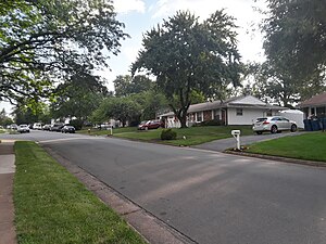
Sterling, Virginia, refers most specifically to a census-designated place (CDP) in Loudoun County, Virginia, United States. The population of the CDP as of the 2020 United States Census was 30,337 The CDP boundaries are confined to a relatively small area between Virginia State Route 28 on the west and Virginia State Route 7 on the northeast, excluding areas near SR 606 and the Dulles Town Center. A much wider region has a preferred mailing address of "Sterling, Virginia", per the United States Postal Service.
Dominion High School
Public school in Sterling, Virginia
Distance: Approx. 2126 meters
Latitude and longitude: 39.0263,-77.3735
Dominion High School is a public secondary school in Sterling, an unincorporated area in Loudoun County, Virginia, United States. Dominion High School first opened in 2003, receiving students from Potomac Falls High School and Park View High School. Dominion's student body lives primarily in the communities of Sugarland Run and Lowes Island.

Park View High School (Loudoun County, Virginia)
High school in Sterling, Virginia, United States
Distance: Approx. 632 meters
Latitude and longitude: 39.015,-77.40080556
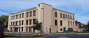
Park View High School is a public secondary school in Sterling, an unincorporated area in Loudoun County, Virginia, United States. The school is part of Loudoun County Public Schools and is located at 400 West Laurel Avenue in the Sterling Park community.

Dulles Town Center
Shopping mall in Dulles, Virginia
Distance: Approx. 3231 meters
Latitude and longitude: 39.03213889,-77.42383333
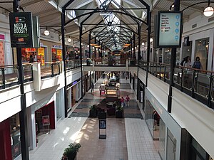
Dulles Town Center is a two-level enclosed shopping mall in Sterling in Loudoun County, Virginia. It is located five miles (8.0 km) north of Washington Dulles International Airport. It is part of the Dulles Town Center census-designated place for population statistical purposes.

Loudoun Academy of Science
Magnet school
Distance: Approx. 2068 meters
Latitude and longitude: 39.02594444,-77.374
The Academy of Science (AOS) is a STEM program for high school students enrolled in Loudoun County Public Schools. The program was previously located in Dominion High School. During the summer of 2018, the Academy of Science joined the Monroe Advanced Technical Academy (MATA) and the new Academy of Engineering and Technology (AET) to form the Academies of Loudoun (ACL).

Dulles Town Center, Virginia
Census-designated place in Virginia
Distance: Approx. 2132 meters
Latitude and longitude: 39.02416667,-77.41527778
Dulles Town Center is a census-designated place (CDP) in Loudoun County, Virginia, United States. It is located about 7 miles (11 km) north of Washington Dulles International Airport. The CDP is the location of the Dulles Town Center shopping mall, for which it is named.
Sugarland Run, Virginia
Census-designated place in Virginia
Distance: Approx. 2940 meters
Latitude and longitude: 39.0375,-77.37527778
Sugarland Run is a planned community and census-designated place in Loudoun County, Virginia, United States. The population at the 2010 census was 11,799. In 2020, it was estimated to be 12,956.

Dranesville Tavern
Historic commercial building in Virginia, United States
Distance: Approx. 2967 meters
Latitude and longitude: 39.00777778,-77.36055556
The Dranesville Tavern that was located in Dranesville, Virginia dates from 1850. It was listed on the National Register of Historic Places in 1972. The building has been moved from its original location and is now located near Herndon.

Vestal's Gap Road and Lanesville Historic District
Historic district in Virginia, United States
Distance: Approx. 865 meters
Latitude and longitude: 39.0175,-77.40305556
Vestal's Gap Road and Lanesville Historic District is a national historic district located in Claude Moore Park at Sterling, Loudoun County, Virginia. It encompasses 1 contributing building and 1 contributing structure. They are "Lanesville," a two-story side-gabled frame house on a solid stone-rubble foundation built about 1807, and a section of the former Vestal's Gap Road, an 18th-century road.
Bloomfield (Herndon, Virginia)
Historic house in Virginia, United States
Distance: Approx. 2996 meters
Latitude and longitude: 39.01027778,-77.35944444
Bloomfield, also known as Holly Knoll, is a historic home located near Herndon, Fairfax County, Virginia. It was built about 1858, and is a two-story, five-bay, red brick I-house with a two-story service wing. The front facade has small one-story front portico with a flat roof is supported by four plain square posts.

All Dulles Area Muslim Society
Distance: Approx. 1568 meters
Latitude and longitude: 39.00639,-77.37936
All Dulles Area Muslim Society (ADAMS) is one of the largest mosques in the United States, located in Sterling, VA and serving 5000 Muslim families. ADAMS offers a wide variety of services. Some are of religious nature such as Islamic and Arabic classes, while others are of communal nature such as Boy and Girl Scout activities.
Weather in this IP's area
light rain
16 Celsius
16 Celsius
15 Celsius
17 Celsius
1005 hPa
83 %
1005 hPa
995 hPa
10000 meters
6.17 m/s
12.86 m/s
160 degree
100 %
