Country:
 Canada
Region:
City:
Latitude and Longitude:
Time Zone:
Postal Code:
IP information under different IP Channel
ip-api
Country
Region
City
ASN
Time Zone
ISP
Blacklist
Proxy
Latitude
Longitude
Postal
Route
IPinfo
Country
Region
City
ASN
Time Zone
ISP
Blacklist
Proxy
Latitude
Longitude
Postal
Route
MaxMind
Country
Region
City
ASN
Time Zone
ISP
Blacklist
Proxy
Latitude
Longitude
Postal
Route
Luminati
Country
CARegion
on
City
ottawa
ASN
Time Zone
America/Toronto
ISP
ROGERS-COMMUNICATIONS
Latitude
Longitude
Postal
db-ip
Country
Region
City
ASN
Time Zone
ISP
Blacklist
Proxy
Latitude
Longitude
Postal
Route
ipdata
Country
Region
City
ASN
Time Zone
ISP
Blacklist
Proxy
Latitude
Longitude
Postal
Route
Popular places and events near this IP address

The Glebe
Neighbourhood in Ottawa, Ontario, Canada
Distance: Approx. 445 meters
Latitude and longitude: 45.40022,-75.69219
The Glebe is a neighbourhood in Ottawa, Ontario, Canada. It is located just south of Downtown Ottawa in the Capital Ward. As of 2016, the neighbourhood had a population of 13,055.

TD Place Arena
Architectural structure at Lansdowne Park in Ottawa
Distance: Approx. 371 meters
Latitude and longitude: 45.39888611,-75.68412222
TD Place Arena, originally the Ottawa Civic Centre, is an indoor arena located in Ottawa, Ontario, Canada. Opened in December 1967, it is used primarily for sports, including curling, figure skating, ice hockey, and lacrosse. The arena has hosted Canadian and world championships in figure skating, curling, and ice hockey, including the first women's world ice hockey championship in 1990.

TD Place Stadium
Stadium in Ottawa, Canada
Distance: Approx. 376 meters
Latitude and longitude: 45.39805556,-75.68361111
TD Place Stadium (originally Lansdowne Park and formerly Frank Clair Stadium) is an outdoor stadium in Ottawa, Ontario, Canada. It is located at Lansdowne Park, on the southern edge of The Glebe neighbourhood, where Bank Street crosses the Rideau Canal. It is the home of the Ottawa Redblacks of the Canadian Football League (CFL), Atlético Ottawa of the Canadian Premier League (CPL) and the Ottawa Gee-Gees football team of Ontario University Athletics (OUA), which represent the University of Ottawa.
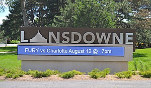
Lansdowne Park
Exhibition grounds in Ottawa
Distance: Approx. 455 meters
Latitude and longitude: 45.399,-75.683
Lansdowne Park is a 40-acre (16 ha) urban park, historic sports, exhibition and entertainment facility in Ottawa, Ontario, Canada, owned by the City of Ottawa. It is located on Bank Street adjacent to the Rideau Canal in The Glebe neighbourhood of central Ottawa. Lansdowne Park contains the TD Place Stadium and Arena complex (formerly Frank Clair Stadium and the Ottawa Civic Centre, respectively), the Aberdeen Pavilion, and the Horticulture Building.

Bank Street Bridge
Bridge in Ottawa, Canada
Distance: Approx. 307 meters
Latitude and longitude: 45.3962,-75.6847
The Bank Street Bridge, officially known as the Bank Street Canal Bridge, is a bridge in Ottawa, Ontario, Canada, that carries Bank Street over the Rideau Canal. It links the Glebe to Old Ottawa South. It also passes over the Queen Elizabeth Driveway and Colonel By Drive.

Brown's Inlet
Body of water in central Ottawa, Canada
Distance: Approx. 30 meters
Latitude and longitude: 45.397365,-75.688677
Brown's Inlet is a body of water in central Ottawa. A former creek, it grew considerably in size with the creation of the Rideau Canal, into which it now empties. Originally considerably larger, the inlet was shortened and divided so that today on the surface it is two ponds, but they are connected underground.

Mayfair Theatre, Ottawa
Motion picture venue in Ottawa, Ontario
Distance: Approx. 463 meters
Latitude and longitude: 45.3946,-75.6838
The Mayfair Theatre is a cinema located in Ottawa, Ontario, Canada. It is Ottawa's oldest active movie theatre, operating since 1932. It operates as an independent repertory cinema.

Mutchmor Public School
School in Ottawa, Ontario, Canada
Distance: Approx. 439 meters
Latitude and longitude: 45.4009,-75.6906
Mutchmor Public School is an elementary school in Ottawa, Ontario, Canada. It is located in The Glebe neighbourhood at the corner of Fifth Avenue and Lyon. It is run by the Ottawa-Carleton District School Board.
Capital Ward
Place in Ontario, Canada
Distance: Approx. 491 meters
Latitude and longitude: 45.4,-75.68333333
Capital Ward or Ward 17 (French: Quartier Capitale) is a city ward located in the centre of Ottawa, Ontario. Situated just south of downtown Ottawa, the ward includes the communities of Old Ottawa East, Old Ottawa South, the Glebe, Heron Park, Carleton University, and Riverside Out of all the wards currently in existence, Capital ward has existed the longest. It was originally created in 1909 from parts of Wellington Ward and Central Ward when the Glebe was settled.

Lansdowne Park redevelopment
History of public project
Distance: Approx. 455 meters
Latitude and longitude: 45.399166,-75.683119
The Lansdowne Park redevelopment was a public-private partnership redevelopment of the Lansdowne Park fairgrounds in Ottawa, Ontario, Canada. In September 2007, cracks were discovered in Frank Clair Stadium, and a portion of the south-side stands was demolished due to safety concerns. The City of Ottawa subsequently initiated an international design competition to redevelop Lansdowne Park.
Augustine College
Distance: Approx. 423 meters
Latitude and longitude: 45.4011,-75.6884
Augustine College (AC) is a private ecumenical Christian liberal arts college in Ottawa, Ontario. Augustine currently offers two semester-long programs focused on the histories of science and the humanities in late and classical antiquity and in the modern era, respectively. AC operates on an unincorporated basis and without program accreditation, but maintains transfer credit agreements with several other postsecondary institutions in North America.
House of Targ
Distance: Approx. 490 meters
Latitude and longitude: 45.39456,-75.6834
House of Targ is a live music venue, arcade and pierogi restaurant in Ottawa, Canada. The venue opened April 17, 2014, with a live performance from Toronto band PUP. Most of the bands booked belong to the rock, indie, alternative, punk, hardcore, metal, ska, synth categories. Some bands and artists that have performed at House of TARG include Pup, The Nils, Rational Youth, The Real McKenzies, UK Subs, Neil Hamburger, Angry Samoans, Agathocles, Extreme Noise Terror, Dead Brain Cells, David Liebe Hart, B.A. Johnston, Rich Aucoin, Chixdiggit, Anciients, Hibria, Dayglo Abortions, Screaming Females, The Courtneys, C. J. Ramone, Ian Blurton, Truckfighters, Bob Log III, Re-Animator, Gorod, Mike Krol, Weaves, Hard Skin, Antidote, Blanks 77, A Wilhelm Scream, Days N' Daze, Moon King, Surfer Blood, Pop.
Weather in this IP's area
scattered clouds
12 Celsius
11 Celsius
10 Celsius
12 Celsius
1011 hPa
64 %
1011 hPa
1003 hPa
10000 meters
6.69 m/s
290 degree
40 %
07:08:56
18:31:39