173.32.100.110 - IP Lookup: Free IP Address Lookup, Postal Code Lookup, IP Location Lookup, IP ASN, Public IP
Country:
Region:
City:
Location:
Time Zone:
Postal Code:
ISP:
ASN:
language:
User-Agent:
Proxy IP:
Blacklist:
IP information under different IP Channel
ip-api
Country
Region
City
ASN
Time Zone
ISP
Blacklist
Proxy
Latitude
Longitude
Postal
Route
db-ip
Country
Region
City
ASN
Time Zone
ISP
Blacklist
Proxy
Latitude
Longitude
Postal
Route
IPinfo
Country
Region
City
ASN
Time Zone
ISP
Blacklist
Proxy
Latitude
Longitude
Postal
Route
IP2Location
173.32.100.110Country
Region
ontario
City
shand's corner
Time Zone
ISP
Language
User-Agent
Latitude
Longitude
Postal
ipdata
Country
Region
City
ASN
Time Zone
ISP
Blacklist
Proxy
Latitude
Longitude
Postal
Route
Popular places and events near this IP address

Norfolk County, Ontario
City in Ontario, Canada
Distance: Approx. 5770 meters
Latitude and longitude: 42.85,-80.26666667
Norfolk County ( NOR-fohk) is a rural single-tier municipality on the north shore of Lake Erie in Southwestern Ontario, Canada with a 2023 population of 73,015. Despite its name, it is no longer a county by definition, as all municipal services are handled by a single level of government. The largest community in Norfolk County is Simcoe, whose 2021 population was 16,121.

Port Dover
Community of Norfolk County, Ontario, Canada
Distance: Approx. 5210 meters
Latitude and longitude: 42.78666667,-80.20305556
Port Dover is an unincorporated community and former town located in Norfolk County, Ontario, Canada, on the north shore of Lake Erie. It is the site of the recurring Friday the 13th motorcycle rally. Prior to the War of 1812, this community was known as Dover Mills.
Lynn River
Distance: Approx. 3076 meters
Latitude and longitude: 42.809696,-80.180347
The Lynn River is a fresh water river located in Norfolk County in Southwestern Ontario, Canada. It empties into Lake Erie at Port Dover.
Norfolk—Haldimand
Former federal electoral district in Ontario, Canada
Distance: Approx. 7599 meters
Latitude and longitude: 42.85,-80.29
Norfolk—Haldimand was a federal electoral district represented in the House of Commons of Canada from 1968 to 1979. It was located in the province of Ontario. This riding was created in 1966 from parts of Brant—Haldimand and Norfolk ridings.
Simcoe (Dennison Field) Airport
Domestic airport in Simcoe, Ontario
Distance: Approx. 5627 meters
Latitude and longitude: 42.81916667,-80.26583333
Simcoe (Dennison Field) Airport (TC LID: CPA4) is located 2 nautical miles (3.7 km; 2.3 mi) southeast of Simcoe, Ontario, Canada.
Simcoe Composite School
Public high school in Simcoe, Ontario, Canada
Distance: Approx. 8553 meters
Latitude and longitude: 42.841147,-80.303949
Simcoe Composite School is a high school in Simcoe, Ontario, Canada. More than 800 students attend this rural secondary school and courses range from English, French, Art, Music, and Mathematics to Computer Sciences, Business, Athletics, Cosmetology, Tech, World History, Civics, and Drama class. Megan Timpf, a representative for the 2008 Canadian softball team at the Olympic Games in Beijing attended this high school.

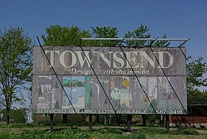
Townsend, Ontario
Planned community in Haldimand County, Ontario, Canada
Distance: Approx. 8304 meters
Latitude and longitude: 42.894862,-80.142034
Townsend is a planned community in Haldimand County, Ontario, Canada, that was founded in 1970 with the expectation it would house the developing industrial region to the south around Nanticoke.
Port Dover Composite School
School in Port Dover, Ontario, Canada
Distance: Approx. 4820 meters
Latitude and longitude: 42.791039,-80.211933
Port Dover Composite School (PDCS) was a public middle and high school located in Port Dover, Ontario, Canada. Shortly after closure, PDCS was converted into an elementary school called Lakewood Public School Students here typically lived south of Simcoe, northeast of Turkey Point and southwest of Jarvis. PDCS had a well established theatre arts program which allowed students to take drama in Grades 9 and 10, and then go on to the unique Theatre Co-op Program.
Sprucedale Youth Centre
Prison and school in Ontario, Canada
Distance: Approx. 6566 meters
Latitude and longitude: 42.834421,-80.280125
Sprucedale Youth Centre (formerly known as Sprucedale Training School) is a youth detention centre in Simcoe, Ontario, Canada operated by the province's Ministry of Children, Community and Social Services. The centre houses high-security male young offenders between 13 and 18 years of age, primarily those convicted of serious offences under the Youth Criminal Justice Act up to and including murder.
Lynn Valley Trail
Nature trail in Norfolk County, Ontario
Distance: Approx. 6319 meters
Latitude and longitude: 42.814229,-80.272551
The Lynn Valley Trail is a 10-kilometre (6.2 mi) trail connecting Simcoe, Ontario, Canada to Port Dover.
Friday the 13th motorcycle rally
Motorcycle rally in Port Dover, Ontario, Canada
Distance: Approx. 5210 meters
Latitude and longitude: 42.78666667,-80.20305556
The Friday the 13th Motorcycle Rally is a motorcycle rally held every Friday the 13th in Port Dover, Ontario, Canada since 1981. Its typical summer attendance exceeds 100,000 bikers.
Baptist Bible College Canada and Theological Seminary
Theological college and seminary in Simcoe, Ontario
Distance: Approx. 6892 meters
Latitude and longitude: 42.85143,-80.28048
Baptist Bible College Canada and Theological Seminary was a college Baptist school and seminary in Ontario. It operated from 1978 to 2017. The college operated a distance education school training pastors for Baptist churches in Canada and elsewhere.
Weather in this IP's area
broken clouds
-4 Celsius
-11 Celsius
-4 Celsius
-4 Celsius
1025 hPa
73 %
1025 hPa
999 hPa
10000 meters
7.01 m/s
8.88 m/s
269 degree
79 %