173.251.247.247 - IP Lookup: Free IP Address Lookup, Postal Code Lookup, IP Location Lookup, IP ASN, Public IP
Country:
Region:
City:
Location:
Time Zone:
Postal Code:
ISP:
ASN:
language:
User-Agent:
Proxy IP:
Blacklist:
IP information under different IP Channel
ip-api
Country
Region
City
ASN
Time Zone
ISP
Blacklist
Proxy
Latitude
Longitude
Postal
Route
db-ip
Country
Region
City
ASN
Time Zone
ISP
Blacklist
Proxy
Latitude
Longitude
Postal
Route
IPinfo
Country
Region
City
ASN
Time Zone
ISP
Blacklist
Proxy
Latitude
Longitude
Postal
Route
IP2Location
173.251.247.247Country
Region
california
City
culver city
Time Zone
America/Los_Angeles
ISP
Language
User-Agent
Latitude
Longitude
Postal
ipdata
Country
Region
City
ASN
Time Zone
ISP
Blacklist
Proxy
Latitude
Longitude
Postal
Route
Popular places and events near this IP address

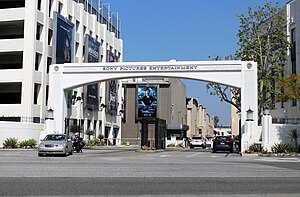
Sony Pictures Studios
Television and film studio complex, California, U.S.
Distance: Approx. 818 meters
Latitude and longitude: 34.01722222,-118.40166667
The Sony Pictures Studios is an American television and film studio complex located in Culver City, California at 10202 West Washington Boulevard and bounded by Culver Boulevard (south), Washington Boulevard (north), Overland Avenue (west) and Madison Avenue (east). Founded in 1912, the facility is currently owned by Sony Pictures and houses the division's film studios, such as Columbia Pictures, TriStar Pictures, and Screen Gems. The complex was the original home of Metro-Goldwyn-Mayer from 1924 to 1986 and Lorimar-Telepictures from 1986 to 1988.

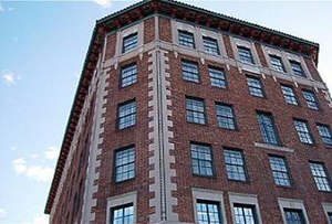
Culver Hotel
Historical building in Culver City, California, US
Distance: Approx. 753 meters
Latitude and longitude: 34.02385,-118.39427
The Culver Hotel is a national historical landmark in downtown Culver City, California. It was built by Harry Culver, the founder of Culver City, and opened on September 4, 1924, with local headlines announcing: "City packed with visitors for opening of Culver skyscraper." Originally named Hotel Hunt, and later known as Culver City Hotel, the six-story Renaissance Revival building was designed by Curlett & Beelman, the architecture firm behind renowned Art Deco buildings throughout Los Angeles, including downtown Los Angeles's Roosevelt and Eastern Columbia buildings. As Culver City became a movie-making mecca beginning in the 1920s, the hotel welcomed legendary stars, some maintaining private residences for months at a time.

Culver Studios
American movie studio in California, opened 1918
Distance: Approx. 746 meters
Latitude and longitude: 34.023894,-118.392475
The Culver Studios is a film studio in Culver City, California. Originally created by silent movie pioneer Thomas H. Ince, classics from Hollywood's Golden Age were filmed there. It was purchased, in 2014, by Hackman Capital Partners, which completely modernized the lot over the next four years, while preserving the site's historic structures.

St. Augustine's Catholic School (Culver City, California)
Primary school in Culver City, California, United States
Distance: Approx. 812 meters
Latitude and longitude: 34.02138889,-118.4
Established in 1926, St. Augustine's Catholic School is a comprehensive Pre-K to 8th grade Western Association of Schools and Colleges accredited institution located in Culver City, California, USA. It was founded by the Daughters Of Mary and Joseph, an order of nuns, and to this day is connected to St. Augustine Church in Culver City.

Southern California Hospital at Culver City
Hospital in California, United States
Distance: Approx. 757 meters
Latitude and longitude: 34.02277778,-118.3975
Southern California Hospital at Culver City is an acute care hospital in Culver City, California. The hospital is located in Culver City's downtown area. The hospital serves West Los Angeles; providing 24 hour medical service.
Dr. Paul Carlson Park
Distance: Approx. 614 meters
Latitude and longitude: 34.013706,-118.397942
Dr. Paul Carlson Park, or, more commonly, Carlson Park, is a small park located in the Carlson Park neighborhood of Culver City, California. It is linear in shape and intended for passive recreational use, featuring open grassy spaces as well as picnic and barbecue facilities.

Kirk Douglas Theatre
Theater in Culver City, California, US
Distance: Approx. 627 meters
Latitude and longitude: 34.02166667,-118.39694444
The Kirk Douglas Theatre is a 317-seat theater located in Culver City, California, United States. Since 2004, it has been operated by the Center Theatre Group.
St. Augustine Catholic Church (Culver City, California)
Church in California, United States
Distance: Approx. 793 meters
Latitude and longitude: 34.02027778,-118.40055556
St. Augustine Catholic Church is a Catholic church located in Culver City, California, part of the Roman Catholic Archdiocese of Los Angeles. The church is located across the street from the Sony Pictures Studios, previously the MGM Studios.

Rancho Rincón de los Bueyes
Historical land grant in California
Distance: Approx. 405 meters
Latitude and longitude: 34.02,-118.39
Rancho Rincón de los Bueyes was a 3,127-acre (12.65 km2) land grant in present-day Los Angeles County, California, given in 1821 to Bernardo Higuera and Cornelio Lopez by Pablo Vicente de Sola, the Spanish Governor of Alta California. In 1843, this Spanish grant was confirmed by Mexican Governor Manuel Micheltorena. Rincón, translated from Spanish, means corner or nook, and Bueyes are oxen or steer.
STAR Prep Academy
School in Los Angeles, California
Distance: Approx. 585 meters
Latitude and longitude: 34.012641,-118.389641
STAR Prep Academy is a co-educational private middle school and high school for students in grades 6-12 located in Los Angeles, California. It is run by STAR, Inc. and provides education for about 60 students.

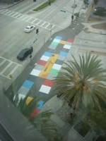
CulverLand
Temporary artwork in Culver City, California, US
Distance: Approx. 757 meters
Latitude and longitude: 34.0239,-118.3942
CulverLand was a temporary artwork and functioning game in Culver City, California, United States, created by John Derevlany. It was funded by an arts grant from the City of Culver City, California, and installed as part of the 2010 Indiecade, the International Festival of Independent Games. In "CulverLand," pedestrians were the playing pieces.

Baldwin Hills Scenic Overlook State Park
California State Park in Baldwin Hills, Los Angeles County
Distance: Approx. 618 meters
Latitude and longitude: 34.0175,-118.38611111
Baldwin Hills Scenic Overlook State Park is a 57-acre (0.23 km2) California State Park located just southwest of downtown Culver City. The park entrance is on Jefferson Boulevard. The main hiking trail is steep and winding.
Weather in this IP's area
few clouds
12 Celsius
11 Celsius
12 Celsius
12 Celsius
1019 hPa
79 %
1019 hPa
1009 hPa
10000 meters
1.68 m/s
1.7 m/s
226 degree
11 %

