Country:
Region:
City:
Latitude and Longitude:
Time Zone:
Postal Code:
IP information under different IP Channel
ip-api
Country
Region
City
ASN
Time Zone
ISP
Blacklist
Proxy
Latitude
Longitude
Postal
Route
Luminati
Country
Region
il
City
chicago
ASN
Time Zone
America/Chicago
ISP
STRATUS-NETWORKS
Latitude
Longitude
Postal
IPinfo
Country
Region
City
ASN
Time Zone
ISP
Blacklist
Proxy
Latitude
Longitude
Postal
Route
db-ip
Country
Region
City
ASN
Time Zone
ISP
Blacklist
Proxy
Latitude
Longitude
Postal
Route
ipdata
Country
Region
City
ASN
Time Zone
ISP
Blacklist
Proxy
Latitude
Longitude
Postal
Route
Popular places and events near this IP address

Chatham, Illinois
Village in Illinois, United States
Distance: Approx. 1526 meters
Latitude and longitude: 39.67277778,-89.69833333
Chatham is a village in Sangamon County, Illinois, United States. It is located 2.8 miles (4.5 km) south of Springfield and has a retail trade area that extends into four other municipalities, including Springfield. The population was 11,500 as of the 2010 census and estimated to be 13,008 as of 2019.
Glenwood High School (Illinois)
Public high school in Chatham, Illinois, United States
Distance: Approx. 2885 meters
Latitude and longitude: 39.6895,-89.6894
Glenwood High School is a public high school in Chatham, Illinois, United States. It is the only high school in the Ball Chatham Community Unit School District 5, which is in Southern Sangamon County, and includes Chatham, Glenarm, and the Southern portion of Springfield, Illinois.
LPGA State Farm Classic
Golf tournament formerly on the LPGA Tour
Distance: Approx. 6146 meters
Latitude and longitude: 39.7288,-89.7115
The LPGA State Farm Classic was a women's professional golf tournament on the LPGA Tour. It was played annually from 1976 to 2011 in the Springfield, Illinois metropolitan area. From 1976 through 2006, the tournament was held at The Rail Golf Course.

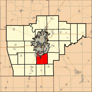
Ball Township, Sangamon County, Illinois
Township in Illinois, United States
Distance: Approx. 6456 meters
Latitude and longitude: 39.6475,-89.64888889
Ball Township is located in Sangamon County, Illinois. As of the 2010 census, its population was 6,701 and it contained 2,403 housing units. The township's offices are located in Glenarm.

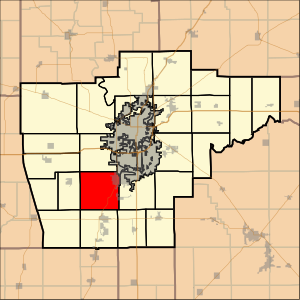
Chatham Township, Sangamon County, Illinois
Township in Illinois, United States
Distance: Approx. 4074 meters
Latitude and longitude: 39.65361111,-89.75583333
Chatham Township is located in Sangamon County, Illinois. As of the 2010 census, its population was 6,978 and it contained 2,963 housing units. Chatham Township changed its name from Campbell Township on September 2, 1863.
Sugar Creek Covered Bridge
United States historic place
Distance: Approx. 5948 meters
Latitude and longitude: 39.64027778,-89.66194444
Sugar Creek Covered Bridge is a covered bridge which crosses Sugar Creek southeast of Chatham, Illinois. The Burr truss bridge is 110 feet (34 m) long and 30 feet (9.1 m) wide. The bridge was constructed by Thomas Black; sources disagree on the date of construction, placing it at either 1827 or 1880.
Interurban Trail (Sangamon County)
Distance: Approx. 993 meters
Latitude and longitude: 39.6721,-89.7047
The Interurban Trail is a 8.3-mile (13.4 km) rail trail in Sangamon County, Illinois, United States. It was built by the Illinois Department of Transportation (IDOT) and occupies an abandoned Illinois Terminal Railroad interurban corridor. It stretches from the south side of Springfield, to the center of Chatham.
WLFZ
Radio station in Springfield, Illinois
Distance: Approx. 7371 meters
Latitude and longitude: 39.711,-89.645
WLFZ (101.9 FM) is a commercial radio station licensed to Springfield, Illinois, and serving Central Illinois. It is owned by Saga Communications, operating as part of its Capitol Radio Group, and has a country music radio format. The radio studios and offices are on East Sangamon Avenue in Springfield.
Glenarm, Illinois
Unincorporated community in Illinois, United States
Distance: Approx. 8017 meters
Latitude and longitude: 39.62361111,-89.64888889
Glenarm is an unincorporated community in Sangamon County, Illinois, United States. Glenarm is located along Interstate 55, south of Springfield. Glenarm has a post office with ZIP code 62536.
Lick Creek (Sangamon River tributary)
River
Distance: Approx. 4491 meters
Latitude and longitude: 39.7069959,-89.6864883
Lick Creek is a 30.6-mile-long (49.2 km) tributary of Lake Springfield and thus a tributary of the Sangamon River in central Illinois. It drains a large portion of southwestern Sangamon County and a marginal adjacent fragment of southeastern Morgan County. The drainage of Lick Creek includes all of Loami, Illinois and part of Chatham, Illinois.
Caldwell Farmstead
Historic house in Illinois, United States
Distance: Approx. 3324 meters
Latitude and longitude: 39.7025,-89.70583333
The Caldwell Farmstead is a historic farmhouse located on Illinois Route 4 north of Chatham, Sangamon County, Illinois. The two-story Towered Italianate house was built in 1876. The red brick house features detailed joint work on the corners and groups of tall windows with molded hoods.

Cotton Hill, Illinois
Flooded town in Illinois, United States
Distance: Approx. 7848 meters
Latitude and longitude: 39.69527778,-89.62888889
Cotton Hill, also known as Crow's Mill or Cotton Hill Post Office, was a small unincorporated community on the banks of Sugar Creek in Ball Township, Sangamon County, Illinois, about eight miles south of downtown Springfield. It stood for slightly over a century, from the 1820s until it was razed in the 1930s to make way for Lake Springfield. In 1900 the community had an estimated population of 150, a post office and a train station on the Illinois Central.
Weather in this IP's area
clear sky
13 Celsius
13 Celsius
12 Celsius
14 Celsius
1012 hPa
89 %
1012 hPa
991 hPa
10000 meters
2.57 m/s
280 degree
06:33:37
16:51:26

