Country:
Region:
City:
Latitude and Longitude:
Time Zone:
Postal Code:
IP information under different IP Channel
ip-api
Country
Region
City
ASN
Time Zone
ISP
Blacklist
Proxy
Latitude
Longitude
Postal
Route
Luminati
Country
Region
79
City
shymkent
ASN
Time Zone
Asia/Almaty
ISP
Kar-Tel LLC
Latitude
Longitude
Postal
IPinfo
Country
Region
City
ASN
Time Zone
ISP
Blacklist
Proxy
Latitude
Longitude
Postal
Route
db-ip
Country
Region
City
ASN
Time Zone
ISP
Blacklist
Proxy
Latitude
Longitude
Postal
Route
ipdata
Country
Region
City
ASN
Time Zone
ISP
Blacklist
Proxy
Latitude
Longitude
Postal
Route
Popular places and events near this IP address

Kazhymukan Munaitpasov Stadium, Shymkent
Distance: Approx. 4146 meters
Latitude and longitude: 42.335493,69.593568
Kajymukan Munaitpasov Stadium (Kazakh: Qajymūqan Mūñaitpasūly) is a multi-purpose stadium in Shymkent, Kazakhstan. It is currently used mostly for football matches. It is home of the FC Ordabasy football club, which plays in the Kazakhstan Premier League, Kazakhstan's top division of football.

Shymkent Zoo
Zoo in Shymkent, Kazakhstan
Distance: Approx. 8824 meters
Latitude and longitude: 42.376971,69.628091
The Shymkent Zoo (Kazakh: Шымкент хайуанханасы, Shymkent haıýanhanasy; Russian: Шымкентский зоопарк) is the state zoo of the city Shymkent in Kazakhstan. It is one of the largest and oldest zoological parks in the country. From the total zoo's area of 54 hectares (130 acres), under an exposition 34 hectares (84 acres).
Sayramsu
River in Turkistan, Kazakhstan
Distance: Approx. 7655 meters
Latitude and longitude: 42.2658,69.6871
The Sayramsu (Kazakh: Сайрамсу) is a river of southern Kazakhstan. It is a tributary of the Badam near Shymkent.

Shymkent
City in Kazakhstan
Distance: Approx. 2096 meters
Latitude and longitude: 42.31666667,69.59583333
Shymkent (Kazakh: Шымкент, Şymkent; pronounced [ʃɯmˈkʲent] ) is a city in Kazakhstan, near the border with Uzbekistan. It is one of three cities in Kazakhstan that have the status of a city of republican significance. It is the third-most populous city in Kazakhstan, behind Almaty and Astana, with an estimated population of 1,002,291 as of 1 June 2018.

Auezov South Kazakhstan State University
University in Shymkent, Kazakhstan
Distance: Approx. 2613 meters
Latitude and longitude: 42.32027567,69.59149271
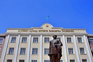
The M. O. Auezov South Kazakhstan State University (Kazakh: М. О. Әуезов атындағы Оңтүстік Қазақстан мемлекеттік университеті) also known as Mukhtar Auezov South Kazakhstan University, is a multidisciplinary higher educational institution in the city of Shymkent, which provides training in 76 technical and humanitarian specialties. It was founded in 1943.
Shymkent University
Distance: Approx. 5289 meters
Latitude and longitude: 42.33434,69.64955
The Shymkent University (Kazakh: Шымкент Университеті) is higher educational institution in the city of Shymkent. The university was founded in 2001 and has 4 faculties and 2 research institutes. The university employs 289 professors, including 16 doctors of sciences, 35 candidates of sciences, senior teachers.

Independence Park (Shymkent)
Urban park in Shymkent, Kazakhstan
Distance: Approx. 948 meters
Latitude and longitude: 42.30666667,69.6
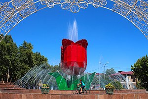
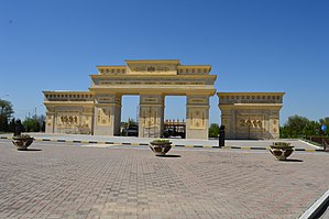
The Independence Park (Kazakh: Тәуелсіздік саябағы, Täuelsızdık saiabağy) is an urban park in the city of Shymkent, Kazakhstan. It was opened in October 2011 as an honor to the 20th anniversary of Independence Day. The central entrance to the park is decorated with an arch and inside the territory, is a singing fountain, numerous flower arrangements, plants for which were brought from the Netherlands.

Arbat (Shymkent)
Distance: Approx. 2629 meters
Latitude and longitude: 42.317407,69.585339
Arbat (Kazakh: Арбат) is a pedestrian zone located at the Beibitshilik Avenue in Shymkent, Kazakhstan. It was opened in June 2018 at the eve of Capital City Day. There are benches and bike paths in the zone as well as about 700 seedlings of spruce, chestnut, white birch and 1000 roses are planted.
Weather in this IP's area
broken clouds
5 Celsius
2 Celsius
5 Celsius
5 Celsius
1032 hPa
81 %
1032 hPa
968 hPa
10000 meters
4 m/s
200 degree
75 %
08:06:08
18:04:59