Country:
Region:
City:
Latitude and Longitude:
Time Zone:
Postal Code:
IP information under different IP Channel
ip-api
Country
Region
City
ASN
Time Zone
ISP
Blacklist
Proxy
Latitude
Longitude
Postal
Route
Luminati
Country
Region
bc
City
vancouver
ASN
Time Zone
America/Vancouver
ISP
ASN-WIBAND-1
Latitude
Longitude
Postal
IPinfo
Country
Region
City
ASN
Time Zone
ISP
Blacklist
Proxy
Latitude
Longitude
Postal
Route
db-ip
Country
Region
City
ASN
Time Zone
ISP
Blacklist
Proxy
Latitude
Longitude
Postal
Route
ipdata
Country
Region
City
ASN
Time Zone
ISP
Blacklist
Proxy
Latitude
Longitude
Postal
Route
Popular places and events near this IP address

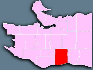
Vancouver South (federal electoral district)
Federal electoral district in British Columbia, Canada
Distance: Approx. 518 meters
Latitude and longitude: 49.22,-123.07
Vancouver South (French: Vancouver-Sud) is a federal electoral district in British Columbia, Canada, that has been represented in the House of Commons of Canada from 1917 to 1997, and since 2004. It covers the southern portion of the city of Vancouver, British Columbia. The district will be replaced by Vancouver Fraserview—South Burnaby for the 45th Canadian federal election.

Vancouver-Kensington
Provincial electoral district in British Columbia, Canada
Distance: Approx. 2001 meters
Latitude and longitude: 49.242,-123.078
Vancouver-Kensington is a provincial electoral district of the Legislative Assembly of British Columbia in Canada.

Knight Street Bridge
Bridge in Richmond, Vancouver
Distance: Approx. 2331 meters
Latitude and longitude: 49.204084,-123.077517
The Knight Street Bridge is a crossing over the north arm of the Fraser River, the Canadian National Railway (CNR) line, and several roads, in Metro Vancouver.

Killarney Secondary School
Public secondary school in Vancouver, British Columbia
Distance: Approx. 1883 meters
Latitude and longitude: 49.22538889,-123.04522222
Killarney Secondary School is a public secondary school in Vancouver, British Columbia, Canada. It is the largest public secondary school in the city by area. The school and the neighbourhood it is located in are named after Killarney, Ireland.
Vancouver Learning Network
Distributed learning school in Vancouver, British Columbia, Canada
Distance: Approx. 1858 meters
Latitude and longitude: 49.2325,-123.09361111
The Vancouver Learning Network (formerly Greater Vancouver Regional Correspondence School) is a public distance education secondary school headquartered in Vancouver, British Columbia, Canada. It is part of the Vancouver School Board. VLN is located at the John Oliver Secondary School in Vancouver, BC. It has its own hallway in which it can operate.

John Oliver Secondary School
Secondary school in Vancouver, British Columbia, Canada
Distance: Approx. 1858 meters
Latitude and longitude: 49.2325,-123.09361111
John Oliver Secondary School is a public secondary school located in Vancouver, British Columbia, Canada, at East 41st Avenue and Fraser Street (between the Vancouver neighbourhoods of Kensington-Cedar Cottage, Riley Park-Little Mountain and Sunset). It is named after John Oliver, the Premier of British Columbia from 1918 to 1927. The school is composed of four main segments: the main building ("A" Building) containing the bulk of the learning areas, including the Auditorium and Learning Commons; a wooden building ("B" Building) affectionately nicknamed "The Barn", due to its appearance, which is closed but was previously used by the mini school and Digital Immersion students; a Drama Studio ("C" Building) which allows for several theatre and acting courses; and a concrete building — the engineering building — bisected by a breezeway, with automotive, metal, and wood shops.

Sunset, Vancouver
Neighbourhood in Vancouver, British Columbia, Canada
Distance: Approx. 1303 meters
Latitude and longitude: 49.224,-123.089
Sunset is one of the most ethnically diverse neighbourhood in Vancouver, British Columbia. It is located in the south-east quadrant of the city. Surrounding the multicultural Fraser Street district, Sunset is bordered by both the Marpole and Oakridge neighbourhoods to the west, and the Victoria-Fraserview neighbourhood to the east.

Khalsa Diwan Society Vancouver
Church in British Columbia, Canada
Distance: Approx. 1648 meters
Latitude and longitude: 49.212,-123.083
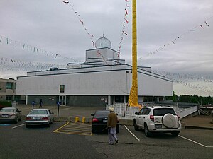
The Khalsa Diwan Society Vancouver (KDS; Punjabi: ਖ਼ਾਲਸਾ ਦਿਵਾਨ ਸੋਸਾਇਟੀ ਵੈਨਕੂਵਰ) is a Sikh gurdwara organization in Vancouver, British Columbia, Canada. Founded in 1906, it is the oldest Sikh society in Greater Vancouver, and its original location was the largest gurdwara in North America. The current gurdwara is located at the intersection of Southwest Marine Drive and Ross Street, in South Vancouver.

Mountain View Cemetery (Vancouver)
Cemetery in Vancouver, British Columbia, Canada
Distance: Approx. 1979 meters
Latitude and longitude: 49.23547222,-123.09263889
Mountain View Cemetery is the only cemetery in the City of Vancouver, British Columbia. Opened in 1886, it is located west of Fraser Street between 31st and 43rd Avenues. It is owned and operated by the City of Vancouver and occupies 0.43 square kilometres (110 acres) of land, containing more than 100,000 grave sites and over 150,000 interred remains.
First Lutheran Church (Vancouver)
Church in British Columbia, Canada
Distance: Approx. 1602 meters
Latitude and longitude: 49.232,-123.0522
The First Lutheran Church is a Lutheran Church located in Vancouver, British Columbia, Canada. It gained local prominence in 2009 when Mikhail Lennikov, an ex-KGB officer, sought refuge within the church to avoid deportation back to his native Russia. He lived in the church with his family for six years before voluntarily leaving Canada in 2015.
Janet Smith case
Distance: Approx. 2074 meters
Latitude and longitude: 49.232762,-123.096753
The Janet Smith case concerns the murder of 22-year-old nursemaid Janet Kennedy Smith in Vancouver, British Columbia, Canada, on 26 July 1924, and the ensuing suspicions of a coverup.

David Thompson Secondary School (Vancouver)
Secondary school in Vancouver, British Columbia, Canada
Distance: Approx. 454 meters
Latitude and longitude: 49.22055556,-123.07027778
David Thompson Secondary School is a public secondary school located in the Fraserview neighbourhood of Central Vancouver. It was opened in 1958. It is located between Killarney Secondary School and Sir Winston Churchill Secondary School.
Weather in this IP's area
light rain
10 Celsius
10 Celsius
9 Celsius
12 Celsius
1012 hPa
83 %
1012 hPa
1001 hPa
10000 meters
7.2 m/s
120 degree
75 %
07:18:51
16:34:22