173.239.247.2 - IP Lookup: Free IP Address Lookup, Postal Code Lookup, IP Location Lookup, IP ASN, Public IP
Country:
Region:
City:
Location:
Time Zone:
Postal Code:
IP information under different IP Channel
ip-api
Country
Region
City
ASN
Time Zone
ISP
Blacklist
Proxy
Latitude
Longitude
Postal
Route
Luminati
Country
Region
hn
City
hanoi
ASN
Time Zone
Asia/Bangkok
ISP
GSL Networks Pty LTD
Latitude
Longitude
Postal
IPinfo
Country
Region
City
ASN
Time Zone
ISP
Blacklist
Proxy
Latitude
Longitude
Postal
Route
IP2Location
173.239.247.2Country
Region
new york
City
greenlawn
Time Zone
America/New_York
ISP
Language
User-Agent
Latitude
Longitude
Postal
db-ip
Country
Region
City
ASN
Time Zone
ISP
Blacklist
Proxy
Latitude
Longitude
Postal
Route
ipdata
Country
Region
City
ASN
Time Zone
ISP
Blacklist
Proxy
Latitude
Longitude
Postal
Route
Popular places and events near this IP address

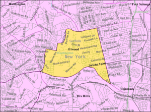
Elwood, New York
Hamlet and census-designated place in New York, United States
Distance: Approx. 2735 meters
Latitude and longitude: 40.84555556,-73.33527778
Elwood is a census-designated place (CDP) in the Town of Huntington in Suffolk County, on Long Island, in New York, United States. The population was 11,426 at the 2020 census.

Greenlawn, New York
Hamlet and census-designated place in New York, United States
Distance: Approx. 271 meters
Latitude and longitude: 40.85777778,-73.36583333
Greenlawn is a hamlet and census-designated place (CDP) in Suffolk County, New York, United States. Located on Long Island in the Town of Huntington, the population was 13,742 at the 2010 census. Students primarily attend the Harborfields Central School District.
Huntington, New York
Town on Long Island, New York
Distance: Approx. 904 meters
Latitude and longitude: 40.86,-73.35222222
Huntington is one of ten towns in Suffolk County, New York, United States. The town's population was 204,127 at the time of the 2020 census, making it the 11th most populous city/town in the state. Founded in 1653, the Town of Huntington is located on the North Shore of Long Island in northwestern Suffolk County, with the Long Island Sound to its north and Nassau County adjacent to the west.
Harborfields High School
School in Greenlawn, New York, United States
Distance: Approx. 1132 meters
Latitude and longitude: 40.86833333,-73.35888889
Harborfields High School is a four-year secondary school located in Greenlawn, New York, United States. It functions as the sole high school for Harborfields Central School District, encompassing the communities of Centerport and Greenlawn along with parts of Huntington and Northport. In 2011, the school was ranked 88th on Newsweek's list of Top 1300 High Schools in America.
Northport High School
Public high school in Northport, New York, USA
Distance: Approx. 2967 meters
Latitude and longitude: 40.87944444,-73.34083333
Northport High School is a four-year secondary school in East Northport, New York on Long Island, New York. It serves as the high school for the Northport-East Northport Union Free School District, which includes Northport, Eatons Neck, Asharoken and much of East Northport, all located in Huntington. Northport High School is home to over 2,000 students and 270 staff members and offers the International Baccalaureate program, two National Academy programs, Finance and Information Technology, Project Lead the Way, Project P.A.T.C.H. and more than 20 Advanced Placement courses.
James H. Boyd Intermediate School
Public school
Distance: Approx. 2091 meters
Latitude and longitude: 40.84777778,-73.3425
James H Boyd Intermediate School, formerly Cuba Hill School, is a three-year Intermediate School that teaches grades 3–5. It is part of the Elwood School District in Huntington, New York.

Greenlawn station
Long Island Rail Road station in Suffolk County, New York
Distance: Approx. 1120 meters
Latitude and longitude: 40.86865833,-73.36297222
Greenlawn is a station on the Port Jefferson Branch of the Long Island Rail Road near the intersection of Boulevard Avenue and Broadway (CR 86) in Greenlawn, New York, a few blocks north of Pulaski Road. It is the first station east of Huntington on the non-electrified section of the branch.
Elwood-John H. Glenn High School
Public school in Elwood, New York, United States
Distance: Approx. 2300 meters
Latitude and longitude: 40.85527778,-73.33583333
Elwood-John H. Glenn High School (often shortened to simply John Glenn High School) is a four-year high school of about 700 students and 70 faculty members, located in the hamlet of Elwood, Town of Huntington, Long Island, New York. The school serves residents of the Elwood School District.
Ireland-Gardiner Farm
Historic house in New York, United States
Distance: Approx. 1700 meters
Latitude and longitude: 40.86277778,-73.38222222
Ireland-Gardiner Farm is a historic home and farm complex located at Greenlawn in Suffolk County, New York. The original section of the main dwelling was built about 1750. It is a 1+1⁄2-story, shingled dwelling with a saltbox profile and a rear shed-roof addition.

Michael Remp House
Historic house in New York, United States
Distance: Approx. 1626 meters
Latitude and longitude: 40.84687,-73.351285
The Michael Remp House is a historic house located at 42 Godfrey Lane in Greenlawn, Suffolk County, New York. It consists of a 1+1⁄2-story, five-bay wide, shingled dwelling, flanked by smaller 1+1⁄2-story, five-bay shingled wings. The earliest section of the house was built in about 1770.

Henry Smith Farmstead
Historic house in New York, United States
Distance: Approx. 1687 meters
Latitude and longitude: 40.85083333,-73.38
Henry Smith Farmstead is a historic home located at Huntington Station in Suffolk County, New York. It is a 2-story, three-bay clapboard dwelling with a 1+1⁄2-story, three-bay south wing. It was built about 1750 and remodelled in the 1860s.

Suydam House
Historic house in New York, United States
Distance: Approx. 3052 meters
Latitude and longitude: 40.88583333,-73.36694444
Suydam House (also known as Suydam Homestead) is a historic home in Centerport in Suffolk County, New York. It was built about 1730 and is a rectangular, five-bay, 1+1⁄2-story saltbox type building with a one-story wing. It features a steeply pitched, asymmetrical gable roof, pierced by a brick chimney.
Weather in this IP's area
overcast clouds
-0 Celsius
-4 Celsius
-1 Celsius
1 Celsius
998 hPa
80 %
998 hPa
996 hPa
10000 meters
3.09 m/s
320 degree
100 %
