173.231.66.39 - IP Lookup: Free IP Address Lookup, Postal Code Lookup, IP Location Lookup, IP ASN, Public IP
Country:
Region:
City:
Location:
Time Zone:
Postal Code:
ISP:
ASN:
language:
User-Agent:
Proxy IP:
Blacklist:
IP information under different IP Channel
ip-api
Country
Region
City
ASN
Time Zone
ISP
Blacklist
Proxy
Latitude
Longitude
Postal
Route
db-ip
Country
Region
City
ASN
Time Zone
ISP
Blacklist
Proxy
Latitude
Longitude
Postal
Route
IPinfo
Country
Region
City
ASN
Time Zone
ISP
Blacklist
Proxy
Latitude
Longitude
Postal
Route
IP2Location
173.231.66.39Country
Region
pennsylvania
City
friedens
Time Zone
America/New_York
ISP
Language
User-Agent
Latitude
Longitude
Postal
ipdata
Country
Region
City
ASN
Time Zone
ISP
Blacklist
Proxy
Latitude
Longitude
Postal
Route
Popular places and events near this IP address

Allegheny Township, Somerset County, Pennsylvania
Township in Pennsylvania, United States
Distance: Approx. 8943 meters
Latitude and longitude: 40.01666667,-78.79138889
Allegheny Township is a township in Somerset County, Pennsylvania, United States. The population was 615 at the 2020 census. It is part of the Johnstown, Pennsylvania, Metropolitan Statistical Area.

Indian Lake, Pennsylvania
Borough in Pennsylvania, United States
Distance: Approx. 5370 meters
Latitude and longitude: 40.0475,-78.85916667
Indian Lake (Private Lake only to land owners within the borough) is a borough in Somerset County, Pennsylvania, United States. It is part of the Johnstown, Pennsylvania Metropolitan Statistical Area. The population was 391 at the 2020 census, down from 394 in 2010.

Shanksville, Pennsylvania
Borough in Pennsylvania, United States
Distance: Approx. 1325 meters
Latitude and longitude: 40.01722222,-78.90583333
Shanksville is a borough in Somerset County, Pennsylvania, United States. It has a population of 197 as of the 2020 U.S. census. It is part of the Somerset, Pennsylvania Micropolitan Statistical Area and is located 78 miles (126 km) southeast of Pittsburgh and 226 miles (364 km) west of Philadelphia.

Stonycreek Township, Somerset County, Pennsylvania
Township in Pennsylvania, United States
Distance: Approx. 3730 meters
Latitude and longitude: 39.98333333,-78.86638889
Stonycreek Township is a township in Somerset County, Pennsylvania, United States. The township takes its name from the stony creek, which flows through it and represents its western boundary. The stream takes its name from the rocky bed over which it flows for a great part of its course.

Flight 93 National Memorial
9/11 memorial in Pennsylvania, US
Distance: Approx. 5464 meters
Latitude and longitude: 40.05666667,-78.90583333
The Flight 93 National Memorial is a memorial built to commemorate the crash of United Airlines Flight 93, which was one of four aircraft hijacked during the September 11 attacks in 2001. The memorial is located in Somerset County, Pennsylvania, with the vast majority in Stonycreek Township, and with a small portion in Shade Township. It is 78 miles (126 km) southeast of Pittsburgh, 122 miles (196 km) west of Harrisburg (the state capital), and 226 miles (364 km) west of Philadelphia.
Allegheny Mountain Tunnel
Vehicular tunnel carrying the Pennsylvania Turnpike through the Allegheny Mountains
Distance: Approx. 6164 meters
Latitude and longitude: 39.96158333,-78.85669444
The Allegheny Mountain Tunnel is a vehicular tunnel carrying the Pennsylvania Turnpike through the Allegheny Mountains. At this point, the Turnpike carries Interstates 70 and 76. When the tunnel was built, it was considered an "engineering marvel." The tunnel was built in 1939 and is used by 11 million vehicles annually today.
Negro Mountain Tunnel
Tunnel located in Somerset County, Pennsylvania
Distance: Approx. 7367 meters
Latitude and longitude: 39.98978,-78.97868
The Negro Mountain Tunnel is a tunnel located in Negro Mountain in Somerset County, Pennsylvania. It was built by New York Central Railroad as part of the proposed but never completed South Pennsylvania Railroad, which over time became known as "Vanderbilt's Folly". The tunnel is located near milepost 116.7 on the Pennsylvania Turnpike where it is ten miles east of the Quemahoning Tunnel (also built for the railroad but never used by the Turnpike), 16 miles east of the Laurel Hill Tunnel (used by the Turnpike but bypassed in 1964), and seven miles west of the Allegheny Mountain Tunnel currently used by the Turnpike.

Shanksville Volunteer Fire Department
Pennsylvania volunteer fire department
Distance: Approx. 1413 meters
Latitude and longitude: 40.01773,-78.90665
The Shanksville Volunteer Fire Department is a volunteer fire department in Shanksville, Pennsylvania. The department provides fire protection and emergency medical services to the boroughs of Shanksville and Indian Lake as well as to Stonycreek Township. The response area is approximately 62 square miles (160 km2) with an estimated 2,500 residents.
Glessner Bridge
United States historic place
Distance: Approx. 2923 meters
Latitude and longitude: 40.02583333,-78.92111111
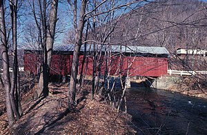
The Glessner Bridge is a historic covered bridge in Stonycreek Township, Somerset County, Pennsylvania. It was built in 1881, and is a 90-foot-long (27 m), multiple Kingpost truss bridge, with half-height plank siding and a tin covered gable roof. The bridge crosses Stonycreek River.
Shanksville-Stonycreek High School
Public high school in Shanksville, Pennsylvania
Distance: Approx. 627 meters
Latitude and longitude: 40.01381,-78.89639
Shanksville-Stonycreek High School, located near the small community of Shanksville, in central Somerset County is a small high school serving a census of 146 in grades 9-12. Located within five miles is the newly dedicated Flight 93 National Memorial in Pennsylvania's Laurel Highlands.

Lambertsville, Pennsylvania
Unincorporated community in Pennsylvania, United States
Distance: Approx. 7491 meters
Latitude and longitude: 40.07416667,-78.91305556
Lambertsville is an unincorporated community and coal town in Stonycreek Township within Somerset County, Pennsylvania, United States. The path of United Airlines Flight 93 flew directly over Lambertsville before crashing in a field southeast of the village on September 11, 2001. Witnesses to the low-flying plane in Lambertsville were the last to see it airborne and the first to place 911 calls after its crash.

Brotherton, Pennsylvania
Unincorporated community in Pennsylvania, United States
Distance: Approx. 6691 meters
Latitude and longitude: 39.97146944,-78.95780278
Brotherton is an unincorporated community in Brothersvalley Township and Stonycreek Township, Somerset County, in the U.S. state of Pennsylvania.
Weather in this IP's area
overcast clouds
-3 Celsius
-10 Celsius
-4 Celsius
-3 Celsius
1021 hPa
56 %
1021 hPa
936 hPa
10000 meters
6.69 m/s
250 degree
100 %

