173.231.58.80 - IP Lookup: Free IP Address Lookup, Postal Code Lookup, IP Location Lookup, IP ASN, Public IP
Country:
Region:
City:
Location:
Time Zone:
Postal Code:
IP information under different IP Channel
ip-api
Country
Region
City
ASN
Time Zone
ISP
Blacklist
Proxy
Latitude
Longitude
Postal
Route
Luminati
Country
ASN
Time Zone
America/Chicago
ISP
WEBNX
Latitude
Longitude
Postal
IPinfo
Country
Region
City
ASN
Time Zone
ISP
Blacklist
Proxy
Latitude
Longitude
Postal
Route
IP2Location
173.231.58.80Country
Region
utah
City
ogden
Time Zone
America/Denver
ISP
Language
User-Agent
Latitude
Longitude
Postal
db-ip
Country
Region
City
ASN
Time Zone
ISP
Blacklist
Proxy
Latitude
Longitude
Postal
Route
ipdata
Country
Region
City
ASN
Time Zone
ISP
Blacklist
Proxy
Latitude
Longitude
Postal
Route
Popular places and events near this IP address

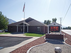
Harrisville, Utah
City in Utah, United States
Distance: Approx. 1308 meters
Latitude and longitude: 41.28666667,-111.995
Harrisville is a city in Weber County, Utah, United States. The population was 5,567 at the 2010 census. It is part of the Ogden–Clearfield, Utah Metropolitan Statistical Area.

Marriott-Slaterville, Utah
City in Utah, United States
Distance: Approx. 3653 meters
Latitude and longitude: 41.25555556,-112.02111111
Marriott-Slaterville is a city in Weber County, Utah, United States. The population was 1,701 at the 2010 census. It is part of the Ogden–Clearfield, Utah Metropolitan Statistical Area.
Golden Spike Arena
Distance: Approx. 873 meters
Latitude and longitude: 41.27555556,-111.99777778
The Golden Spike Arena is a 6,500-seat multi-purpose arena in Ogden, Utah. The arena hosts local concerts, trade shows and sporting events for the area. The Golden Spike Arena was the home to the Ogden Knights of the American Indoor Football Association.

Defense Depot Ogden
U.S. military installation in Ogden, Utah, US
Distance: Approx. 1700 meters
Latitude and longitude: 41.26396389,-111.99918611
Defense Depot Ogden was a U.S. military installation located in Ogden, Utah, United States. It encompassed 1,139 acres (5 km2) with its southwest corner located on 12th Street (1200 South) and Tomlinson Road (1200 West). Its eastern border is the old Utah Northern Railroad, now owned by the Union Pacific Railroad.

Ben Lomond High School
Public school in Ogden, Utah, US
Distance: Approx. 4193 meters
Latitude and longitude: 41.25,-111.95166667
Ben Lomond High School is a comprehensive high school located in the Ogden City School District of Ogden, Utah, United States, currently educating students in grades 10–12. As of 2018, the principal is Steve Poll, his first year at Ben Lomond (2018/19).
Canyon High School (Ogden, Utah)
Public school in Ogden, Utah, US
Distance: Approx. 3643 meters
Latitude and longitude: 41.24652778,-111.96961111
Canyon High School was a high school in Ogden, Utah.

Ogden Nature Center
Nature preserve in Utah
Distance: Approx. 3778 meters
Latitude and longitude: 41.24472222,-112.00361111
The Ogden Nature Center is a 152-acre (0.62 km2) nature preserve and education center located in Ogden, Utah. Created in 1975, it was Utah's first nature center.
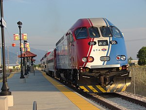
Pleasant View station
Distance: Approx. 3967 meters
Latitude and longitude: 41.3075,-112.01055556
Pleasant View is a closed commuter rail station in Pleasant View, Utah, formerly served by the Utah Transit Authority's (UTA) FrontRunner train. Located approximately 6 miles north of Ogden Central station, Pleasant View was the northernmost station along the FrontRunner line prior to its closure on August 10, 2018, when service north of Ogden was suspended. It was also the least-used station on FrontRunner, with few daily riders.

Ogden–Weber Technical College
Technical college in Ogden, Utah, US
Distance: Approx. 2336 meters
Latitude and longitude: 41.26416667,-111.96472222
Ogden–Weber Technical College (also referred to as OTECH, Ogden-Weber Tech or OWTC) is a public technical college in Ogden, Utah. It is one of the largest of the eight technical colleges within the Utah System of Higher Education (USHE). The college offers open-entry, open-exit, competency-based education targeted at technical skills and job placement (also called career and technical education).
Utah State Industrial School
Reform school in the United States
Distance: Approx. 3796 meters
Latitude and longitude: 41.24583333,-112.0075
Utah State Industrial School was a juvenile reform school that operated in Ogden, Utah from October 31, 1889 to 1983.

John F. and Lillia Dumke House
United States historic place
Distance: Approx. 4415 meters
Latitude and longitude: 41.23861111,-111.97138889
The John F. Dumke and Lillia or John F. and Lillia Dumke House, at 1607 Kiesel Ave. in Ogden, Utah, was built in 1920. It was listed on the National Register of Historic Places in 2007.

Utah Schools for the Deaf and the Blind
School in Ogden, Utah, United States
Distance: Approx. 4476 meters
Latitude and longitude: 41.2510445,-111.945884
Utah Schools for the Deaf and the Blind (USDB) is a state education agency of Utah that educates blind and deaf children. It includes a day and boarding school in Ogden, which houses the USDB headquarters, and sites in Salt Lake City and Springville.
Weather in this IP's area
clear sky
5 Celsius
4 Celsius
3 Celsius
7 Celsius
1025 hPa
60 %
1025 hPa
856 hPa
10000 meters
2.06 m/s
310 degree
