Country:
Region:
City:
Latitude and Longitude:
Time Zone:
Postal Code:
IP information under different IP Channel
ip-api
Country
Region
City
ASN
Time Zone
ISP
Blacklist
Proxy
Latitude
Longitude
Postal
Route
Luminati
Country
Region
ca
City
oakland
ASN
Time Zone
America/Los_Angeles
ISP
AS-SONICTELECOM
Latitude
Longitude
Postal
IPinfo
Country
Region
City
ASN
Time Zone
ISP
Blacklist
Proxy
Latitude
Longitude
Postal
Route
db-ip
Country
Region
City
ASN
Time Zone
ISP
Blacklist
Proxy
Latitude
Longitude
Postal
Route
ipdata
Country
Region
City
ASN
Time Zone
ISP
Blacklist
Proxy
Latitude
Longitude
Postal
Route
Popular places and events near this IP address
Fruitvale station
Rapid transit station in San Francisco Bay Area
Distance: Approx. 755 meters
Latitude and longitude: 37.7748,-122.2241
Fruitvale station is a Bay Area Rapid Transit (BART) station located in the Fruitvale District of Oakland, California. The elevated station has two side platforms. The station is served by the Orange, Green, and Blue lines.

Fruitvale, Oakland, California
Neighborhood of Oakland in Alameda, California, United States
Distance: Approx. 221 meters
Latitude and longitude: 37.77972222,-122.22027778
Fruitvale (originally Fruit Vale and formerly Brays) is a neighborhood in Oakland, California, United States. It is located approximately 4 miles (6.44 km) southeast of Downtown, and is home to the city's largest Hispanic population, with Hispanics constituting 53.8% of Fruitvale's population. Fruitvale's ZIP code is 94601.

Fremont High School (Oakland, California)
Public high school in Oakland, California , United States
Distance: Approx. 1012 meters
Latitude and longitude: 37.77351389,-122.20903611
Fremont High School is an urban public high school located in East Oakland, California, United States. It was formerly a group of smaller high schools located on the same campus and known as Fremont Federation of High Schools. The school's present configuration is that of the "wall to wall" career academies model, consisting of a 9th Grade House which feeds into one of two California Partnership Academies (CPA), specifically the Architecture Academy and the Media Academy.
Sausal Creek (Alameda County)
River in California, United States
Distance: Approx. 829 meters
Latitude and longitude: 37.77916667,-122.22722222
Sausal Creek, 3.1 miles (5.0 km) long, is one of the principal creeks in Oakland, California. The creek derives its name from the Spanish word for willow grove (sausal). Native arroyo willows were once common along its banks.
St. Elizabeth High School (Oakland, California)
Private, coeducational school in Oakland, , California, United States
Distance: Approx. 399 meters
Latitude and longitude: 37.77861111,-122.22222222
St. Elizabeth High School was a private, Roman Catholic high school in Oakland, California, established in 1921 by the Franciscan Friars. It was located in the Roman Catholic Diocese of Oakland.

Patten University
Distance: Approx. 791 meters
Latitude and longitude: 37.78638889,-122.21944444
Patten University is an online college in Oakland, California. Its parent organization, Patten Educational Foundation, was founded in 1944 by Bebe Patten as a bible college, and went through several stages in its history, variously under the names Oakland Bible Institute, Patten Bible Institute, Patten College, then Patten University. It is accredited by the Distance Education Accrediting Commission.

Oakland Charter Academy
Charter school in the United States
Distance: Approx. 627 meters
Latitude and longitude: 37.775138,-122.213148
Oakland Charter Academy (OCA) originally Jingletown Charter School, is a charter school in Oakland, California serving middle school students. Opened in 1994, it is the first and oldest charter school in Oakland and one of the first in California. After a dramatic turnaround, it became the second public school in Oakland to win the National Blue Ribbon award.
Oakland Charter High School
Charter school in the United States
Distance: Approx. 791 meters
Latitude and longitude: 37.78638889,-122.21944444
Oakland Charter High School is a charter school in Oakland, California serving high school students. It was established in 2007. The school mascot is the matador.

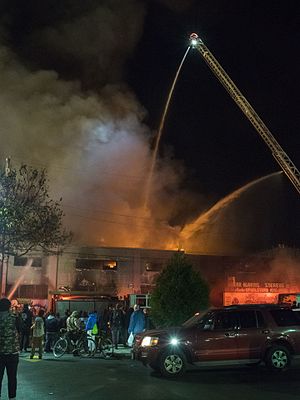
Ghost Ship warehouse fire
2016 California underground warehouse party inferno
Distance: Approx. 840 meters
Latitude and longitude: 37.7777,-122.2271
On December 2, 2016, at about 11:20 p.m. PST, a fire started in a former warehouse that had been unlawfully converted into an artist collective with living spaces (named the Ghost Ship) in Oakland, California, which was hosting a concert with 80–100 attendees. The blaze killed 36 people, making it the deadliest fire in the history of Oakland.
Cristo Rey De La Salle East Bay High School
Catholic, de la salle brothers school in Oakland, California, United States
Distance: Approx. 389 meters
Latitude and longitude: 37.77865556,-122.22211667
Cristo Rey De La Salle East Bay High School is a work of the San Francisco New Orleans District of the De La Salle Brothers. Opened in 2018, it is a member of the national Cristo Rey Network of work-study schools for underserved Hispanic Asian American and African American students. The new school occupies the former premises of St.

St. Joseph's Home for the Aged (Oakland, California)
Historic place in Oakland, California
Distance: Approx. 1255 meters
Latitude and longitude: 37.780833,-122.231944
St. Joseph's Home for the Aged is a historical four story brick building in Oakland, California. The St.
Alfred H. Cohen House
Historic home in Oakland, California
Distance: Approx. 781 meters
Latitude and longitude: 37.77972222,-122.22666667
Alfred H. Cohen House, also known as the Cohen Bray House, is a residence located in the Fruitvale neighborhood of Oakland, California. The house was originally part of the Peralta land grant, known as "Oak Tree Farm." The building was officially listed on the National Register of Historic Places on June 19, 1973, and placed on the List of Oakland Designated Landmarks.
Weather in this IP's area
light rain
19 Celsius
18 Celsius
17 Celsius
21 Celsius
1014 hPa
36 %
1014 hPa
1013 hPa
10000 meters
3.13 m/s
4.92 m/s
65 degree
75 %
06:43:23
17:02:13

