173.226.36.21 - IP Lookup: Free IP Address Lookup, Postal Code Lookup, IP Location Lookup, IP ASN, Public IP
Country:
Region:
City:
Location:
Time Zone:
Postal Code:
ISP:
ASN:
language:
User-Agent:
Proxy IP:
Blacklist:
IP information under different IP Channel
ip-api
Country
Region
City
ASN
Time Zone
ISP
Blacklist
Proxy
Latitude
Longitude
Postal
Route
db-ip
Country
Region
City
ASN
Time Zone
ISP
Blacklist
Proxy
Latitude
Longitude
Postal
Route
IPinfo
Country
Region
City
ASN
Time Zone
ISP
Blacklist
Proxy
Latitude
Longitude
Postal
Route
IP2Location
173.226.36.21Country
Region
kentucky
City
louisville
Time Zone
America/Kentucky/Louisville
ISP
Language
User-Agent
Latitude
Longitude
Postal
ipdata
Country
Region
City
ASN
Time Zone
ISP
Blacklist
Proxy
Latitude
Longitude
Postal
Route
Popular places and events near this IP address

Seneca Gardens, Kentucky
City in Kentucky, United States
Distance: Approx. 884 meters
Latitude and longitude: 38.22722222,-85.67722222
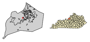
Seneca Gardens is a home rule-class city in Jefferson County, Kentucky, United States, and a part of the Louisville Metro government. With the single exception of the Keneseth Israel Synagogue, all buildings within city limits are residential. The population was 696 as of the 2010 census.

Strathmoor Manor, Kentucky
City in Kentucky, United States
Distance: Approx. 335 meters
Latitude and longitude: 38.21888889,-85.68361111
Strathmoor Manor is a home rule-class city in Jefferson County, Kentucky, United States. The population was 337 at the 2010 census. The city is characterized by tree-lined streets and wide setbacks.

Strathmoor Village, Kentucky
City in Kentucky, United States
Distance: Approx. 606 meters
Latitude and longitude: 38.22083333,-85.67777778
Strathmoor Village is a home rule-class city in Jefferson County, Kentucky, United States. The population was 648 at the 2010 census.
Ear X-tacy
Distance: Approx. 757 meters
Latitude and longitude: 38.224,-85.69279
ear X-tacy was a Louisville, Kentucky "alternative record store," owned and operated by John Timmons. The store announced its closing on October 31, 2011, after 26 years in business.

Assumption High School (Kentucky)
Private, all-girls school in Louisville, , Kentucky, United States
Distance: Approx. 805 meters
Latitude and longitude: 38.21694444,-85.67777778
Assumption High School is a Catholic all-girls high school located in Louisville, Kentucky, sponsored by the Sisters of Mercy.
Highlands–Douglass, Louisville
Louisville neighborhood in Kentucky, United States
Distance: Approx. 803 meters
Latitude and longitude: 38.228977,-85.685511
Highlands–Douglass is a neighborhood five miles (8 km) southeast of downtown Louisville, Kentucky, United States. The neighborhood is bound by Bardstown Road, Speed Avenue, Taylorsville Road, and Cherokee Park. It is considered a part of a larger area of Louisville called The Highlands.
Gardiner Lane, Louisville
Neighborhood in Louisville, Kentucky
Distance: Approx. 960 meters
Latitude and longitude: 38.21472222,-85.67833333
Gardiner Lane is a neighborhood in eastern Louisville, Kentucky, United States. Its boundaries are Emerson Avenue to the north, Bardstown Road to the east, I-264 to the south, and Tremont Drive to the west. As with surrounding neighborhoods, it was farmland well into the first half of the 1900s.

Keneseth Israel (Louisville, Kentucky)
Synagogue in Louisville, Kentucky
Distance: Approx. 888 meters
Latitude and longitude: 38.22405556,-85.67486111
Keneseth Israel is a Conservative synagogue located at 2531 Taylorsville Road, Louisville, Kentucky, in the United States. The congregation's original synagogue building was constructed in Louisville in 1928. It was designed by Joseph & Joseph and was listed on the National Register of Historic Places.

William R. Belknap School
United States historic place
Distance: Approx. 448 meters
Latitude and longitude: 38.22194444,-85.68972222
The Willam R. Belknap School is a former school building in the Belknap neighborhood of Louisville, Kentucky United States. It was added to the National Register of Historic Places in 1982. It was designated as a local landmark by the Louisville Metro Landmarks Commission in 2001.
Louisville Classical Academy
Independent, nonsectarian school
Distance: Approx. 886 meters
Latitude and longitude: 38.22547222,-85.69358333
Louisville Classical Academy (LCA) is a nonsectarian, independent school from kindergarten through to grade eight. The school is located in the highlands neighborhood of Louisville, Kentucky, the school provides a classical liberal arts education through the disciplines of literature, Latin, Greek, mathematics, and music.
Belknap, Louisville
Louisville neighborhood in Kentucky, United States
Distance: Approx. 185 meters
Latitude and longitude: 38.2203,-85.6855
Belknap is an urban neighborhood three and a half miles east of downtown Louisville, Kentucky, USA. The neighborhood is bound by Bardstown Road, Douglass Boulevard, Dundee Road and Newburg Road. It is part of a larger area of Louisville called the Highlands. Belknap is often described as the neighborhood in the heart of The Highlands.
Woodbourne House
United States historic place
Distance: Approx. 928 meters
Latitude and longitude: 38.22583333,-85.69388889
Woodbourne House is a Greek Revival historic building in the Highlands-Douglass neighborhood of Louisville, Kentucky that is listed on the National Register of Historic Places. In 1939, the building was purchased by Rugby University School, a private school. The building is now used for apartments for elderly people.
Weather in this IP's area
clear sky
0 Celsius
-3 Celsius
-1 Celsius
1 Celsius
1016 hPa
60 %
1016 hPa
995 hPa
10000 meters
2.57 m/s
220 degree