173.212.46.103 - IP Lookup: Free IP Address Lookup, Postal Code Lookup, IP Location Lookup, IP ASN, Public IP
Country:
 USA
USARegion:
City:
Location:
Time Zone:
Postal Code:
ISP:
ASN:
language:
User-Agent:
Proxy IP:
Blacklist:
IP information under different IP Channel
ip-api
Country
Region
City
ASN
Time Zone
ISP
Blacklist
Proxy
Latitude
Longitude
Postal
Route
db-ip
Country
Region
City
ASN
Time Zone
ISP
Blacklist
Proxy
Latitude
Longitude
Postal
Route
IPinfo
Country
Region
City
ASN
Time Zone
ISP
Blacklist
Proxy
Latitude
Longitude
Postal
Route
IP2Location
173.212.46.103Country
usRegion
north carolina
City
toast
Time Zone
America/New_York
ISP
Language
User-Agent
Latitude
Longitude
Postal
ipdata
Country
Region
City
ASN
Time Zone
ISP
Blacklist
Proxy
Latitude
Longitude
Postal
Route
Popular places and events near this IP address

Mount Airy, North Carolina
City in North Carolina, United States
Distance: Approx. 1331 meters
Latitude and longitude: 36.50833333,-80.61527778
Mount Airy is a city in Surry County, North Carolina, United States. As of the 2020 United States census, the city's population was 10,676. As of 2020, the city is the most populous municipality in Surry County.
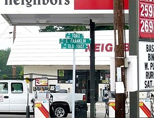
Toast, North Carolina
Census-designated place in North Carolina, United States
Distance: Approx. 853 meters
Latitude and longitude: 36.49666667,-80.63472222
Toast is a census-designated place (CDP) in Surry County, North Carolina, United States, just west of Mount Airy. The population was 1,922 at the 2000 census. A post office called Toast has been in operation since 1929.

Franklin, Surry County, North Carolina
Unincorporated community in North Carolina, US
Distance: Approx. 1440 meters
Latitude and longitude: 36.489,-80.634
Franklin is an unincorporated community in the Mount Airy Township of Surry County, North Carolina, United States, on the outskirts of the city of Mount Airy. The community is located on South Franklin Road just south of Toast. Area landmarks include Franklin Elementary School and Franklin Volunteer Fire Department.

Mount Airy Fiddlers Convention
Distance: Approx. 1797 meters
Latitude and longitude: 36.5151,-80.6181
The Mount Airy Fiddlers Convention is a popular festival devoted to old-time and bluegrass music, as well as related arts such as dance, which takes place each summer at Veterans Memorial Park in Mount Airy, North Carolina, United States. It was established in 1972. It is held on the first weekend in June.

Andy Griffith Museum
Museum in Mount Airy, NC, US
Distance: Approx. 1603 meters
Latitude and longitude: 36.49783333,-80.60877778
The Andy Griffith Museum is a museum dedicated to the life and career of American actor, television producer, and singer Andy Griffith. The museum, which houses the world's largest collection of Andy Griffith memorabilia, is located in Griffith's hometown of Mount Airy, North Carolina. Much of the museum's collection was acquired by Griffith's friend and the founder of Andy Griffith Museum, Emmett Forrest.

Trinity Episcopal Church (Mount Airy, North Carolina)
Historic church in North Carolina, United States
Distance: Approx. 1790 meters
Latitude and longitude: 36.50305556,-80.60666667
Trinity Episcopal Church is a historic Episcopal church located in Mount Airy, Surry County, North Carolina. It was built in 1896, and is a one-story, Gothic Revival-style masonry structure of uncoarsed granite rubble, locally sourced and donated by parishioner Thomas Woodruff, president of the North Carolina Granite Corporation at that time. The first service in the new building was held in July of 1896.

Mayberry Mall
Shopping mall just outside Mount Airy, North Carolina
Distance: Approx. 773 meters
Latitude and longitude: 36.50634,-80.62193
Mayberry Mall is a shopping mall located just outside Mount Airy, North Carolina on the east side of U.S. Highway 52. It was named after the fictitious town of Mayberry in which The Andy Griffith Show was based. There are three anchor stores, Belk, Hobby Lobby and Shoe Show.

Renfro Mill
Historic mill building in North Carolina, US
Distance: Approx. 1472 meters
Latitude and longitude: 36.50138889,-80.61
Renfro Mill, also known as R. Roberts Leaf Tobacco House, is a historic industrial building located at Mount Airy, Surry County, North Carolina. The original section was built as a tobacco barn about 1893. The largest addition was built in 1946–1947.

W. F. Carter House
Historic house in North Carolina, United States
Distance: Approx. 1984 meters
Latitude and longitude: 36.49666667,-80.60472222
W. F. Carter House, also known as the Carter House, is a historic home located at Mount Airy, Surry County, North Carolina. It was built about 1908, and is a two-story, Classical Revival style frame dwelling. It features a central two-story Ionic order portico, with a one-story Doric order porch which runs beneath the portico for the full length of the three-bay facade.
Mount Airy Historic District (Mount Airy, North Carolina)
Historic district in North Carolina, United States
Distance: Approx. 1743 meters
Latitude and longitude: 36.49972222,-80.60694444
Mount Airy Historic District is a national historic district located at Mount Airy, Surry County, North Carolina. The district encompasses 187 contributing buildings in the central business district and surrounding industrial and residential sections of Mount Airy. They were primarily built between about 1880 and 1930 and include notable examples of Late Victorian and Bungalow / American Craftsman architecture.
Mount Airy High School
American public school in North Carolina
Distance: Approx. 1590 meters
Latitude and longitude: 36.5118,-80.6157
Mount Airy High School is located on N South Street in Mount Airy, North Carolina. The front office is at the corner of N South Street and Orchard Street. The school first opened in 1895.
Rocky Creek (Lovills Creek tributary)
Stream in North Carolina, USA
Distance: Approx. 1216 meters
Latitude and longitude: 36.51055556,-80.62138889
Rocky Creek is a 2.22 mi (3.57 km) long 1st order tributary to Lovills Creek in Surry County, North Carolina.
Weather in this IP's area
clear sky
9 Celsius
8 Celsius
9 Celsius
11 Celsius
1024 hPa
74 %
1024 hPa
973 hPa
10000 meters
2.66 m/s
5.42 m/s
356 degree
7 %