173.205.220.88 - IP Lookup: Free IP Address Lookup, Postal Code Lookup, IP Location Lookup, IP ASN, Public IP
Country:
Region:
City:
Location:
Time Zone:
Postal Code:
IP information under different IP Channel
ip-api
Country
Region
City
ASN
Time Zone
ISP
Blacklist
Proxy
Latitude
Longitude
Postal
Route
Luminati
Country
ASN
Time Zone
America/Chicago
ISP
EWHEELERINC-01
Latitude
Longitude
Postal
IPinfo
Country
Region
City
ASN
Time Zone
ISP
Blacklist
Proxy
Latitude
Longitude
Postal
Route
IP2Location
173.205.220.88Country
Region
oregon
City
portland
Time Zone
America/Los_Angeles
ISP
Language
User-Agent
Latitude
Longitude
Postal
db-ip
Country
Region
City
ASN
Time Zone
ISP
Blacklist
Proxy
Latitude
Longitude
Postal
Route
ipdata
Country
Region
City
ASN
Time Zone
ISP
Blacklist
Proxy
Latitude
Longitude
Postal
Route
Popular places and events near this IP address
Raleigh Hills, Oregon
Unincorporated community in the state of Oregon, United States
Distance: Approx. 1848 meters
Latitude and longitude: 45.49166667,-122.75
Raleigh Hills is a census-designated place and neighborhood in Washington County, Oregon within the metropolitan area of Portland, Oregon, United States. It is located in the southwest hills in Washington County, with Beaverton to the west, West Slope to the north, and Progress and Garden Home to the south. As of the 2000 census, the census-designated place had a total population of 5,865.

West Haven-Sylvan, Oregon
CDP in Oregon, United States
Distance: Approx. 1794 meters
Latitude and longitude: 45.51555556,-122.76388889
West Haven-Sylvan is a census-designated place (CDP) in Washington and Multnomah counties, Oregon, United States, north of U.S. Route 26. As of the 2020 census, the CDP population was 9,299.

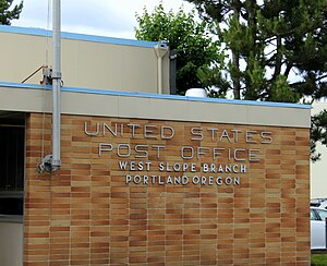
West Slope, Oregon
Unincorporated community in the state of Oregon, United States
Distance: Approx. 1637 meters
Latitude and longitude: 45.49944444,-122.74944444
West Slope is an unincorporated suburb, neighborhood of Beaverton, Oregon, United States and a census-designated place. It is in Washington County, to the east of Cedar Hills, to the northwest of Raleigh Hills and south of U.S. Route 26. Fire protection and EMS services are provided through Tualatin Valley Fire and Rescue.

Sunset Transit Center
Distance: Approx. 1400 meters
Latitude and longitude: 45.510244,-122.781012
The Sunset Transit Center is a TriMet bus transit center and light rail station on the MAX Blue and Red lines in Beaverton, Oregon. It opened for MAX in 1998 and is the 5th stop westbound on the Westside MAX. This is the first stop after the Robertson Tunnel under Portland's West Hills. Sunset TC is the second-busiest station on the Westside MAX line, with a weekday average of almost 6,000 daily riders in 2012.

Catlin Gabel School
Private school in Oregon, United States
Distance: Approx. 1107 meters
Latitude and longitude: 45.509819,-122.767373
The Catlin Gabel School (Catlin Gabel, Catlin, or CGS) is a private preschool–12 school located in West Haven-Sylvan in Washington County, Oregon, with a Portland, Oregon postal address. Annual enrollment is approximately 780 students from across the Portland metro area.
Providence St. Vincent Medical Center
Hospital in Oregon, United States
Distance: Approx. 1107 meters
Latitude and longitude: 45.51,-122.7718
Providence St. Vincent Medical Center, is a non-profit, acute care teaching hospital in an unincorporated section of Washington County, Oregon, in the West Haven-Sylvan area north of Beaverton, Oregon and west of Portland, Oregon, United States – and within the Portland metropolitan area. The hospital was founded in 1875 by the Sisters of Providence, a Roman Catholic sisterhood from Montreal, Quebec, Canada.
Oregon College of Art and Craft
Former art school from 1907 to 2019 in Portland, Oregon
Distance: Approx. 1338 meters
Latitude and longitude: 45.51055556,-122.76194444
The Oregon College of Art and Craft (OCAC) was a private art college from 1907 to 2019 in Portland, Oregon, United States. The college granted Bachelor of Fine Arts and Master of Fine Arts degrees as well as art-focused certificates. The college offered an Artist-in-Residence program and provided continuing education in the arts to the local community.

Jesuit High School (Beaverton, Oregon)
Private, coeducational school in Portland, Oregon, United States
Distance: Approx. 1620 meters
Latitude and longitude: 45.48555556,-122.76972222
Jesuit High School is a private, Catholic, college-preparatory school run by the USA West Province of the Society of Jesus in Beaverton outside Portland, Oregon, United States, in the Archdiocese of Portland. It was founded by the Jesuits in 1956 and uses a Jesuit, college-preparatory curriculum. It is coeducational and enrolls approximately 1,300 students of all faiths.

Canyon Road
Street connecting Portland with Beaverton, Oregon, United States
Distance: Approx. 1849 meters
Latitude and longitude: 45.504516,-122.747551
Canyon Road (formerly known as Great Plank Road) is a 6.5 mi (10.5 km) major road and partial state highway, which serves as a connector between Beaverton and Portland, Oregon, United States. It was the first major road constructed between the Tualatin Valley and Portland, and has contributed significantly to Portland becoming the area's major deep water port, and subsequent early growth of the city. The total modern length is 6.5 miles (10.5 km), and 2.7 miles (4.3 km) of the route is coterminous with U.S. Route 26.

Edison High School (Portland, Oregon)
Private school in Portland, Oregon, United States
Distance: Approx. 1650 meters
Latitude and longitude: 45.485284,-122.769631
Edison High School is a private high school in Portland, Oregon, United States. Edison High School is open to students who have learning differences such as Dyslexia, Attention Deficit Disorder (ADD), & Attention Deficit Hyperactivity Disorder (ADHD). Edison is located on the campus of Jesuit High School and students go back and forth to take classes at both schools.
Elkhorn (sculpture)
Outdoor sculpture by Lee Kelly in the U.S. state of Oregon
Distance: Approx. 1225 meters
Latitude and longitude: 45.51083,-122.76693
Elkhorn is an outdoor 1979 sculpture by Lee Kelly, installed at Catlin Gabel School in West Haven-Sylvan, a census-designated place in Washington County and the Portland metropolitan area, in the U.S. state of Oregon.
A Donkey, 3 Rocks, and a Bird.
Sculpture in West Haven-Sylvan, Oregon, U.S.
Distance: Approx. 1365 meters
Latitude and longitude: 45.512,-122.76619444
A Donkey, 3 Rocks, and a Bird., also known as Donkey, Bird and Rocks and Donkey, Three Rocks, and a Bird, is an outdoor 1992 sculpture by Brad Rude, installed at Catlin Gabel School in West Haven-Sylvan, a census-designated place in Washington County and the Portland metropolitan area, in the U.S. state of Oregon.
Weather in this IP's area
overcast clouds
6 Celsius
6 Celsius
5 Celsius
7 Celsius
1031 hPa
95 %
1031 hPa
1020 hPa
10000 meters
0.45 m/s
0.89 m/s
196 degree
100 %

