173.197.211.15 - IP Lookup: Free IP Address Lookup, Postal Code Lookup, IP Location Lookup, IP ASN, Public IP
Country:
Region:
City:
Location:
Time Zone:
Postal Code:
ISP:
ASN:
language:
User-Agent:
Proxy IP:
Blacklist:
IP information under different IP Channel
ip-api
Country
Region
City
ASN
Time Zone
ISP
Blacklist
Proxy
Latitude
Longitude
Postal
Route
db-ip
Country
Region
City
ASN
Time Zone
ISP
Blacklist
Proxy
Latitude
Longitude
Postal
Route
IPinfo
Country
Region
City
ASN
Time Zone
ISP
Blacklist
Proxy
Latitude
Longitude
Postal
Route
IP2Location
173.197.211.15Country
Region
california
City
santa monica
Time Zone
America/Los_Angeles
ISP
Language
User-Agent
Latitude
Longitude
Postal
ipdata
Country
Region
City
ASN
Time Zone
ISP
Blacklist
Proxy
Latitude
Longitude
Postal
Route
Popular places and events near this IP address

Mid-City West, Los Angeles
Los Angeles neighborhood in Central LA
Distance: Approx. 652 meters
Latitude and longitude: 34.0255,-118.4874
Mid-City West is an area in the western part of Central Los Angeles that is served by the Mid City West Neighborhood Council. It contains the neighborhoods of Beverly–Fairfax, Beverly Grove, Burton Way, Carthay Circle, Melrose, Miracle Mile and Park La Brea.

Gehry Residence
Architect Frank Gehry's personal home
Distance: Approx. 547 meters
Latitude and longitude: 34.03517222,-118.48475833
The Gehry Residence is architect Frank Gehry's home. It was originally an extension, designed by Gehry and built around an existing Dutch colonial style house. It makes use of unconventional materials, such as chain-link fences and corrugated steel.

UCLA Santa Monica Medical Center
Hospital in California, United States
Distance: Approx. 451 meters
Latitude and longitude: 34.02754,-118.48659
UCLA Santa Monica Medical Center is a Teaching hospital located within the city of Santa Monica, California. The hospital was founded in 1926, and is a member of the UCLA Health. The hospital is also known internationally for operating its Rape Treatment Center and the adjoining Stuart House for sexually abused children.

Saint John's Health Center
Hospital in California, United States
Distance: Approx. 871 meters
Latitude and longitude: 34.0306,-118.479
Providence Saint John's Health Center, formerly St. Johns Hospital and Health Center, is a private not-for-profit, Roman Catholic hospital in Santa Monica, California, United States. The hospital was founded in 1942 by the Sisters of Charity of Leavenworth.

Rancho San Vicente y Santa Mónica
Pre-statehood California land grant
Distance: Approx. 1080 meters
Latitude and longitude: 34.03,-118.5
Rancho San Vicente y Santa Mónica was a 33,000-acre (130 km2) Mexican land grant in present-day Los Angeles County, California given by governor Juan Alvarado in 1839 to Francisco Sepúlveda II, a soldier and citizen of Los Angeles. The rancho included what are now Santa Monica, Brentwood, Mandeville Canyon, and parts of Bel-Air and West Los Angeles.

Father's Office
Gastropub in Santa Monica, California
Distance: Approx. 947 meters
Latitude and longitude: 34.02916667,-118.49833333
Father's Office is a gastropub located at 1018 Montana Avenue in Santa Monica, California and has become famous for the Office Burger, which Esquire called one of the best burgers in the world.

Emperor's College of Traditional Oriental Medicine
Educational institution in Culver City, California, USA
Distance: Approx. 358 meters
Latitude and longitude: 34.03027778,-118.48472222
Emperor's College is a private for-profit graduate school of traditional Asian medicine in Culver City, California. Founded in 1983, it offers master's and doctoral programs with accreditation in acupuncture and Asian medicine.

Santa Monica Road Race Course
Motorsport track in the United States
Distance: Approx. 858 meters
Latitude and longitude: 34.039,-118.488
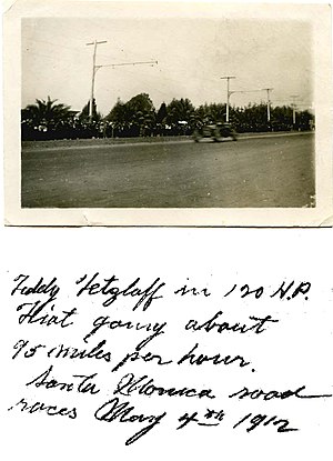
The Santa Monica road race course was an American race track consisting of public roads. Established by a consortium of Southern California auto dealers who sought to promote cars, buying them as well as racing them, at a time when they were rather rare in Los Angeles, the Santa Monica road races lasted for ten years.

Douglas Park (Santa Monica)
Park in Santa Monica, California, United States
Distance: Approx. 971 meters
Latitude and longitude: 34.03569,-118.4793
Douglas Park is a 10.7 acres (4.3 ha) park in Santa Monica, California. Formerly the site of an aircraft factory and movie studio lot, the park is named after Donald Douglas and hosts a number of facilities, including a bowling green and Los Angeles County's largest municipal pond.

Citrin (restaurant)
French restaurant in Santa Monica, California, U.S.
Distance: Approx. 810 meters
Latitude and longitude: 34.02444444,-118.49133333
Citrin is a Michelin-starred French restaurant in Santa Monica, California.

Mélisse
French restaurant in Santa Monica, California, U.S.
Distance: Approx. 815 meters
Latitude and longitude: 34.02436111,-118.49122222
Mélisse is a Michelin-starred French restaurant in Santa Monica, California.
Rustic Canyon (restaurant)
Restaurant in Santa Monica, California, U.S.
Distance: Approx. 742 meters
Latitude and longitude: 34.02508333,-118.49130556
Rustic Canyon is a restaurant in Santa Monica, California. The restaurant serves American / Californian cuisine and has received a Michelin star.
Weather in this IP's area
clear sky
12 Celsius
10 Celsius
10 Celsius
13 Celsius
1013 hPa
40 %
1013 hPa
999 hPa
10000 meters
1.54 m/s
70 degree