173.197.210.26 - IP Lookup: Free IP Address Lookup, Postal Code Lookup, IP Location Lookup, IP ASN, Public IP
Country:
Region:
City:
Location:
Time Zone:
Postal Code:
ISP:
ASN:
language:
User-Agent:
Proxy IP:
Blacklist:
IP information under different IP Channel
ip-api
Country
Region
City
ASN
Time Zone
ISP
Blacklist
Proxy
Latitude
Longitude
Postal
Route
db-ip
Country
Region
City
ASN
Time Zone
ISP
Blacklist
Proxy
Latitude
Longitude
Postal
Route
IPinfo
Country
Region
City
ASN
Time Zone
ISP
Blacklist
Proxy
Latitude
Longitude
Postal
Route
IP2Location
173.197.210.26Country
Region
california
City
corona
Time Zone
America/Los_Angeles
ISP
Language
User-Agent
Latitude
Longitude
Postal
ipdata
Country
Region
City
ASN
Time Zone
ISP
Blacklist
Proxy
Latitude
Longitude
Postal
Route
Popular places and events near this IP address

California Institution for Women
Women's prison in Chino, California
Distance: Approx. 3551 meters
Latitude and longitude: 33.95,-117.635
California Institution for Women (CIW) is an American women's state prison located in the city of Chino, San Bernardino County, California, east of Los Angeles, although the mailing address states "Corona," which is in Riverside County, California.

Prado Reservoir
Reservoir in California, US
Distance: Approx. 2792 meters
Latitude and longitude: 33.90262,-117.6289
Prado Reservoir is a reservoir in northwestern Riverside County and southwestern San Bernardino County, a couple of miles west of the city of Corona, in the U.S. state of California. The reservoir has a capacity of 362,000 acre-feet (447,000,000 m3) and is formed by Prado Dam on the Santa Ana River. The dam is composed of rock-fill and has a height of 106 feet (32 m) above the original streambed.
Corona Municipal Airport
Airport in Corona, California
Distance: Approx. 3063 meters
Latitude and longitude: 33.89777778,-117.6025
Corona Municipal Airport (ICAO: KAJO, FAA LID: AJO), formerly L66, is three miles northwest of Downtown Corona, serving Riverside County, California, United States. The airport has a few businesses, such as a cafe, "Flying Academy" flight training center, and aircraft maintenance and repair. Most U.S. airports use the same three-letter location identifier for the FAA and IATA, but Corona Municipal Airport is AJO to the FAA and has no IATA code (Aljouf, Yemen has IATA code AJO).

Prado Regional Park
Distance: Approx. 3876 meters
Latitude and longitude: 33.9452,-117.6461
Prado Regional Park is a 2,000-acre (8.1 km2) park in Chino, California within the jurisdiction of San Bernardino County. It offers fishing, archery, camping, a golf course, horseback riding, and a shooting range, which was the site of the 1984 Olympic shooting events. The park traces its origins to the Santa Ana River floods of 1937 and 1938, which prompted the construction of the Prado Dam in 1939.

Corona–West station
Commuter rail station in Corona, California
Distance: Approx. 4242 meters
Latitude and longitude: 33.8858,-117.6136
Corona–West station (also known as West Corona station) is a Metrolink station in Corona, California on the 91/Perris Valley and Inland Empire–Orange County lines. The station is located at 155 South Auto Center Drive. Like all Metrolink stations in Riverside County, this station is owned by the Riverside County Transportation Commission.

California Rehabilitation Center
State prison in Norco, California, US
Distance: Approx. 3566 meters
Latitude and longitude: 33.93,-117.575
California Rehabilitation Center (CRC) is a state prison located in Norco, Riverside County, California. The prison is sometimes referenced as "Norco" or "Norco Prison".

Lake Norconian Club
Historic place in California, United States
Distance: Approx. 4095 meters
Latitude and longitude: 33.929,-117.569
The Lake Norconian Club is a historic former hotel/resort in Norco, California, opened in 1929, sited in a rural community, whose main businesses were poultry, rabbits, and agriculture. It was later known as The Norconian (sometimes billed as The Norconian – World's Resort Supreme) and Clark's Hot Springs. The resort complex is still largely intact, after over 70 years as a naval base and prison.

Temescal Creek (Riverside County)
River in the United States
Distance: Approx. 1982 meters
Latitude and longitude: 33.90611111,-117.61388889
Temescal Creek (shown on federal maps as Temescal Wash) is an approximately 29-mile-long (47 km) watercourse in Riverside County, in the U.S. state of California. Flowing primarily in a northwestern direction, it connects Lake Elsinore with the Santa Ana River. It drains the eastern slopes of the Santa Ana Mountains on its left and on its right the western slopes of the Temescal Mountains along its length.

Chino Creek
River in California, United States
Distance: Approx. 3686 meters
Latitude and longitude: 33.90222222,-117.64305556
Chino Creek is a major stream of the Pomona Valley, in the western Inland Empire region of Southern California. It is a tributary of the Santa Ana River.
Norco College
Community college in Norco, California
Distance: Approx. 4161 meters
Latitude and longitude: 33.913904,-117.569495
Norco College is a public community college in Norco, California. Norco College is part of the Riverside Community College District (RCCD), which is part of the larger California Community Colleges System.

Lake Norconian
Lake in Riverside County, California
Distance: Approx. 3886 meters
Latitude and longitude: 33.92416667,-117.57083333
Lake Norconian is an artificial lake in Norco, Riverside County, California. Lake Norconian was created in the early 1920s as part of the Norconian Resort. This 60-acre (24 ha) lake was equipped with a boat house and pavilion.

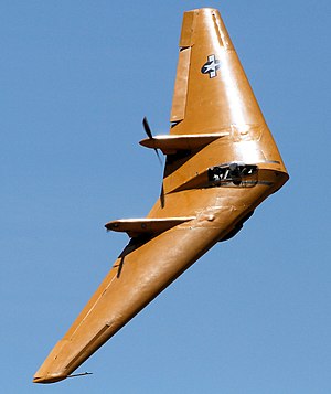
2019 Northrop N-9M crash
April 2019 plane crash in Norco, California, US
Distance: Approx. 3551 meters
Latitude and longitude: 33.92936111,-117.57502778
On April 22, 2019, a Northrop N-9MB aircraft crashed in Norco, California, United States, killing the pilot. The aircraft was the last survivor of four built and was destroyed in the crash.
Weather in this IP's area
overcast clouds
10 Celsius
10 Celsius
9 Celsius
11 Celsius
1014 hPa
86 %
1014 hPa
986 hPa
10000 meters
1.54 m/s
270 degree
100 %