173.197.210.143 - IP Lookup: Free IP Address Lookup, Postal Code Lookup, IP Location Lookup, IP ASN, Public IP
Country:
 USA
USARegion:
City:
Location:
Time Zone:
Postal Code:
ISP:
ASN:
language:
User-Agent:
Proxy IP:
Blacklist:
IP information under different IP Channel
ip-api
Country
Region
City
ASN
Time Zone
ISP
Blacklist
Proxy
Latitude
Longitude
Postal
Route
db-ip
Country
Region
City
ASN
Time Zone
ISP
Blacklist
Proxy
Latitude
Longitude
Postal
Route
IPinfo
Country
Region
City
ASN
Time Zone
ISP
Blacklist
Proxy
Latitude
Longitude
Postal
Route
IP2Location
173.197.210.143Country
usRegion
california
City
los angeles
Time Zone
America/Los_Angeles
ISP
Language
User-Agent
Latitude
Longitude
Postal
ipdata
Country
Region
City
ASN
Time Zone
ISP
Blacklist
Proxy
Latitude
Longitude
Postal
Route
Popular places and events near this IP address

Desilu
American production company
Distance: Approx. 777 meters
Latitude and longitude: 34.089777,-118.334722
Desilu Productions, Inc. () was an American television production company founded and co-owned by husband and wife Desi Arnaz and Lucille Ball. The company is best known for shows such as I Love Lucy, The Lucy Show, Mannix, The Untouchables, Mission: Impossible and Star Trek.

Formosa Cafe
Restaurant in California, United States
Distance: Approx. 279 meters
Latitude and longitude: 34.090558,-118.34595
The Formosa Cafe is a restaurant and bar founded in 1925 and located at 7156 Santa Monica Boulevard at the intersection with North Formosa Avenue, in West Hollywood, California. The Formosa was founded in 1925 by 1920s prize-fighter Jimmy Bernstein. Bernstein operated his establishment initially in a Red Car trolley located just east of The United Artists studio lot.

Plummer Park
Distance: Approx. 779 meters
Latitude and longitude: 34.0931,-118.3511
Plummer Park is a park in West Hollywood, California, United States, on the eastern side of the city. The park is between Santa Monica Boulevard and Fountain Avenue, bordered by North Vista Street and North Fuller Avenue, 6 blocks west of La Brea Avenue. The east side of West Hollywood is dominated by Russian speaking immigrants, and the park is a popular gathering place for Russians.
Sunset Las Palmas Studios
Independent filming lot in Hollywood
Distance: Approx. 777 meters
Latitude and longitude: 34.089777,-118.334722
Sunset Las Palmas Studios, formerly General Service Studios and Hollywood Center Studios, is an American independent entertainment production lot located at 1040 North Las Palmas Avenue in the Hollywood neighborhood of Los Angeles. It has stage facilities and provides filmmaking services to clients in the film, television and advertising industries. Founded in 1919, it is one of the oldest production facilities in Hollywood and has been the host of many notable motion picture productions for over a century.

Samuel Goldwyn Studio
Hollywood backlot
Distance: Approx. 363 meters
Latitude and longitude: 34.089575,-118.346475
Samuel Goldwyn Studio was the name that Samuel Goldwyn used to refer to the lot located on the corner of Formosa Avenue and Santa Monica Boulevard in West Hollywood, California, as well as the offices and stages that his company, Samuel Goldwyn Productions, rented there during the 1920s and 1930s. At various times, the location was also known as Pickford–Fairbanks Studios, the United Artists Studio, Warner Hollywood Studios, and its name since 1999, The Lot at Formosa.

West Hollywood Gateway
Shopping mall in West Hollywood, California
Distance: Approx. 199 meters
Latitude and longitude: 34.09,-118.3447
The West Hollywood Gateway is a 248,000 sq ft (23,000 m2) two-level urban vertical retail power center in West Hollywood, California. It was developed by the JH Snyder Company and designed by architect Jon Jerde, located on the southwest corner Santa Monica Blvd. and La Brea Avenue at the border of West Hollywood and Los Angeles.
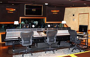
Westlake Recording Studios
Recording studio in California, US
Distance: Approx. 504 meters
Latitude and longitude: 34.09095,-118.348461
Westlake Recording Studios is a music recording studio in West Hollywood, California.

Radio Recorders
Distance: Approx. 99 meters
Latitude and longitude: 34.0904847,-118.3422266
Radio Recorders, Inc. was an American recording studio located in Los Angeles, California. During the 1940s and 1950s, Radio Recorders was one of the largest independent recording studios in the world.
Yeshiva Ohr Elchonon Chabad/West Coast Talmudical Seminary
School in Los Angeles, California
Distance: Approx. 711 meters
Latitude and longitude: 34.085442,-118.346571
Yeshiva Ohr Elchonon Chabad West Coast Talmudical Seminary (YOEC) is a yeshiva college in Los Angeles, California. It is the largest yeshiva college on the West Coast of the United States. The yeshiva also houses a private boys high school accredited by the Western Association of Schools and Colleges, called Yeshiva Ohr Elchonon Chabad High School.

Jim Henson Company Lot
Film and recording complex
Distance: Approx. 589 meters
Latitude and longitude: 34.09638889,-118.34305556
The Jim Henson Company Lot, formerly A&M Studios, is a studio property located just south of the southeast corner of North La Brea Avenue and Sunset Boulevard in Hollywood. Originally established by film star Charlie Chaplin, the property served as Charlie Chaplin Studios from 1917 to 1953, which later earned the site designation as a Los Angeles Historic-Cultural Monument. After being sold by Chaplin in 1953, the property went through several changes in ownership and has served at various times as the original studio of Hanna-Barbera Productions, Kling Studios, the Red Skelton Studios, the shooting location for the Adventures of Superman and Perry Mason television series.

Original Cannabis Cafe
Restaurant in California, United States
Distance: Approx. 376 meters
Latitude and longitude: 34.092668,-118.3466097
The Original Cannabis Cafe, known previously as Lowell Farms: A Cannabis Cafe until December 2019, is an indoor-outdoor restaurant located in West Hollywood, California. It is the first cannabis restaurant in the United States and opened on October 1, 2019, founded by 11 partners and investors including Houston Hospitality. The cafe has a flower menu and farm-to-table cuisine that is "designed to enhance the cannabis experience." Budtenders, also known as "flower hosts", are available to give suggestions on which strains of cannabis pair best with each meal and will roll a joint for the patrons at the table.
Regen Projects
Contemporary art gallery in Los Angeles, California
Distance: Approx. 493 meters
Latitude and longitude: 34.0905,-118.3377
Regen Projects is a contemporary art gallery in Los Angeles, California.
Weather in this IP's area
broken clouds
17 Celsius
16 Celsius
12 Celsius
22 Celsius
1012 hPa
70 %
1012 hPa
991 hPa
10000 meters
7.2 m/s
260 degree
75 %