173.197.210.106 - IP Lookup: Free IP Address Lookup, Postal Code Lookup, IP Location Lookup, IP ASN, Public IP
Country:
Region:
City:
Location:
Time Zone:
Postal Code:
ISP:
ASN:
language:
User-Agent:
Proxy IP:
Blacklist:
IP information under different IP Channel
ip-api
Country
Region
City
ASN
Time Zone
ISP
Blacklist
Proxy
Latitude
Longitude
Postal
Route
db-ip
Country
Region
City
ASN
Time Zone
ISP
Blacklist
Proxy
Latitude
Longitude
Postal
Route
IPinfo
Country
Region
City
ASN
Time Zone
ISP
Blacklist
Proxy
Latitude
Longitude
Postal
Route
IP2Location
173.197.210.106Country
Region
california
City
santa monica
Time Zone
America/Los_Angeles
ISP
Language
User-Agent
Latitude
Longitude
Postal
ipdata
Country
Region
City
ASN
Time Zone
ISP
Blacklist
Proxy
Latitude
Longitude
Postal
Route
Popular places and events near this IP address

Crossroads School (Santa Monica, California)
Private, college preparatory school in Santa Monica, California, United States
Distance: Approx. 216 meters
Latitude and longitude: 34.02444444,-118.47388889
Crossroads School for Arts & Sciences is a private/independent, college preparatory school in Santa Monica, California, United States. The school is a former member of the G20 Schools Group.
Playboy Studio West
Distance: Approx. 392 meters
Latitude and longitude: 34.028427,-118.47659
Playboy Studio West is located at 2112 Broadway Avenue, Santa Monica, California. It is one of Playboy's key studio facilities for Playboy photographers to shoot centerfolds and Playmate pictorials. Many models had their test nude shoots taken at this facility prior to being considered for a Playmate pictorial in Playboy.
Santa Monica–Malibu Unified School District
School district in Santa Monica, California, US
Distance: Approx. 694 meters
Latitude and longitude: 34.02222222,-118.47888889
Santa Monica–Malibu Unified School District (SMMUSD) is a school district located in Santa Monica, California. The district serves the cities of Santa Monica and Malibu, as well as a portion of Westlake Village, the Pepperdine University census-designated place, and a portion of the Topanga census-designated place. It has ten elementary schools, two middle schools, three high schools, an adult high school, and an alternative school.
Santa Monica neighborhoods
Distance: Approx. 687 meters
Latitude and longitude: 34.0242,-118.4802
The western border of Santa Monica, California, is the 3-mile (4.8 km) stretch of Santa Monica Bay. On its other sides, the city is bordered by various districts of Los Angeles: the northwestern border is Pacific Palisades, the eastern border is Brentwood north of Wilshire Boulevard and West Los Angeles south of Wilshire, the northeastern border is generally San Vicente Boulevard up to the Riviera Country Club, the southwestern border is Venice Beach and the southern border is with West Los Angeles and Mar Vista.

Bergamot (arts center)
Art gallery facility in Santa Monica, California, US
Distance: Approx. 635 meters
Latitude and longitude: 34.027677,-118.46652
Bergamot Station Arts Center is a Santa Monica facility housing many different private art galleries and appears in most tourist guides as a primary cultural destination. Opened September 17, 1994 as Bergamot Station the campus-like complex is owned by the city of Santa Monica and presently managed by the Worthe Group.

Saint John's Health Center
Hospital in California, United States
Distance: Approx. 718 meters
Latitude and longitude: 34.0306,-118.479
Providence Saint John's Health Center, formerly St. Johns Hospital and Health Center, is a private not-for-profit, Roman Catholic hospital in Santa Monica, California, United States. The hospital was founded in 1942 by the Sisters of Charity of Leavenworth.

26th Street/Bergamot station
Light rail station
Distance: Approx. 353 meters
Latitude and longitude: 34.0279,-118.4699
26th Street/Bergamot station is an at-grade light rail station in the Los Angeles Metro Rail system. It is located near the intersection of 26th Street and Olympic Boulevard in Santa Monica, California and near the Bergamot Station Arts Center. The station is served by the E Line.

17th Street/SMC station
Light rail station
Distance: Approx. 666 meters
Latitude and longitude: 34.0237,-118.4797
17th Street/SMC station is an at-grade light rail station in the Los Angeles Metro Rail system located near the intersection of 17th Street and Colorado Avenue in Santa Monica, California. It is served by the E Line.

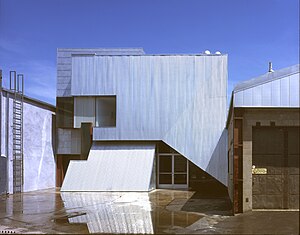
Koning Eizenberg Architecture
Architectural firm located in Santa Monica, California, United States
Distance: Approx. 569 meters
Latitude and longitude: 34.03135334,-118.47409273
Koning Eizenberg Architecture (KEA) is an architecture firm located in Santa Monica, California established in 1981. The firm is recognized for a range of project types including: adaptive reuse of historic buildings, educational facilities, community places, and housing. Principals Hank Koning, Julie Eizenberg, Brian Lane, and Nathan Bishop work collaboratively with developers, cities and not-for-profit clients.
Electronic Café International
Performance space in Santa Monica, California, USA
Distance: Approx. 495 meters
Latitude and longitude: 34.023893,-118.477713
Electronic Café International (ECI), established in 1988 by Kit Galloway and Sherrie Rabinowitz, is a performance space and real café housed in the 18th Street Arts Center in Santa Monica, California.

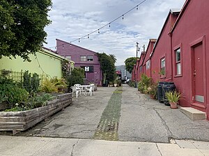
18th Street Arts Center
Arts center in Santa Monica, California, United States
Distance: Approx. 457 meters
Latitude and longitude: 34.024157,-118.477424
18th Street Arts Center is a nonprofit arts center in Santa Monica, California. 18th Street Arts Center amplifies the impact of artists on society. Conceived as a radical think tank in the shape of an artist community.

Virginia Avenue Park
Park in Santa Monica, California, United States
Distance: Approx. 741 meters
Latitude and longitude: 34.02138889,-118.46777778
Virginia Avenue Park is a 9.5 acres (3.8 ha) park located in the Pico neighborhood of Santa Monica, California. Originally opened in 1976, the park was redeveloped and expanded in the 1990s and early 2000s, reopening in 2005. The park hosts a number of community activities such as a weekly farmers market, afterschool programs, and social program assistance.
Weather in this IP's area
scattered clouds
12 Celsius
11 Celsius
11 Celsius
13 Celsius
1013 hPa
67 %
1013 hPa
999 hPa
10000 meters
40 %