173.197.206.128 - IP Lookup: Free IP Address Lookup, Postal Code Lookup, IP Location Lookup, IP ASN, Public IP
Country:
Region:
City:
Location:
Time Zone:
Postal Code:
IP information under different IP Channel
ip-api
Country
Region
City
ASN
Time Zone
ISP
Blacklist
Proxy
Latitude
Longitude
Postal
Route
Luminati
Country
Region
fl
City
sarasota
ASN
Time Zone
America/New_York
ISP
TWC-7843-BB
Latitude
Longitude
Postal
IPinfo
Country
Region
City
ASN
Time Zone
ISP
Blacklist
Proxy
Latitude
Longitude
Postal
Route
IP2Location
173.197.206.128Country
Region
florida
City
fort pierce
Time Zone
America/New_York
ISP
Language
User-Agent
Latitude
Longitude
Postal
db-ip
Country
Region
City
ASN
Time Zone
ISP
Blacklist
Proxy
Latitude
Longitude
Postal
Route
ipdata
Country
Region
City
ASN
Time Zone
ISP
Blacklist
Proxy
Latitude
Longitude
Postal
Route
Popular places and events near this IP address

Fort Pierce, Florida
City in Florida, United States
Distance: Approx. 5189 meters
Latitude and longitude: 27.43888889,-80.33555556
Fort Pierce is a city in and the county seat of St. Lucie County, Florida, United States. The city is part of the Treasure Coast region of Atlantic Coast Florida.

Fort Pierce South, Florida
CDP in Florida, United States
Distance: Approx. 3206 meters
Latitude and longitude: 27.41583333,-80.3525
Fort Pierce South is a census-designated place (CDP) in St. Lucie County, Florida, United States. The population was 5,062 at the 2010 census.

Indian River Estates, Florida
CDP in Florida, United States
Distance: Approx. 3977 meters
Latitude and longitude: 27.36444444,-80.30861111
Indian River Estates is a census-designated place (CDP) in St. Lucie County, Florida, United States. The population was 6,220 at the 2010 census.

White City, St. Lucie County, Florida
CDP in Florida, United States
Distance: Approx. 999 meters
Latitude and longitude: 27.38333333,-80.33333333
White City is a census-designated place (CDP) in St. Lucie County, Florida, United States. The population was 3,719 at the 2010 census.
Indian River State College
Public college in Fort Pierce, Florida, US
Distance: Approx. 4230 meters
Latitude and longitude: 27.4237,-80.3579
Indian River State College (IRSC) is a public college based in Fort Pierce, Florida, serving the Treasure Coast region. It is part of the Florida College System and offers associate and bachelor's degree programs as well as vocational certificates. It was established in 1959.

Heathcote Botanical Gardens
Distance: Approx. 3050 meters
Latitude and longitude: 27.41827778,-80.324
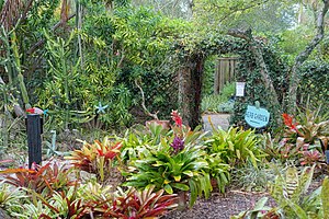
Heathcote Botanical Gardens is a five-acre subtropical botanical garden located at 210 Savannah Road, Fort Pierce, Florida, United States. Heathcote is a non-profit, 501 (C)3 educational foundation that bills itself as the "Green Heart of the Treasure Coast." It began in 1960 as the commercial nursery of landscape architect Molly Crimmons and her husband, Jim. Heathcote Botanical Gardens was established in 1986 when the site was purchased by local citizens with contributions from the City of Fort Pierce, St.

Old Fort Pierce Park
United States historic site in Florida
Distance: Approx. 5079 meters
Latitude and longitude: 27.43638889,-80.32055556
Old Fort Pierce Park is the site of Fort Pierce, a military installation constructed by the U.S. Army in Florida with the purpose of being a main supply depot for the army during the Second Seminole War. The modern town of Fort Pierce derives its name from this installation. Fort Pierce, named for its first commander Benjamin Kendrick Pierce, was built in 1838 as a defensive position in the Second Seminole War.

Savannas Preserve State Park
Park in Florida
Distance: Approx. 3263 meters
Latitude and longitude: 27.37888889,-80.30444444
Savannas Preserve State Park is a Florida State Park, located along much of the Atlantic Coast between Fort Pierce and Jensen Beach. Savannas Preserve also has a group of youth volunteers, the Junior Friends of Savannas Preserve State Park.

Jules Frere House
Historic house in Florida, United States
Distance: Approx. 3549 meters
Latitude and longitude: 27.42416667,-80.335
The Jules Frere House is a historic house located at 2404 Sunrise Boulevard in Fort Pierce, Florida. It is locally significant as one of the best examples of the Spanish Colonial Revival style in Fort Pierce, maintaining its original qualities exceptionally well.
Captain Hammond House
Historic house in Florida, United States
Distance: Approx. 3315 meters
Latitude and longitude: 27.36361111,-80.34277778
The Captain Hammond House is a historic house located at 5775 Citrus Avenue in White City, Florida. It was built for and served as the home for the retired New England sea captain John Hammond.
WQCS
Radio station in Fort Pierce, Florida
Distance: Approx. 3968 meters
Latitude and longitude: 27.422,-80.356
WQCS (FM 88.9) is the National Public Radio (NPR) member station for the Treasure Coast of Florida. Licensed to Fort Pierce, it is owned by Indian River State College, with studios in Building Q of the college's main campus in Fort Pierce. The station is non-commercial and listener-supported.
Fort Pierce Central High School
Public school in Fort Pierce, Florida, United States
Distance: Approx. 1705 meters
Latitude and longitude: 27.3911,-80.351
Fort Pierce Central High School is a public high school located in Fort Pierce, Florida, United States. It is part of the St. Lucie Public Schools district.
Weather in this IP's area
clear sky
10 Celsius
9 Celsius
10 Celsius
11 Celsius
1017 hPa
92 %
1017 hPa
1017 hPa
10000 meters
2.57 m/s
310 degree
