173.197.202.53 - IP Lookup: Free IP Address Lookup, Postal Code Lookup, IP Location Lookup, IP ASN, Public IP
Country:
Region:
City:
Location:
Time Zone:
Postal Code:
IP information under different IP Channel
ip-api
Country
Region
City
ASN
Time Zone
ISP
Blacklist
Proxy
Latitude
Longitude
Postal
Route
Luminati
Country
Region
fl
City
sarasota
ASN
Time Zone
America/New_York
ISP
TWC-7843-BB
Latitude
Longitude
Postal
IPinfo
Country
Region
City
ASN
Time Zone
ISP
Blacklist
Proxy
Latitude
Longitude
Postal
Route
IP2Location
173.197.202.53Country
Region
virginia
City
virginia beach
Time Zone
America/New_York
ISP
Language
User-Agent
Latitude
Longitude
Postal
db-ip
Country
Region
City
ASN
Time Zone
ISP
Blacklist
Proxy
Latitude
Longitude
Postal
Route
ipdata
Country
Region
City
ASN
Time Zone
ISP
Blacklist
Proxy
Latitude
Longitude
Postal
Route
Popular places and events near this IP address

Princess Anne High School
High school in Virginia Beach, Virginia, United States
Distance: Approx. 3120 meters
Latitude and longitude: 36.845,-76.12777778
Princess Anne High School (PAHS) is one of 11 high schools in the Virginia Beach City Public School System. The school features, as its academy, the International Baccalaureate Programme. Opened in 1954, it is the oldest remaining high school in Virginia Beach, Virginia, United States.
Thalia, Virginia
Unincorporated area in Virginia, United States
Distance: Approx. 2482 meters
Latitude and longitude: 36.84361111,-76.12083333
Thalia is a residential neighborhood in the northeastern area of the independent city of Virginia Beach in the Hampton Roads region of Virginia.
Kings Grant, Virginia
Neighborhood in Virginia Beach, Virginia, United States
Distance: Approx. 2197 meters
Latitude and longitude: 36.85583333,-76.08361111
Kings Grant is a neighborhood located within the Lynnhaven section of Virginia Beach, Virginia, United States. Transportation routes within Kings Grant include Kings Grant Road, North Lynnhaven Road and Little Neck Road. Schools serving Kings Grant include Kings Grant and Kingston Elementary Schools, Lynnhaven Middle School and First Colonial High School.

Mount Trashmore Park
Park in Virginia Beach, Virginia
Distance: Approx. 2721 meters
Latitude and longitude: 36.831,-76.1232
Mount Trashmore Park, also known simply as Mount Trashmore, is a city park located in Virginia Beach, Virginia, which opened in 1974, Mount Trashmore is an example of landfill reuse, as its creation consisted of the conversion of an abandoned landfill into a park. The park spans 165 acres (67 ha) with hills larger than 60 feet (18 m) high and 800 feet (240 m) long. Facilities include three large, two medium, and six small picnic shelters, playground areas, four volleyball areas, parking, vending machines and restrooms.

Lynnhaven Mall
Shopping mall in Virginia, USA
Distance: Approx. 3140 meters
Latitude and longitude: 36.81638889,-76.07111111
Lynnhaven Mall is an enclosed super-regional shopping mall in Virginia Beach, Virginia, USA. It opened in August 1981. At 1,170,000 square feet (109,000 m2) of gross leasable area, it is the largest mall in the Hampton Roads metropolitan area of southeastern Virginia and one of the largest malls on the East Coast. The mall contains more than 180 stores, including Dillard's, JCPenney, and Macy's as main anchor stores.
Camp Ashby (Virginia)
Distance: Approx. 2387 meters
Latitude and longitude: 36.844235,-76.119493
Camp Ashby in the Thalia community of Princess Anne County, Virginia was the largest Prisoner of War camp in South Hampton Roads during World War II. It housed 6,000 German troops, many of Adolf Hitler's Afrika Corps who had been captured in North Africa during the closing years of World War II. Camp Ashby was erected quickly in 1942 on land leased from the state. At the time, the property's dominant feature was the Tidewater Victory Memorial Hospital, a tuberculosis sanitarium at Virginia Beach Boulevard and Thalia Road. That building became the camp's headquarters.

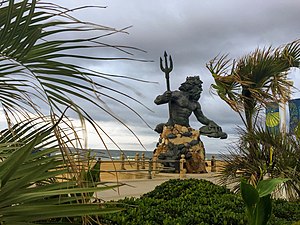
Neptune Festival
Distance: Approx. 1409 meters
Latitude and longitude: 36.841605,-76.078776
The Neptune Festival is an annual festival in Virginia Beach, Virginia. Virginia Beach Chamber of Commerce President and RK Chevrolet founder Richard Kline created the idea in 1973, to celebrate the heritage of the city. The first celebration took place in 1974.

Virginia Beach Town Center
Distance: Approx. 3550 meters
Latitude and longitude: 36.84277778,-76.13327778
Virginia Beach Town Center is a group of offices, hotels, stores, and restaurants located in the central business district of Virginia Beach, Virginia.
Lynnhaven, Virginia
Borough in Virginia, United States
Distance: Approx. 3571 meters
Latitude and longitude: 36.81325,-76.06825
Lynnhaven is one of the seven original boroughs created when the city of Virginia Beach, Virginia was formed in 1963. It is located in the North Central portion of the city. This area was originally located at the mouth of the Lynnhaven Bay inlet.

Armada Hoffler Tower
High-rise office building in Virginia, United States
Distance: Approx. 3567 meters
Latitude and longitude: 36.84263889,-76.1335
The Armada Hoffler Tower is a high rise multi-office building in Town Center, Virginia Beach, Virginia. [1] Opened in 2003, it is known as the first building built in the new Virginia Beach Town Center. The 23 story tower is 396 feet (121 meters) tall.
Miller-Motte College
American private technical college system
Distance: Approx. 3473 meters
Latitude and longitude: 36.84066,-76.13273
Miller-Motte College, formerly Miller-Motte Technical College, is a system of private for-profit technical colleges throughout the southeastern United States. Its parent company is Ancora Education.

Francis Land House
Historic house in Virginia, United States
Distance: Approx. 1289 meters
Latitude and longitude: 36.84111111,-76.08
The Francis Land House, or Rose Hall, is a historic brick house in located within the Rose Hall District near Princess Anne Plaza in Virginia Beach, Virginia. It was the plantation home of the prominent Land family, a founding family of Princess Anne County, Virginia.
Weather in this IP's area
clear sky
5 Celsius
2 Celsius
4 Celsius
6 Celsius
1019 hPa
58 %
1019 hPa
1018 hPa
10000 meters
4.12 m/s
290 degree