Country:
 USA
USARegion:
City:
Latitude and Longitude:
Time Zone:
Postal Code:
IP information under different IP Channel
ip-api
Country
Region
City
ASN
Time Zone
ISP
Blacklist
Proxy
Latitude
Longitude
Postal
Route
IPinfo
Country
Region
City
ASN
Time Zone
ISP
Blacklist
Proxy
Latitude
Longitude
Postal
Route
MaxMind
Country
Region
City
ASN
Time Zone
ISP
Blacklist
Proxy
Latitude
Longitude
Postal
Route
Luminati
Country
USRegion
hi
City
honolulu
ASN
Time Zone
Pacific/Honolulu
ISP
TWC-20001-PACWEST
Latitude
Longitude
Postal
db-ip
Country
Region
City
ASN
Time Zone
ISP
Blacklist
Proxy
Latitude
Longitude
Postal
Route
ipdata
Country
Region
City
ASN
Time Zone
ISP
Blacklist
Proxy
Latitude
Longitude
Postal
Route
Popular places and events near this IP address

Lanai City, Hawaii
Census-designated place in Hawaii, United States
Distance: Approx. 214 meters
Latitude and longitude: 20.8275,-156.92194444
Lāna‘i City is a census-designated place (CDP) on the island of Lāna‘i, in Maui County, Hawai‘i, United States. The population was 3,332 at the 2020 census. Lāna‘i City is the island's commercial center.

Lanai
Sixth-largest Hawaiian island
Distance: Approx. 507 meters
Latitude and longitude: 20.825,-156.92
Lanai (Hawaiian: Lānaʻi, Hawaiian: [laːˈnɐʔi, naːˈnɐʔi], lə-NY, lah-NAH-ee, also US: lah-NY, lə-NAH-ee,) is the sixth-largest of the Hawaiian Islands and the smallest publicly accessible inhabited island in the chain. It is colloquially known as the Pineapple Island because of its past as an island-wide pineapple plantation. The island's only settlement of note is the small town of Lanai City.

Lanai Airport
Airport
Distance: Approx. 5480 meters
Latitude and longitude: 20.78555556,-156.95138889
Lanai Airport (IATA: LNY, ICAO: PHNY, FAA LID: LNY), also written as Lānaʻi Airport, is a state-owned public-use airport located three nautical miles or about 3.4 miles (6 km) southwest of the central business district of Lanai City (Lānaʻi City), in Maui County, Hawaii. The airport began regular operations in 1930. It is the only airport serving the island of Lanai (Lānaʻi).
Four Seasons Resort Lanai
Resort in Lanai, Hawaii
Distance: Approx. 9988 meters
Latitude and longitude: 20.74166667,-156.89638889
Four Seasons Resort Lanai is a Four Seasons resort hotel located in Lanai City on the island of Lānaʻi, the smallest and least inhabited of Hawaii's six major islands that once was recognized for its pineapple plantation. The island of Lānaʻi hosts two other hotels, Sensei Lanai, A Four Seasons Resort (previously known as "The Lodge at Koele"), and Hotel Lanai, a 3-star boutique hotel. Originally opened as The Manele Bay Hotel in 1991, the hotel started operating under the Four Seasons brand in 2005.
Lanai High and Elementary School
School in Lanai City, Lanai, Maui County, Hawaii, United States
Distance: Approx. 271 meters
Latitude and longitude: 20.82611111,-156.92194444
Lānaʻi High and Elementary School (LHES) is located on the island of Lanai in the U.S. state of Hawaii. It is the largest of six K-12 public schools in the Hawaii State Department of Education system. Lanai High and Elementary School is the only school on the island located in the heart of Lanai City, which is also the only urban settlement on the island.

Manele, Hawaii
Census-designated place in Hawaii, United States
Distance: Approx. 9755 meters
Latitude and longitude: 20.74583333,-156.89027778
Manele (Hawaiian: Mānele) is a census-designated place (CDP) in Maui County, Hawaii, United States, on the island of Lanai. As of the 2020 census, the CDP had a population of 7. Manele is one of only two census-designated places on Lanai, the other being the much larger Lanai City.
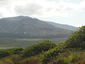
Lānaihale
Hawaiian mountain
Distance: Approx. 5675 meters
Latitude and longitude: 20.811151,-156.872376
Lānaihale is a mountain peak in Hawaiʻi. It is the highest point of the island of Lanai.
Kaumalapau, Hawaii
Unincorporated community in the state of Hawaii, United States
Distance: Approx. 8177 meters
Latitude and longitude: 20.78694444,-156.98944444
Kaumalapau is an unincorporated community in Maui County on the island of Lanai in the state of Hawaii. Kaumalapau is a name derived from the Hawaiian language meaning "soot placed in gardens". Kaumalapau was declared the "most difficult to pronounce" place name in the state of Hawaii by Reader's Digest.
Weather in this IP's area
overcast clouds
20 Celsius
21 Celsius
20 Celsius
22 Celsius
1015 hPa
88 %
1015 hPa
960 hPa
10000 meters
2.57 m/s
60 degree
100 %
06:24:12
18:00:53