172.98.51.143 - IP Lookup: Free IP Address Lookup, Postal Code Lookup, IP Location Lookup, IP ASN, Public IP
Country:
 Lebanon
Region:
City:
Location:
Time Zone:
Postal Code:
ISP:
ASN:
language:
User-Agent:
Proxy IP:
Blacklist:
IP information under different IP Channel
ip-api
Country
Region
City
ASN
Time Zone
ISP
Blacklist
Proxy
Latitude
Longitude
Postal
Route
db-ip
Country
Region
City
ASN
Time Zone
ISP
Blacklist
Proxy
Latitude
Longitude
Postal
Route
IPinfo
Country
Region
City
ASN
Time Zone
ISP
Blacklist
Proxy
Latitude
Longitude
Postal
Route
IP2Location
172.98.51.143Country
lbRegion
liban-nord
City
tripoli
Time Zone
Asia/Beirut
ISP
Language
User-Agent
Latitude
Longitude
Postal
ipdata
Country
Region
City
ASN
Time Zone
ISP
Blacklist
Proxy
Latitude
Longitude
Postal
Route
Popular places and events near this IP address

North Governorate
Governorate of Lebanon
Distance: Approx. 376 meters
Latitude and longitude: 34.43333333,35.85
North Governorate (Arabic: الشمال, Aš Šamāl) is one of the governorates of Lebanon and one of the two governorates of North Lebanon. Its capital is Tripoli. Ramzi Nohra has been its governor since May 2, 2014.

Siege of Tripoli
Distance: Approx. 618 meters
Latitude and longitude: 34.43326194,35.84441389
The siege of Tripoli lasted from 1102 until 12 July 1109. It took place on the site of the present day Lebanese city of Tripoli, in the aftermath of the First Crusade. It led to the establishment of the fourth crusader state, the County of Tripoli.

Tripoli District, Lebanon
District in North Governorate, Lebanon
Distance: Approx. 376 meters
Latitude and longitude: 34.43333333,35.85
The Tripoli District is a small, but very densely populated district in the North Governorate of Lebanon. It consists of the city Tripoli, its port town El Mina and the surrounding area. The vast majority of residents are Sunni Muslim (approximately 80%), a small minority Orthodox and Maronite Christians, and a small minority of Alawite Muslims.

Al-Attar Mosque
Mosque in Tripoli, Lebanon
Distance: Approx. 396 meters
Latitude and longitude: 34.4365,35.84538889
The Al-Attar Mosque (Arabic: مسجد العطار) is a Sunni Islam congregational mosque (jāmiʿ), located at Bab al-Hadeed, in the Old City of Tripoli, in the Northern Governorate of Lebanon. The mosque was built in 1350 C.E. during the Mamluk period. The mosque is widely noted for its unusual layout, its interior bears no resemblance to any other known mosque types,: 76 and for its square-shaped minaret, an integral part of the skyline of Tripoli: 75 and the tallest Mamluk minaret in the city.

Al-Uwaysiyat Mosque
Mosque in Tripoli, Lebanon
Distance: Approx. 474 meters
Latitude and longitude: 34.43527778,35.84483333
The Al-Uwaysiyat (Arabic: جامع الأويسي) is a mosque, located in Tripoli, in the Northern Governorate of Lebanon.

Al-Burtasi Mosque
Mosque in Tripoli, Lebanon
Distance: Approx. 336 meters
Latitude and longitude: 34.43569444,35.84625
The Al-Burtasi Mosque (Arabic: مسجد البرطاسي) is a mosque, located in Tripoli, in the Northern Governorate of Lebanon. The Burtasi mosque is considered one of the most beautiful Mamluk mosques in Tripoli.

Al-Tawbat Mosque
Mosque in Tripoli, Lebanon
Distance: Approx. 414 meters
Latitude and longitude: 34.43777778,35.84538889
The Al-Tawbat Mosque is a mosque, located in Tripoli, in the Northern Governorate of Lebanon. The mosque was built in the Mamluk era, during the 14th century.

Citadel of Tripoli
12th-century fortress in Tripoli, Lebanon
Distance: Approx. 602 meters
Latitude and longitude: 34.4334,35.8445
The Citadel of Tripoli (Arabic: قَلْعَة طَرَابُلُس ALA-LC: Qalʻat Ṭarābulus) is a 12th-century fortress in Tripoli, Lebanon. It was built at the top of a hill "during the initial Frankish siege of the city between 1102 and 1109" on the orders of Raymond de Saint-Gilles, who baptized it the Castle of Mount Pilgrim (French: château du Mont-Pèlerin; Latin: castellum Montis Peregrini) while local Muslims have been referring to it as the Castle of Saint-Gilles (Arabic: قَلْعَة سَان جِيل Qalʻat Sān Jīl). However, very little of the original structure has survived, the castle having been rebuilt several times, and for the last time in the early 19th century, when the citadel was extensively restored and rebuilt by the Ottoman governor of Tripoli Mustafa Agha Barbar.
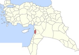
Tripoli Eyalet
Ottoman province (1579-1864)
Distance: Approx. 376 meters
Latitude and longitude: 34.43333333,35.85
Tripoli Eyalet (Ottoman Turkish: ایالت طرابلس شام, romanized: Eyālet-i Ṭrāblus-ı Şām; Arabic: طرابلس الشام) was an eyalet of the Ottoman Empire. The capital was in Tripoli, Lebanon. Its reported area in the 19th century was 1,629 square miles (4,220 km2).
Melkite Greek Catholic Archeparchy of Tripoli
Eastern Catholic archeparchy in Lebanon
Distance: Approx. 379 meters
Latitude and longitude: 34.4333,35.85
Melkite Greek Catholic Archeparchy of Tripoli (in Latin: Archeparchy Tripolitana Graecorum Melkitarum) is a diocese of the Melkite Greek Catholic Church suffragan of the Melkite Greek Catholic Archeparchy of Tyre.
Tripoli Sanjak
Subdivision in the Ottoman Empire
Distance: Approx. 376 meters
Latitude and longitude: 34.43333333,35.85
The Tripoli Sanjak (Arabic: سنجق طرابلس الشام) was a prefecture (sanjak) of the Ottoman Empire, located in modern-day Lebanon and Syria. The city of Tripoli was the Sanjak's capital. It had a population of 175,063 in 1914.

Abd al-Wahid Mosque
Mosque in Tripoli, Lebanon
Distance: Approx. 518 meters
Latitude and longitude: 34.4349,35.8445
The Abd al-Wahid Mosque (Arabic: مسجد عبد الواحد المكناسي) is a mosque, located in Tripoli, in the North Governorate of Lebanon.
Weather in this IP's area
light rain
12 Celsius
11 Celsius
12 Celsius
12 Celsius
1019 hPa
60 %
1019 hPa
996 hPa
10000 meters
3.66 m/s
3.59 m/s
182 degree
84 %