Country:
Region:
City:
Latitude and Longitude:
Time Zone:
Postal Code:
IP information under different IP Channel
ip-api
Country
Region
City
ASN
Time Zone
ISP
Blacklist
Proxy
Latitude
Longitude
Postal
Route
Luminati
Country
Region
ia
City
robins
ASN
Time Zone
America/Chicago
ISP
EIDG-AS1
Latitude
Longitude
Postal
IPinfo
Country
Region
City
ASN
Time Zone
ISP
Blacklist
Proxy
Latitude
Longitude
Postal
Route
db-ip
Country
Region
City
ASN
Time Zone
ISP
Blacklist
Proxy
Latitude
Longitude
Postal
Route
ipdata
Country
Region
City
ASN
Time Zone
ISP
Blacklist
Proxy
Latitude
Longitude
Postal
Route
Popular places and events near this IP address

Linn County, Iowa
County in Iowa, United States
Distance: Approx. 5594 meters
Latitude and longitude: 42.07861111,-91.59972222
Linn County is a county located in the U.S. state of Iowa. As of the 2020 census, the population was 230,299, making it the second-most populous county in Iowa. The county seat is Cedar Rapids.
Hiawatha, Iowa
City in Iowa, United States
Distance: Approx. 3651 meters
Latitude and longitude: 42.04444444,-91.68111111
Hiawatha is a city in Linn County, Iowa, United States. It is a suburb located in the northwestern side of Cedar Rapids and is part of the Cedar Rapids Metropolitan Statistical Area. The population was 7,183 at the time of the 2020 census, an increase from 6,480 in 2000.

Robins, Iowa
City in Iowa, United States
Distance: Approx. 332 meters
Latitude and longitude: 42.07277778,-91.66861111
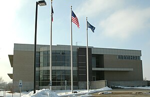
Robins is a city in Linn County, Iowa, United States. The population was 3,353 at the time of the 2020 census. It is a suburb of Cedar Rapids and part of the Cedar Rapids Metropolitan Statistical Area.

Linn-Mar Community School District
Public school district in Marion, Iowa, United States
Distance: Approx. 6263 meters
Latitude and longitude: 42.053779,-91.597446
Linn-Mar Community School District is a public school district in Linn County, Iowa, that administrates seven elementary schools, two intermediate schools, two junior high schools and a senior high school. The district includes the northern part of Marion, Iowa, an area in Cedar Rapids, part of Robins and rural areas in the county. As of 2019, more than 7700 students were enrolled in district schools.
Linn-Mar High School
Public secondary school in Marion, Iowa, United States
Distance: Approx. 6255 meters
Latitude and longitude: 42.053,-91.598
Linn-Mar High School is a public high school, part of the Linn-Mar Community School District. It serves students in grades 9 through 12 and is located in Marion, Iowa.
John F. Kennedy High School (Iowa)
Public secondary school in Cedar Rapids, Iowa, United States
Distance: Approx. 5773 meters
Latitude and longitude: 42.02472222,-91.68083333
Kennedy High School is a public high school located in Cedar Rapids, Iowa. Kennedy was founded in 1967. The building was dedicated by Senator Edward M. Kennedy, younger brother of the school's namesake President John F. Kennedy.
KZIA
Radio station in Cedar Rapids, Iowa
Distance: Approx. 3087 meters
Latitude and longitude: 42.057,-91.695
KZIA, known as "Z 102.9", is a radio station based in Cedar Rapids, Iowa. It has a Top 40 (CHR) format primarily staffed with local personalities, including morning DJs Dancin' Eric Hanson, Clare Duffy, and Producer Ben, known as “The Morning Scramble.” Eric and Clare were recognized as the Iowa Broadcasters of the Year in 2022 by the Iowa Broadcasters Association. Other hosts include Lady J, Those Girls in the Afternoon with Destiny and Taylor, and Jaidyn on the Night Show.
KDAT
Radio station in Cedar Rapids, Iowa
Distance: Approx. 2428 meters
Latitude and longitude: 42.08083333,-91.69583333
KDAT (104.5 FM) is a radio station broadcasting an adult contemporary music format. Licensed to Cedar Rapids, Iowa, the station serves the Cedar Rapids-Iowa City area. The station is currently owned by Townsquare Media.
Toddville, Iowa
Unincorporated community in Iowa, United States
Distance: Approx. 4869 meters
Latitude and longitude: 42.09916667,-91.71694444
Toddville is an unincorporated community in western Linn County, Iowa, United States. It lies along local roads just off I-380, northwest of the city of Cedar Rapids, the county seat of Linn County. Its elevation is 787 feet (240 m).
Midway, Linn County, Iowa
Unincorporated community in Iowa, United States
Distance: Approx. 4187 meters
Latitude and longitude: 42.10611111,-91.69694444
Midway is an unincorporated community in Linn County, Iowa, United States. Midway is located in Monroe Township on the north edge of the city of Robins and is 9 miles (14 km) north of Cedar Rapids.
Monroe Township, Linn County, Iowa
Township in Linn County, Iowa, U.S.
Distance: Approx. 3949 meters
Latitude and longitude: 42.0778,-91.715
Monroe Township is a township in Linn County, Iowa.

Taylor–Van Note House
Historic house in Iowa, United States
Distance: Approx. 6309 meters
Latitude and longitude: 42.04202778,-91.72880556
The Taylor–Van Note House, also known as Blairs Ferry Wayside Inn/Vanesther Place, is a historic building located in Cedar Rapids, Iowa, United States. Charles Taylor had this two-story, wood frame, vernacular Greek Revival house built in 1846. The family owned the house until 1888 when it was sold to Lazarus Van Note, whose family owned it as late as 1985.
Weather in this IP's area
overcast clouds
8 Celsius
7 Celsius
7 Celsius
9 Celsius
1012 hPa
91 %
1012 hPa
981 hPa
10000 meters
1.79 m/s
3.58 m/s
292 degree
96 %
06:46:16
16:54:24
