Country:
 USA
USARegion:
City:
Latitude and Longitude:
Time Zone:
Postal Code:
IP information under different IP Channel
ip-api
Country
Region
City
ASN
Time Zone
ISP
Blacklist
Proxy
Latitude
Longitude
Postal
Route
IPinfo
Country
Region
City
ASN
Time Zone
ISP
Blacklist
Proxy
Latitude
Longitude
Postal
Route
MaxMind
Country
Region
City
ASN
Time Zone
ISP
Blacklist
Proxy
Latitude
Longitude
Postal
Route
Luminati
Country
USRegion
la
City
ball
ASN
Time Zone
America/Chicago
ISP
UNITI-FIBER
Latitude
Longitude
Postal
db-ip
Country
Region
City
ASN
Time Zone
ISP
Blacklist
Proxy
Latitude
Longitude
Postal
Route
ipdata
Country
Region
City
ASN
Time Zone
ISP
Blacklist
Proxy
Latitude
Longitude
Postal
Route
Popular places and events near this IP address

Ball, Louisiana
Town in Louisiana, United States
Distance: Approx. 1417 meters
Latitude and longitude: 31.40805556,-92.40222222
Ball is a town in Rapides Parish, just north of Pineville, Louisiana, United States. Established in 1972, it is part of the Alexandria, Louisiana Metropolitan Statistical Area. The population was 4,000 at the 2010 census, an increase of 8.7 percent over the 2000 tabulation of 3,681.
Louisiana National Guard Training Center Pineville
US Army installation in Louisiana
Distance: Approx. 4782 meters
Latitude and longitude: 31.37569444,-92.389525
Louisiana National Guard Training Center Pineville (previously Camp Beauregard) is a Louisiana National Guard installation located northeast of Pineville, Louisiana, primarily in Rapides Parish, but also extending northward into Grant Parish. It is operated and owned by the Louisiana National Guard as one of their main training areas. The current base covers 12,500 acres (51 km2) and is home to many different units and elements of the Louisiana Army National Guard.
KLAA-FM
Radio station in Louisiana, United States
Distance: Approx. 1507 meters
Latitude and longitude: 31.428,-92.405
KLAA-FM (103.5 MHz, "LA 103.5") is an American country music radio station broadcasting in the Alexandria metropolitan area. The station is licensed to Tioga, Louisiana, which is located northeast of Alexandria in Rapides Parish. It is branded as Louisiana's 10 In A Row Country with the slogan of "LA 103.5" and is owned by Stephens Media Group, through SMG-Alexandria, LLC. Its studios are located in Pineville and its transmitter is in Ball, Louisiana.
Tioga, Louisiana
Unincorporated community in Louisiana, United States
Distance: Approx. 4613 meters
Latitude and longitude: 31.38722222,-92.42555556
Tioga is an unincorporated community in northern Rapides Parish, Louisiana, United States. It is part of the Alexandria, Louisiana Metropolitan Statistical Area. The population in 2010 was 1,965.
Camp Livingston
U.S. Army military camp during World War II in Louisiana
Distance: Approx. 4141 meters
Latitude and longitude: 31.444244,-92.362232
Camp Livingston was a U.S. Army military camp during World War II. It was located on the border between Rapides and Grant Parishes, near Pineville, 12 mi (19 km) north of Alexandria, Louisiana.

Creola, Louisiana
Village in Louisiana, United States
Distance: Approx. 8406 meters
Latitude and longitude: 31.42861111,-92.48138889
Creola is an incorporated village in Grant Parish, Louisiana, United States. It was incorporated on January 23, 2002, under the provisions of the Lawrason Act. An incorporation election was held in October 2000 with 36 people (97.3%) voting in favor of the measure and 1 (2.7%) voting against.

United States Penitentiary, Pollock
High-security United States prison in Louisiana
Distance: Approx. 7036 meters
Latitude and longitude: 31.46666667,-92.44166667
The United States Penitentiary, Pollock (USP Pollock) is a high-security United States federal prison for male inmates in unincorporated Grant Parish, Louisiana. It is part of the Pollock Federal Correctional Complex (FCC Pollock) and operated by the Federal Bureau of Prisons, a division of the United States Department of Justice. The facility also has an adjacent satellite prison camp for minimum-security male offenders.
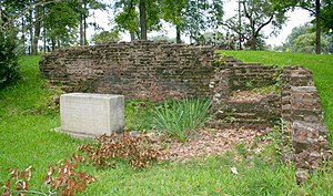
Old LSU Site
United States historic place
Distance: Approx. 7845 meters
Latitude and longitude: 31.35861111,-92.43722222
The Old LSU Site is located in Pineville, Louisiana. In November 1859, the institution's main building was completed. The institution's first superintendent was Major William Tecumseh Sherman.
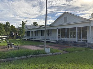
Tioga Commissary
United States historic place
Distance: Approx. 5155 meters
Latitude and longitude: 31.38305556,-92.42861111
Tioga Commissary is located in Tioga, Louisiana. It was added to the National Register of Historic Places on October 16, 1986. Located north of Alexandria the Commissary is part of the Tioga Heritage Park and Museum In 1905 Stephen Lee purchased a sawmill, built by Julius Levin, and surrounding land from Daniel F. Clark, owner of Union Lumber Company.
J. Levy Dabadie Correctional Center
Distance: Approx. 5046 meters
Latitude and longitude: 31.37333333,-92.38916667
J. Levy Dabadie Correctional Center (JLDCC or DCC) was a men's prison adjacent to the Louisiana National Guard base on the grounds of Camp Beauregard and in Pineville, Louisiana. A facility of the Louisiana Department of Public Safety and Corrections, JLDCC is about 1 mile (1.6 km) east of the intersection of U.S. Route 165 and Louisiana Highway 116. Dabadie opened in 1970.
Federal Correctional Complex, Pollock
US federal prison complex
Distance: Approx. 7063 meters
Latitude and longitude: 31.466,-92.443
The Federal Correctional Complex, Pollock (FCC Pollock) is a United States federal prison complex for male inmates in unincorporated Grant Parish, Louisiana. It is run by the Federal Bureau of Prisons, a division of the United States Department of Justice, and consists of two facilities: Federal Correctional Institution, Pollock (FCI Pollock): a medium-security facility. United States Penitentiary, Pollock (USP Pollock): a high-security facility with an adjacent satellite prison camp for minimum-security inmates.
Federal Correctional Institution, Pollock
US federal prison
Distance: Approx. 6948 meters
Latitude and longitude: 31.46583333,-92.44138889
The Federal Correctional Institution, Pollock (FCI Pollock) is a medium-security United States federal prison for male inmates in unincorporated Grant Parish, Louisiana. It is part of the Pollock Federal Correctional Complex and operated by the Federal Bureau of Prisons, a division of the United States Department of Justice. FCC Pollock is located in central Louisiana, approximately 15 miles (24 km) north of Alexandria.
Weather in this IP's area
few clouds
30 Celsius
30 Celsius
27 Celsius
30 Celsius
1011 hPa
48 %
1011 hPa
1007 hPa
10000 meters
4.63 m/s
30 degree
20 %
07:07:19
18:46:53