Country:
Region:
City:
Latitude and Longitude:
Time Zone:
Postal Code:
IP information under different IP Channel
ip-api
Country
Region
City
ASN
Time Zone
ISP
Blacklist
Proxy
Latitude
Longitude
Postal
Route
Luminati
Country
Region
ca
City
losangeles
ASN
Time Zone
America/Los_Angeles
ISP
T-MOBILE-AS21928
Latitude
Longitude
Postal
IPinfo
Country
Region
City
ASN
Time Zone
ISP
Blacklist
Proxy
Latitude
Longitude
Postal
Route
db-ip
Country
Region
City
ASN
Time Zone
ISP
Blacklist
Proxy
Latitude
Longitude
Postal
Route
ipdata
Country
Region
City
ASN
Time Zone
ISP
Blacklist
Proxy
Latitude
Longitude
Postal
Route
Popular places and events near this IP address

East Los Angeles, California
Unincorporated community in California, United States
Distance: Approx. 1372 meters
Latitude and longitude: 34.03333333,-118.16666667
East Los Angeles (Spanish: Este de Los Ángeles), or East L.A., is an unincorporated area situated within Los Angeles County, California, United States. According to the United States Census Bureau, East Los Angeles is designated as a census-designated place (CDP) for statistical purposes. The most recent data from the 2020 census reports a population of 118,786, reflecting a 6.1% decrease compared to the 2010 population of 126,496.
Home of Peace Cemetery (Los Angeles)
Jewish cemetery in Los Angeles, California
Distance: Approx. 1830 meters
Latitude and longitude: 34.02166667,-118.175
The Home of Peace Memorial Park and Mortuary (Hebrew: בית הקברות בית שלום Beit Kvarot Beit Shalom), also called the Home of Peace Cemetery, is a Jewish cemetery in Los Angeles, California. It is located at 4334 Whittier Boulevard west of Interstate 710 in East Los Angeles.

Calvary Cemetery (Los Angeles)
Cemetery located in California, U.S.
Distance: Approx. 1977 meters
Latitude and longitude: 34.02833333,-118.17666667
Calvary Cemetery is a Roman Catholic cemetery that the Archdiocese of Los Angeles runs in the community of East Los Angeles, California. It is also called "New Calvary Cemetery" because it succeeded the original Calvary Cemetery (on north Broadway), over which Cathedral High School was built.
East Los Angeles College
Community college in Monterey Park, California, US
Distance: Approx. 1908 meters
Latitude and longitude: 34.0416,-118.15
East Los Angeles College (ELAC) is a public community college in Monterey Park, California, a suburb of Los Angeles. It is part of the California Community Colleges System and the Los Angeles Community College District. With fourteen communities comprising its primary service area and an enrollment of 35,403 students, ELAC had the largest student body campus by enrollment in the state of California as of 2018.

Weingart Stadium
Distance: Approx. 2001 meters
Latitude and longitude: 34.04277778,-118.15166667
Weingart Stadium (formerly East Los Angeles College Stadium or ELAC Stadium) is a 22,355-capacity multi-purpose stadium located at East Los Angeles College, in Monterey Park, California. It was built in 1951 at a cost of $3.1 million, and following renovations in 1984 it was renamed after philanthropist Ben Weingart.
Garfield High School (California)
Public school in East Los Angeles, California, United States
Distance: Approx. 207 meters
Latitude and longitude: 34.02555556,-118.15777778
James A. Garfield High School is a year-round public high school founded in 1925 in East Los Angeles, an unincorporated section of Los Angeles County, California. At Garfield, 38% of students participate in advanced placement programs. Approximately 93% of the student population comes from disadvantaged backgrounds with limited financial or social opportunities.
Golden Gate Theater
United States historic place
Distance: Approx. 590 meters
Latitude and longitude: 34.02013889,-118.15786111
Golden Gate Theater is a former California Churrigueresque-style movie palace built in 1927 on Whittier Boulevard in East Los Angeles, California. In 1982, it was listed on the National Register of Historic Places. The theater closed in 1986; the retail building built around it was damaged in the 1987 Whittier Narrows earthquake and demolished in 1992.

Atlantic station (Los Angeles Metro)
Light rail station in East Los Angeles, California
Distance: Approx. 936 meters
Latitude and longitude: 34.0334,-118.154
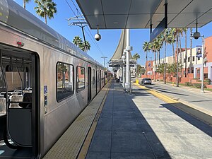
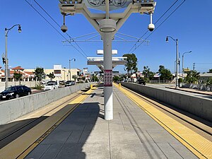
Atlantic station is an at grade light rail station on the E Line of the Los Angeles Metro Rail system. It is located at the intersection of Atlantic and Pomona Boulevards in East Los Angeles. This station opened on November 15, 2009, as part of the Gold Line Eastside Extension and currently serves as the eastern terminus of the E Line.

East LA Civic Center station
Los Angeles Metro Rail station
Distance: Approx. 1049 meters
Latitude and longitude: 34.0332,-118.1614
East LA Civic Center station is an at-grade light rail station on the E Line of the Los Angeles Metro Rail system. It is located at the intersection of 3rd Street and Mednik Avenue in East Los Angeles, California, adjacent to the Los Angeles County government buildings of the East Los Angeles Civic Center, after which the station is named. This station opened on November 15, 2009, as part of the Gold Line Eastside Extension.

Maravilla station
Los Angeles Metro Rail station
Distance: Approx. 1479 meters
Latitude and longitude: 34.0331,-118.1684
Maravilla station is an at-grade light rail station on the E Line of the Los Angeles Metro Rail system. It is located at the intersection of 3rd Street and Ford Boulevard in East Los Angeles, California near Interstate 710. This station opened in 2009 as part of the Gold Line Eastside Extension.
Chinese Cemetery of Los Angeles
Distance: Approx. 1983 meters
Latitude and longitude: 34.03638889,-118.17222222
The Chinese Cemetery of Los Angeles is one of several historical cemeteries found around East Los Angeles, including Evergreen and Calvary cemeteries. Located at First Street and Eastern Avenue in the Belvedere Gardens section of East Los Angeles, today the cemetery is now bordered on the south by the Pomona Freeway (60) and on the east by the Long Beach Freeway (710). The cemetery was established by the Chinese Consolidated Benevolent Association of Los Angeles (CCBA) in 1922 to provide burial grounds for Chinese residents in Los Angeles, as at the time, all cemeteries in Los Angeles barred anyone of Chinese descent from purchasing burial plots.
Vincent Price Art Museum
University art museum in Monterey Park, CA
Distance: Approx. 1719 meters
Latitude and longitude: 34.0388,-118.147
The Vincent Price Art Museum (VPAM) is an art museum located at East Los Angeles College in Monterey Park, California, US. The museum is named after American actor Vincent Price who donated portions of his personal art collection to the college in 1957. The museum's collection now contains over 9,000 objects ranging from impressionist paintings to Japanese prints to objects from the Ancient Americas, 2,000 of which were donated by Price. It has been a venue for underrepresented artists since its founding, organizing key solo exhibitions for Los Angeles-based artists including Laura Aguilar, Carlos Almaraz, Nao Bustamante, Rafa Esparza, Judithe Hernández, Manuel López, Star Montana and Shizu Saldamando.
Weather in this IP's area
broken clouds
17 Celsius
16 Celsius
15 Celsius
19 Celsius
1009 hPa
53 %
1009 hPa
1002 hPa
10000 meters
4.63 m/s
210 degree
75 %
06:25:53
16:49:02
