172.255.59.191 - IP Lookup: Free IP Address Lookup, Postal Code Lookup, IP Location Lookup, IP ASN, Public IP
Country:
 Canada
Region:
City:
Location:
Time Zone:
Postal Code:
ISP:
ASN:
language:
User-Agent:
Proxy IP:
Blacklist:
IP information under different IP Channel
ip-api
Country
Region
City
ASN
Time Zone
ISP
Blacklist
Proxy
Latitude
Longitude
Postal
Route
db-ip
Country
Region
City
ASN
Time Zone
ISP
Blacklist
Proxy
Latitude
Longitude
Postal
Route
IPinfo
Country
Region
City
ASN
Time Zone
ISP
Blacklist
Proxy
Latitude
Longitude
Postal
Route
IP2Location
172.255.59.191Country
caRegion
ontario
City
richmond hill
Time Zone
America/Toronto
ISP
Language
User-Agent
Latitude
Longitude
Postal
ipdata
Country
Region
City
ASN
Time Zone
ISP
Blacklist
Proxy
Latitude
Longitude
Postal
Route
Popular places and events near this IP address

ATI Technologies
Canadian technology corporation
Distance: Approx. 2363 meters
Latitude and longitude: 43.83888889,-79.38
ATI Technologies Inc. was a Canadian semiconductor technology corporation based in Markham, Ontario, that specialized in the development of graphics processing units and chipsets. Founded in 1985, the company listed publicly in 1993 and was acquired by AMD in 2006.

David Dunlap Observatory
Observatory
Distance: Approx. 2546 meters
Latitude and longitude: 43.8629,-79.4227
The David Dunlap Observatory (DDO) is an astronomical observatory site in Richmond Hill, Ontario, Canada. Established in 1935, it was owned and operated by the University of Toronto until 2008. It was then acquired by the city of Richmond Hill, which provides a combination of heritage preservation, unique recreation opportunities and a celebration of the astronomical history of the site.
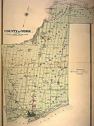
York County, Ontario
Historic county in Canada
Distance: Approx. 2525 meters
Latitude and longitude: 43.857,-79.423
York County is a historic county in Upper Canada, Canada West, and the Canadian province of Ontario. It was organized by the Upper Canada administration from the lands of the Toronto Purchase and others. Created in 1792, at its largest size, it encompassed the area that presently comprises the City of Toronto, the regional municipalities of Halton, Peel, and York as well as portions of Regional Municipality of Durham and the City of Hamilton.

Buttonville Municipal Airport
Former airport in Markham, Ontario, Canada (1953–2023)
Distance: Approx. 1865 meters
Latitude and longitude: 43.86083333,-79.36861111
Buttonville Municipal Airport or Toronto/Buttonville Municipal Airport (IATA: YKZ, ICAO: CYKZ) was a medium-sized airport in the neighbourhood of Buttonville in Markham, Ontario, Canada, 29 km (18 mi) north of Downtown Toronto, which closed in November 2023. It was operated by Torontair. Due to its location within Toronto's suburbs, there were several strict noise-reduction procedures for aircraft using the airport, which was open and staffed 24 hours a day, 365 days a year.

Buttonville, Markham
Neighbourhood in York, Ontario, Canada
Distance: Approx. 2431 meters
Latitude and longitude: 43.86444444,-79.3625
Buttonville is a suburban neighbourhood and former hamlet in the city of Markham, Ontario, Canada, bordering the larger Unionville district. The hamlet was named after its founder, John Button. About 30,000 residents live in the area, which is located along the Woodbine Avenue corridor from approximately Highway 7 in the south to Sixteenth Avenue in the north, with the historic hamlet itself located roughly midway between the two arterials.

Richmond Hill (federal electoral district)
Federal electoral district in Ontario, Canada
Distance: Approx. 2620 meters
Latitude and longitude: 43.87,-79.42
Richmond Hill is a federal electoral district in Ontario, Canada, that has been represented in the House of Commons of Canada since 2004. It was created in 2003 from parts of Oak Ridges riding. Following the 2022 Canadian federal electoral redistribution, this riding will be renamed Richmond Hill South at the first election held after approximately April 2024.

Brown's Corners, Markham
Place in Ontario, Canada
Distance: Approx. 2819 meters
Latitude and longitude: 43.84972222,-79.35861111
Brown's Corners is an unincorporated community in Markham, Regional Municipality of York in the Greater Toronto Area of Ontario, Canada and located near the corner of Woodbine Avenue and Highway 7. The community, founded in 1842, was named for local settler Alexander Brown Sr. (1771–1851) who acquired 100 acres (40 ha) in 1838.

Toronto Montessori Schools
Private school in Richmond Hill, Ontario, Canada
Distance: Approx. 2193 meters
Latitude and longitude: 43.841535,-79.405725
Lauremont School, formerly Toronto Montessori Schools, is one of the oldest Montessori schools in Canada. Founded by Helma Trass in 1961, it still remains the most well-known Montessori and IB school in Ontario. The school moved to Richmond Hill from Toronto in 1964.
Peoples Christian Academy
Private school in Markham, Ontario, Canada
Distance: Approx. 2218 meters
Latitude and longitude: 43.86112,-79.36423
Peoples Christian Academy (PCA) is a JK–12 private, Christian co-educational school in Markham, Ontario, Canada. It was established in 1971 as an elementary school.
Richmond Hill (provincial electoral district)
Provincial electoral district in Ontario, Canada
Distance: Approx. 2620 meters
Latitude and longitude: 43.87,-79.42
Richmond Hill is a provincial electoral district in Ontario, Canada, that has been represented in the Legislative Assembly of Ontario since the 2007 provincial election. It was created in 2003 from parts of Oak Ridges riding.
Dollar, Ontario
Place in Ontario, Canada
Distance: Approx. 1699 meters
Latitude and longitude: 43.84472222,-79.38222222
Dollar is a former community of Markham Township, now the cities of Markham and Richmond Hill, Ontario, Canada and was located near the corner of 3rd Line and 15th Avenue (present-day Leslie Street and Highway 7). In 1869, Dollar was granted a post office, which was located on the north-west corner of Line 3 (Leslie Street) and 15th Avenue. In 1871 Dollar also had general store, a blacksmith shop and a church.

Headford United Church
Church in Ontario, Canada
Distance: Approx. 1260 meters
Latitude and longitude: 43.86956,-79.38897
Headford United Church is a historic church in Richmond Hill, Ontario, Canada. Currently known as Orthodox Church of the Nativity of the Mother of God.
Weather in this IP's area
overcast clouds
-0 Celsius
-6 Celsius
-1 Celsius
1 Celsius
1004 hPa
83 %
1004 hPa
978 hPa
10000 meters
6.39 m/s
15.94 m/s
243 degree
100 %