Country:
Region:
City:
Latitude and Longitude:
Time Zone:
Postal Code:
IP information under different IP Channel
ip-api
Country
Region
City
ASN
Time Zone
ISP
Blacklist
Proxy
Latitude
Longitude
Postal
Route
Luminati
Country
Region
tx
City
amarillo
ASN
Time Zone
America/Chicago
ISP
NTS-ONLINE
Latitude
Longitude
Postal
IPinfo
Country
Region
City
ASN
Time Zone
ISP
Blacklist
Proxy
Latitude
Longitude
Postal
Route
db-ip
Country
Region
City
ASN
Time Zone
ISP
Blacklist
Proxy
Latitude
Longitude
Postal
Route
ipdata
Country
Region
City
ASN
Time Zone
ISP
Blacklist
Proxy
Latitude
Longitude
Postal
Route
Popular places and events near this IP address

Amarillo Civic Center
Convention center in Texas, United States
Distance: Approx. 2962 meters
Latitude and longitude: 35.2090615,-101.8315972
The Amarillo Civic Center is a multi-purpose convention center in Amarillo, Texas. It consists of multiple facilities including: A 2,848-seat auditorium with 2,324 permanent seats used for concerts, Broadway shows and other events. The Cal Farley Coliseum, a 4,987-seat multi-purpose arena serving as home to the Amarillo Wranglers of the North American Hockey League and the Amarillo Dusters of the National Arena League.
Amarillo National Center
Distance: Approx. 3093 meters
Latitude and longitude: 35.2038833,-101.79712772
The Amarillo National Center is a 10,000-seat multi-purpose arena in Amarillo, Texas. It was built in 2000. Along with the Amarillo Civic Center, it hosts local concerts and sporting events for the Amarillo area.
Potter County Memorial Stadium
Baseball stadium in Amarillo, Texas, US
Distance: Approx. 2754 meters
Latitude and longitude: 35.206334,-101.799649
Potter County Memorial Stadium was a baseball-only stadium in Amarillo, Texas. It was most recently home to the Texas AirHogs, a professional baseball team and member of the American Association, and the West Texas A&M Buffaloes baseball team, which is a member of the Division II Lone Star Conference. It was home to the Amarillo Dillas of United League Baseball until 2010.

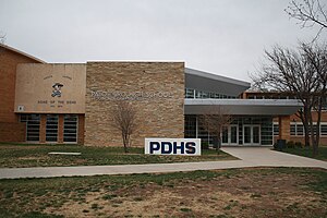
Palo Duro High School
Public school in Amarillo, Texas, United States
Distance: Approx. 1301 meters
Latitude and longitude: 35.22675,-101.82454
Palo Duro High School is a school located in the city of Amarillo, Texas, United States, and is one of four high schools in the Amarillo Independent School District. As of the 2016–17 school year, it has 2,075 students. The school was named after Palo Duro Canyon, a canyon system in the Texas Panhandle.
Dick Bivins Stadium
American 15,000-capacity stadium
Distance: Approx. 3064 meters
Latitude and longitude: 35.20305556,-101.80083333
The 15,000-capacity Dick Bivins Stadium is a stadium in Amarillo, Texas, USA, located at 800 S Marrs Street on the city's east side. It is primarily used for American football, and is the home field of the Amarillo Independent School District (AISD). During the season, many Texas Panhandle area high school football teams play regular and post-season games here.

Santa Fe 5000
Preserved American 2-10-4 steam locomotive
Distance: Approx. 2683 meters
Latitude and longitude: 35.2114,-101.830225
Santa Fe No. 5000 is a 2-10-4 "Texas" type steam locomotive constructed by Baldwin Locomotive Works in 1930 for the Atchison, Topeka and Santa Fe Railway. No.

Hornet (roller coaster)
Steel roller coaster in Texas
Distance: Approx. 2620 meters
Latitude and longitude: 35.2442,-101.833
Hornet is a family twister roller coaster located at Wonderland Park in Amarillo, Texas. It was previously enclosed and located at Six Flags AstroWorld, as well as at Boblo Island Amusement Park.
Wonderland Park (Texas)
Amusement park in Amarillo, Texas, United States
Distance: Approx. 2327 meters
Latitude and longitude: 35.240752,-101.83209
Wonderland Park is an amusement park located in Thompson Memorial Park, Amarillo, Texas, United States.
KTNZ
Radio station in Amarillo, Texas
Distance: Approx. 2142 meters
Latitude and longitude: 35.24694444,-101.82027778
KTNZ (1360 AM) is a radio station broadcasting a Catholic religious format. Licensed to Amarillo, Texas, United States, the station is currently owned by Catholic Radio of the Texas High Plains. Formerly KDJW, this station became KTNZ on March 1, 2021, as part of the move of the English-language Catholic programming from Saint Valentine Catholic Radio to 1010 AM (renamed KDJW).
Texas Tornado (roller coaster)
Distance: Approx. 2520 meters
Latitude and longitude: 35.243721,-101.832064
The Texas Tornado is a steel roller coaster at Wonderland amusement park in Amarillo, Texas. It is the first coaster to be designed by North American water ride company Hopkins Rides. The design for Texas Tornado was scribbled on a napkin at a cocktail party at a trade show.
St. Laurence Catholic Church (Amarillo, Texas)
Church in Texas, United States
Distance: Approx. 1992 meters
Latitude and longitude: 35.2355,-101.79
St. Laurence Catholic Church, formerly St. Laurence Cathedral, is a parish church in the Diocese of Amarillo located in Amarillo, Texas, United States.

Herring Hotel (Amarillo, Texas)
United States historic place
Distance: Approx. 2915 meters
Latitude and longitude: 35.21027778,-101.8325
The Herring Hotel is one of the oldest buildings in downtown Amarillo, Texas. It was completed in 1926 and was named after the builder and operator, Cornelius Taylor Herring (1849–1931). The building was added to the National Register of Historic Places on January 25, 2024.
Weather in this IP's area
overcast clouds
4 Celsius
-2 Celsius
3 Celsius
5 Celsius
1015 hPa
88 %
1015 hPa
888 hPa
10000 meters
9.77 m/s
15.95 m/s
290 degree
100 %
07:15:53
17:46:15

