Country:
Region:
City:
Latitude and Longitude:
Time Zone:
Postal Code:
IP information under different IP Channel
ip-api
Country
Region
City
ASN
Time Zone
ISP
Blacklist
Proxy
Latitude
Longitude
Postal
Route
Luminati
Country
Region
ca
City
losaltos
ASN
Time Zone
America/Los_Angeles
ISP
STANFORD
Latitude
Longitude
Postal
IPinfo
Country
Region
City
ASN
Time Zone
ISP
Blacklist
Proxy
Latitude
Longitude
Postal
Route
db-ip
Country
Region
City
ASN
Time Zone
ISP
Blacklist
Proxy
Latitude
Longitude
Postal
Route
ipdata
Country
Region
City
ASN
Time Zone
ISP
Blacklist
Proxy
Latitude
Longitude
Postal
Route
Popular places and events near this IP address

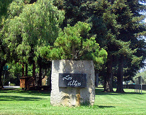
Los Altos, California
City in California, United States
Distance: Approx. 1395 meters
Latitude and longitude: 37.36805556,-122.0975
Los Altos ( ; Spanish for "The Heights") is a city in Santa Clara County, California, in the San Francisco Bay Area. The population was 31,625 according to the 2020 census. Most of the city's growth occurred between 1950 and 1980.

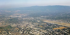
Silicon Valley
Technology hub in California, United States
Distance: Approx. 2664 meters
Latitude and longitude: 37.3775,-122.0675
Silicon Valley is a region in Northern California that is a global center for high technology and innovation. Located in the southern part of the San Francisco Bay Area, it corresponds roughly to the geographical area of the Santa Clara Valley. The term "Silicon Valley" refers to the area in which high-tech business has proliferated in Northern California, and it also serves as a general metonym for California's high-tech business sector.

Loyola, California
Unincorporated community in California, United States
Distance: Approx. 1498 meters
Latitude and longitude: 37.35138889,-122.10055556
Loyola is a census-designated place in Santa Clara County, California, United States. The population was 3,491 at the 2020 census. It was ranked as one of the wealthiest neighborhoods in America, with homes ranging from cottages to sprawling ranch houses and mansions.

El Camino Hospital
Hospital in California, US
Distance: Approx. 1257 meters
Latitude and longitude: 37.369,-122.08
El Camino Health is a non-profit hospital with 420 beds (Mountain View Main Campus) based on a 41-acre (17 ha) campus in Mountain View, California. There is a second, smaller hospital campus, El Camino Hospital, Los Gatos, in Los Gatos, with additional satellite clinics in the West Valley/Lower Peninsula area of Silicon Valley. Since September 2017, the CEO has been Dan Woods.

Pinewood School, Los Altos
Private, non-sectarian school in the United States
Distance: Approx. 1948 meters
Latitude and longitude: 37.36753889,-122.10581667
Pinewood School is a private, non-sectarian college preparatory school in the affluent Silicon Valley communities of Los Altos and Los Altos Hills, in Santa Clara County, California. The school was founded as an extracurricular center for performing arts but in the 1960’s, they renovated to become a full time school. They are made up of 3 campuses, Lower campus, Middle Campus, and Upper Campus.

Mountain View–Los Altos Union High School District
School district in California, United States
Distance: Approx. 1939 meters
Latitude and longitude: 37.361005,-122.064836
The Mountain View–Los Altos Union High School District (MVLA) is a school district serving high school students in Mountain View, Los Altos, and Los Altos Hills, California. The elementary and middle school students in the region are served by the Mountain View Whisman School District and Los Altos School District.
Saint Francis High School (Mountain View, California)
Private school in Mountain View, California, United States
Distance: Approx. 1192 meters
Latitude and longitude: 37.3696113,-122.0848122
Saint Francis High School, founded in 1955 by the Brothers of Holy Cross, is a Catholic, co-educational, college preparatory secondary school located in Mountain View, California, United States. The Brothers of Holy Cross serve both on the faculty and on the Board of Directors. The school is located in the Diocese of San Jose in California.

Mountain View High School (Mountain View, California)
Public school in Mountain View, California , United States
Distance: Approx. 1694 meters
Latitude and longitude: 37.36,-122.0675
Mountain View High School (MVHS) is located at 3535 Truman Avenue, Mountain View, California, 94040. It is one of two Mountain View-Los Altos Union High School District public high schools - the other being Los Altos High School. The three main feeder schools are Graham Middle School, Crittenden Middle School, and Blach Intermediate School.
Alta Vista High School (California)
High school in California, United States
Distance: Approx. 1774 meters
Latitude and longitude: 37.36069,-122.06666
Alta Vista High School is a continuation high school that is part of the Mountain View-Los Altos Union High School District. Their staff includes one principal, two counselor/teachers, six full-time teachers, three instructional aides, a director of coordinated services/case management, CHAC/AACI counselors, Stanford Medical School support staff, an office manager, and a technical support. The school's mascot is an Aztec.
Stream Processors, Inc.
Distance: Approx. 2790 meters
Latitude and longitude: 37.38318889,-122.07835556
Stream Processors, Inc. (SPI), was a Silicon Valley–based fabless semiconductor company specializing in the design and manufacture of high-performance digital signal processors for applications including video surveillance, multi-function printers and video conferencing. The company ceased operations in 2009.

Hale Creek
River in California, United States
Distance: Approx. 2728 meters
Latitude and longitude: 37.38333333,-122.09027778
Hale Creek is a short stream originating in the foothills of Los Altos Hills, California in Santa Clara County, California, United States. Its source is in the Rancho San Antonio Open Space Preserve, west of Neary Quarry. The creek flows northeasterly 4.6 miles (7.4 km) through the cities of Los Altos Hills, Los Altos, and Mountain View before joining Permanente Creek.
Rancho San Antonio de Padua
Distance: Approx. 1552 meters
Latitude and longitude: 37.35,-122.1
Rancho San Antonio was a 7,982-acre (32.30 km2) Mexican land grant in present-day Santa Clara County, California given in 1839 by Governor Juan Alvarado to Juan Prado Mesa. The grant was bounded by Adobe Creek to the north and Stevens Creek to the south, and included Permanente Creek, and present-day Los Altos Hills.
Weather in this IP's area
clear sky
6 Celsius
6 Celsius
4 Celsius
9 Celsius
1017 hPa
81 %
1017 hPa
1009 hPa
10000 meters
0.89 m/s
1.34 m/s
240 degree
06:49:30
16:57:15