Country:
Region:
City:
Latitude and Longitude:
Time Zone:
Postal Code:
IP information under different IP Channel
ip-api
Country
Region
City
ASN
Time Zone
ISP
Blacklist
Proxy
Latitude
Longitude
Postal
Route
Luminati
Country
ASN
Time Zone
Europe/Brussels
ISP
Eurofiber Nederland BV
Latitude
Longitude
Postal
IPinfo
Country
Region
City
ASN
Time Zone
ISP
Blacklist
Proxy
Latitude
Longitude
Postal
Route
db-ip
Country
Region
City
ASN
Time Zone
ISP
Blacklist
Proxy
Latitude
Longitude
Postal
Route
ipdata
Country
Region
City
ASN
Time Zone
ISP
Blacklist
Proxy
Latitude
Longitude
Postal
Route
Popular places and events near this IP address

East Flanders
Province of Belgium
Distance: Approx. 2774 meters
Latitude and longitude: 51,3.75
East Flanders (Dutch: Oost-Vlaanderen [ˌoːst ˈflaːndərə(n)] ; French: Flandre-Orientale [flɑ̃dʁ ɔʁjɑ̃tal]; German: Ostflandern [ˈɔstˌflandɐn] ; West Flemish: Ôost-Vloandern) is a province of Belgium. It borders (clockwise from the North) the Dutch province of Zeeland and the Flemish province of Antwerp, Flemish Brabant, Hainaut and West Flanders. It has an area of 3,007 km2 (1,161 sq mi), divided into six administrative districts containing 60 municipalities, and a population of over 1.57 million as of January 2024.
Merelbeke
Municipality in Flemish Community, Belgium
Distance: Approx. 2774 meters
Latitude and longitude: 51,3.75
Merelbeke (Dutch pronunciation: [ˈmeːrəlˌbeːkə]) is a municipality located in the Flemish province of East Flanders, in Belgium. The municipality comprises the villages of Bottelare, Lemberge, Melsen, Merelbeke proper, Munte and Schelderode. In 2021, Merelbeke had a total population of 24,779.

I Love Techno
Music event in Montpellier, France
Distance: Approx. 2615 meters
Latitude and longitude: 51.02707778,3.69179167
I Love Techno is an international techno music event that takes place in Montpellier, France. National and international DJs perform every year at this event. Associated with the event is a set of music prizes known as the Elektropedia Awards, which are given for excellence in various categories related to techno and the broader electronic dance music genre.

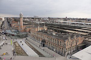
Gent-Sint-Pieters railway station
Railway station in East Flanders, Belgium
Distance: Approx. 3108 meters
Latitude and longitude: 51.03527778,3.70972222
Gent-Sint-Pieters railway station (Dutch: Station Gent-Sint-Pieters; French: Gare de Gand-Saint-Pierre) is the main railway station in Ghent, East Flanders, Belgium, and the fourth-busiest in Belgium and busiest in Flanders, with 17.65 million passengers a year. The station is operated by the National Railway Company of Belgium (NMBS/SNCB).

Planet Group Arena
Football stadium in Ghent, Belgium
Distance: Approx. 1819 meters
Latitude and longitude: 51.01611111,3.73416667
The Planet Group arena (also called Arteveldestadion) is a multi-use stadium in Ghent, Belgium, until 2024 known as Ghelamco Arena. It hosts the home matches of football club K.A.A. Gent and was officially opened on 17 July 2013, making it the first newly built Belgian football stadium since 1974. The stadium seats 20,185 and replaced the Jules Ottenstadion, which had been Gent's home since 1920.

Vlaams Instituut voor Biotechnologie
Distance: Approx. 1727 meters
Latitude and longitude: 51.017925,3.69406667
VIB is a research institute located in Flanders, Belgium. It was founded by the Flemish government in 1995, and became a full-fledged institute on 1 January 1996. The main objective of VIB is to strengthen the excellence of Flemish life sciences research and to turn the results into new economic growth.
CropDesign
Distance: Approx. 628 meters
Latitude and longitude: 51.012923,3.714001
CropDesign is a biotech company located in Ghent, Belgium. The company develops a portfolio of agronomic traits for the global commercial seed markets. It has developed a technology platform to discover genetic traits for the improvement of corn, rice and other plants.

Zwijnaarde science park
Distance: Approx. 227 meters
Latitude and longitude: 51.0094,3.71158
The Zwijnaarde science park is a science park of Ghent University, located in Zwijnaarde near Ghent (Belgium). The science park has an area of 52 hectare (ha) and comprises the Ardoyen campus (30 ha) of the University of Ghent and the Ardoyen science park (22 ha). The Ardoyen campus comprises several institutes of the engineering and science faculty of the university.

Reijvissche Castle
Castle in Belgium
Distance: Approx. 1513 meters
Latitude and longitude: 51.0127,3.6923
Reyvissche Castle is a castle in Zwijnaarde Belgium.
Sint-Denijs-Westrem Airfield
Airport in Ghent, Belgium
Distance: Approx. 2672 meters
Latitude and longitude: 51.02666667,3.68944444
Sint-Denijs-Westrem Airport is a closed civil airport and military airfield, located in Sint-Denijs-Westrem, 3.2 km southwest of Ghent, East Flanders, Belgium.
Ghent/Industry Zone Heliport
Airport in Belgium
Distance: Approx. 1936 meters
Latitude and longitude: 51.02055556,3.73027778
Ghent/Industry Zone Heliport (ICAO: EBGT) is a heliport serving Ghent University Hospital located near Ghent, East Flanders, Belgium.

Ghent University Hospital
Hospital in Ghent, Belgium
Distance: Approx. 2086 meters
Latitude and longitude: 51.024,3.726
Ghent University Hospital (Dutch: Universitair Ziekenhuis Gent; UZ Gent) is one of the largest hospitals in Belgium. It is closely linked to Ghent University, the university's rector also being the hospital's president. Both the university and the hospital are autonomous entities of the Flemish Government.
Weather in this IP's area
scattered clouds
9 Celsius
9 Celsius
8 Celsius
10 Celsius
1028 hPa
97 %
1028 hPa
1027 hPa
10000 meters
0.99 m/s
0.99 m/s
264 degree
45 %
07:46:31
17:11:05
