171.22.234.25 - IP Lookup: Free IP Address Lookup, Postal Code Lookup, IP Location Lookup, IP ASN, Public IP
Country:
Region:
City:
Location:
Time Zone:
Postal Code:
IP information under different IP Channel
ip-api
Country
Region
City
ASN
Time Zone
ISP
Blacklist
Proxy
Latitude
Longitude
Postal
Route
Luminati
Country
Region
34
City
asiago
ASN
Time Zone
Europe/Rome
ISP
Omegacom S.R.L.S.
Latitude
Longitude
Postal
IPinfo
Country
Region
City
ASN
Time Zone
ISP
Blacklist
Proxy
Latitude
Longitude
Postal
Route
IP2Location
171.22.234.25Country
Region
veneto
City
asiago
Time Zone
Europe/Rome
ISP
Language
User-Agent
Latitude
Longitude
Postal
db-ip
Country
Region
City
ASN
Time Zone
ISP
Blacklist
Proxy
Latitude
Longitude
Postal
Route
ipdata
Country
Region
City
ASN
Time Zone
ISP
Blacklist
Proxy
Latitude
Longitude
Postal
Route
Popular places and events near this IP address

Asiago-DLR Asteroid Survey
Distance: Approx. 5592 meters
Latitude and longitude: 45.84861,11.56889
The Asiago-DLR Asteroid Survey (ADAS; obs. code: 209) was an astronomical survey conducted in the early 2000s to search for comets and asteroids, with special emphasis on near-Earth objects. The Minor Planet Center directly credits ADAS with the discovery of more than 200 minor planets after 2001.

Asiago
Township in Veneto, Italy
Distance: Approx. 1173 meters
Latitude and longitude: 45.86666667,11.51666667
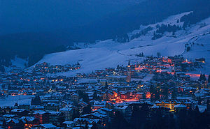
Asiago (Italian: [aˈzjaːɡo]; Venetian: Axiago, Cimbrian: Slege, German: Schlägen [ˈʃlɛːɡn̩]) is a minor township (population roughly 6,500) with the title of city[1] in the surrounding plateau region (the Altopiano di Asiago or Altopiano dei Sette Comuni, Asiago plateau) in the Province of Vicenza in the Veneto region of Northeastern Italy. It is near the border between the Veneto and Trentino-Alto Adige/Südtirol regions in the foothills of the Alps, approximately equidistant (60 km) from Trento to the west and Vicenza to the south. The Asiago region is the origin of Asiago cheese.

Asiago Astrophysical Observatory
Observatory
Distance: Approx. 1735 meters
Latitude and longitude: 45.8663,11.52608
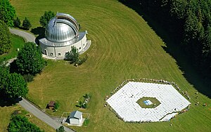
The Asiago Astrophysical Observatory (Osservatorio Astrofisico di Asiago, or Asiago Observatory for short) is an Italian astronomical observatory (IAU code 043) owned and operated by the University of Padua. Founded in 1942, it is located on the plateau of Asiago, 90 kilometers northwest of Padua, near the town of Asiago. Its main instrument is the 1.22-meter Galilei telescope, currently used only for spectrometric observations.

Battle of Asiago
Battle on the Italian Front during World War I
Distance: Approx. 2990 meters
Latitude and longitude: 45.90194444,11.50888889
The Südtirol Offensive, also known as the Battle of Asiago or Battle of the Plateaux (in Italian: Battaglia degli Altipiani), wrongly nicknamed Strafexpedition "Punitive expedition" (this name has no reference in official Austrian documentation of the time and it is considered to be of popular origin), was a major offensive launched by the Austro-Hungarians on the territory of Vicentine Alps in the Italian Front on 15 May 1916, during World War I. It was an "unexpected" attack that took place near Asiago in the province of Vicenza (now in northeast Italy, then on the Italian side of the border between the Kingdom of Italy and Austria-Hungary) after the Fifth Battle of the Isonzo (March 1916). Commemorating this battle and the soldiers killed in World War I is the Asiago War Memorial.

Gallio, Veneto
Comune in Veneto, Italy
Distance: Approx. 3411 meters
Latitude and longitude: 45.88333333,11.55
Gallio (Cimbrian: Ghèl) is a town in the province of Vicenza, Veneto, Italy. It is on SP76. As of 2007 Gallio had an estimated population of 2,454.
Roana
Comune in Veneto, Italy
Distance: Approx. 3302 meters
Latitude and longitude: 45.88333333,11.46666667
Roana (Cimbrian: Robàan) is a comune on the Asiago Plateau, in the province of Vicenza, Veneto, Italy. It is West of SP249 road. The comune consists of six villages (in Italian "frazioni"), also referred to as the six bell towers, since each town has its own church; spread over a total area of 7,838 hectares: Camporovere, Canove, Cesuna, Mezzaselva, Roana and Tresché Conca.

Rotzo
Comune in Veneto, Italy
Distance: Approx. 8393 meters
Latitude and longitude: 45.86666667,11.4
Rotzo (Cimbrian: Rotz) is a town in the province of Vicenza, Veneto, northern-eastern Italy. It is east of SP350 road, and is part of the Sette Comuni plateau.

Stoccareddo
Frazione in Veneto, Italy
Distance: Approx. 7223 meters
Latitude and longitude: 45.86666667,11.6
Stoccareddo is a village in the comune of Gallio, Province of Vicenza, Italy. It is known for its 400 villagers (380 of them with the surname Baù) with great health who tend to be able to consume fatty foods without the consequences of strokes and heart attacks. Informally, Stoccareddo is known as "Il paese dei Baù", meaning "The Country of the Baù".

Cima Ekar Observing Station
Observatory
Distance: Approx. 5586 meters
Latitude and longitude: 45.85,11.57
The Cima Ekar Observing Station (Italian: Stazione osservativa di Asiago Cima Ekar; obs. code: 098) is an astronomical observatory on the crest of Cima Ekar, a mountain ridge located approximately 4 kilometers southeast of and 350 m higher than the town of Asiago, Italy. The Station is an annex to the nearby Asiago Astrophysical Observatory, also operated by the University of Padua.

Monte Zebio
Mountain in Italy
Distance: Approx. 5679 meters
Latitude and longitude: 45.92611111,11.50861111
Monte Zebio (Italian pronunciation: [ˈmonte dˈdzeːbjo]) is a mountain of the Veneto, Italy. It has an elevation of 1,819 metres (5,968 ft).

Asiago War Memorial
World War I memorial in Asiago, Italy
Distance: Approx. 997 meters
Latitude and longitude: 45.87461389,11.52044167
The Asiago War Memorial is a World War I memorial located in the town of Asiago in the Province of Vicenza in the Veneto region of northeast Italy. Surrounded by mountains that were the site of several World War I battles, the monument houses the remains of over 50,000 Italian and Austro-Hungarian soldiers and is a popular destination for travelers to the region. In Italian the memorial is called Sacrario Militare di Asiago or Sacrario Militare del Leiten.

Trampolino di Pakstall
Ski jumping
Distance: Approx. 3982 meters
Latitude and longitude: 45.8962,11.5491
Trampolino di Pakstall is a ski jumping normal hill in Gallio, Italy.
Weather in this IP's area
clear sky
-4 Celsius
-7 Celsius
-5 Celsius
-4 Celsius
1031 hPa
59 %
1031 hPa
932 hPa
10000 meters
1.97 m/s
1.4 m/s
336 degree
