170.83.233.209 - IP Lookup: Free IP Address Lookup, Postal Code Lookup, IP Location Lookup, IP ASN, Public IP
Country:
Region:
City:
Location:
Time Zone:
Postal Code:
IP information under different IP Channel
ip-api
Country
Region
City
ASN
Time Zone
ISP
Blacklist
Proxy
Latitude
Longitude
Postal
Route
Luminati
Country
Region
ca
City
roseville
ASN
Time Zone
America/Los_Angeles
ISP
SOCIEDAD BUENA HOSTING, S.A.
Latitude
Longitude
Postal
IPinfo
Country
Region
City
ASN
Time Zone
ISP
Blacklist
Proxy
Latitude
Longitude
Postal
Route
IP2Location
170.83.233.209Country
Region
minnesota
City
roseville
Time Zone
America/Chicago
ISP
Language
User-Agent
Latitude
Longitude
Postal
db-ip
Country
Region
City
ASN
Time Zone
ISP
Blacklist
Proxy
Latitude
Longitude
Postal
Route
ipdata
Country
Region
City
ASN
Time Zone
ISP
Blacklist
Proxy
Latitude
Longitude
Postal
Route
Popular places and events near this IP address

Roseville, Minnesota
City in Minnesota, United States
Distance: Approx. 1059 meters
Latitude and longitude: 45.01527778,-93.15305556
Roseville is a city in Ramsey County, Minnesota, United States. It is one of two Twin Cities suburbs that are bordered directly by Saint Paul and Minneapolis (Lauderdale being the other suburb). Roseville comprises Falcon Heights, Lauderdale, and southern Roseville.
Guidant John Rose Minnesota Oval
Distance: Approx. 1776 meters
Latitude and longitude: 45.0216119,-93.1513381
The Guidant John Rose Minnesota Oval (officially stylized as OVAL), formerly the John Rose Minnesota Oval, is an outdoor ice rink in Roseville, Minnesota, United States. It is claimed to be the largest artificial outdoor skating surface in North America. The facility was constructed from June to December 1993.

Har Mar Mall
Shopping mall in Minnesota, United States
Distance: Approx. 591 meters
Latitude and longitude: 45.0046,-93.1638
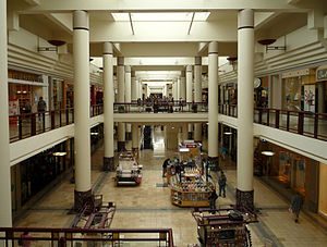
Har Mar Mall is an enclosed shopping mall in Roseville, Minnesota, United States, a suburb of the Twin Cities. Har Mar Mall comprises over 430,000 square feet (40,000 m2) of retail space and the mall's anchor stores are Famous Footwear, Michaels, HomeGoods, Barnes & Noble, K&G Fashion Superstore, Burlington, Cub Foods, H&R Block, Marshalls, Painting with a Twist, Sport Clips, Waxing the City, Elements Massage, and a Chase Bank branch. The mall contains 45 tenants.
Minneapolis Business College
Distance: Approx. 1299 meters
Latitude and longitude: 45.00694444,-93.17305556
Minneapolis Business College (MBC) was a for-profit career college in Roseville, Minnesota. It was founded in 1874 and moved to its current suburban location in 1983. It had nearby housing for students but over half of students came from the immediate Twin Cities area.

Roseville Area High School
Public school in Roseville, Minnesota, United States
Distance: Approx. 747 meters
Latitude and longitude: 45.01194444,-93.15194444
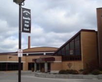
Roseville Area High School (RAHS) is a public high school in Roseville, Minnesota, United States. It serves Roseville and the surrounding communities of Arden Hills, Falcon Heights, Lauderdale, Little Canada, Maplewood, and Shoreview. RAHS is the only comprehensive public high school in Roseville Area School District 623.

Rosedale Center
Shopping mall in Minnesota, United States
Distance: Approx. 1421 meters
Latitude and longitude: 45.0125,-93.17222222
Rosedale Center, known as Rosedale, is a shopping center in Roseville, Minnesota. The mall is centrally located between the Twin Cities of Minneapolis and St. Paul, surrounded by suburbs and close to major highways, and serves a trade area population almost 2 million people.

Bennett Lake (Minnesota)
Lake in the state of Minnesota, United States
Distance: Approx. 1776 meters
Latitude and longitude: 45.01805556,-93.14166667
Bennett Lake is a lake located in Roseville, Minnesota, a suburb of the Twin Cities. It occupies 28 acres (11 ha) acres and is known for its shore fishing. The lake is adjacent to Roseville Central Park, the city's largest park.

Frank Jay Haynes
American photographer (1853–1921)
Distance: Approx. 1757 meters
Latitude and longitude: 44.9972,-93.13817
Frank Jay Haynes (October 28, 1853 – March 10, 1921), known as F. Jay or "the Professor" to almost all who knew him, was a professional photographer, publisher, and entrepreneur from Minnesota who played a major role in documenting through photographs the settlement and early history of the Northwestern United States. He became both the official photographer of the Northern Pacific Railway and of Yellowstone National Park as well as operating early transportation concessions in the park. His photographs were widely published in articles, journals, and books, and turned into stereographs and postcards in the late 19th and early 20th century.
Larpenteur Avenue
Road in Minnesota, United States
Distance: Approx. 1618 meters
Latitude and longitude: 44.99166667,-93.15416667
Larpenteur Avenue (Ramsey County Road 30) is a main thoroughfare in Ramsey County, Minnesota, United States. Originally named Minneapolis Avenue, it was renamed by the Saint Paul City Council in 1904 in honor of Auguste Louis Larpenteur, a fur trader and one of the original 12 citizens in the city of Saint Paul. The west end of Larpenteur Avenue is at the border with Hennepin County in Lauderdale, immediately west of Minnesota State Highway 280.

Rosedale Transit Center
Bus station in Roseville, Minnesota
Distance: Approx. 1171 meters
Latitude and longitude: 45.0126,-93.1683
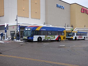
Rosedale Transit Center is a transit center in the Saint Paul suburb of Roseville, Minnesota. The transit center is named after the adjacent shopping mall, Rosedale Center. Rosedale Transit Center is the northern terminus for the Metro A Line, a bus rapid transit line serving Saint Paul and south Minneapolis.
Snelling & County Road B station
Bus station in Roseville, Minnesota, United States
Distance: Approx. 776 meters
Latitude and longitude: 45.0053,-93.1664
Snelling & County Road B is a bus rapid transit station on the A Line in Roseville, Minnesota. The station is located at the intersection of County Road B with Snelling Avenue. The southbound station platform is southwest of County Road B, while the northbound station platform is located between County Road B and the entrance road to Har Mar Mall.
Snelling & Larpenteur station
Bus station in Falcon Heights, Minnesota, United States
Distance: Approx. 1791 meters
Latitude and longitude: 44.99166667,-93.16666667
Snelling & Larpenteur is a bus rapid transit station on the A Line in Falcon Heights, Minnesota, United States. The station is located at the intersection of Larpenteur Avenue on Snelling Avenue. Both station platforms are located far-side of Larpenteur Avenue.
Weather in this IP's area
overcast clouds
-5 Celsius
-12 Celsius
-6 Celsius
-4 Celsius
1022 hPa
83 %
1022 hPa
987 hPa
10000 meters
5.66 m/s
150 degree
100 %