170.82.211.213 - IP Lookup: Free IP Address Lookup, Postal Code Lookup, IP Location Lookup, IP ASN, Public IP
Country:
Region:
City:
Location:
Time Zone:
Postal Code:
ISP:
ASN:
language:
User-Agent:
Proxy IP:
Blacklist:
IP information under different IP Channel
ip-api
Country
Region
City
ASN
Time Zone
ISP
Blacklist
Proxy
Latitude
Longitude
Postal
Route
db-ip
Country
Region
City
ASN
Time Zone
ISP
Blacklist
Proxy
Latitude
Longitude
Postal
Route
IPinfo
Country
Region
City
ASN
Time Zone
ISP
Blacklist
Proxy
Latitude
Longitude
Postal
Route
IP2Location
170.82.211.213Country
Region
san juan-laventille
City
san juan
Time Zone
America/Port_of_Spain
ISP
Language
User-Agent
Latitude
Longitude
Postal
ipdata
Country
Region
City
ASN
Time Zone
ISP
Blacklist
Proxy
Latitude
Longitude
Postal
Route
Popular places and events near this IP address

Saint Joseph, Trinidad and Tobago
Place in Tunapuna-Piarco, Trinidad and Tobago
Distance: Approx. 3699 meters
Latitude and longitude: 10.65555556,-61.41666667
Saint Joseph was founded in 1592 by Antonio de Berrio and is the oldest town in Trinidad and Tobago. Originally named San José de Oruña, it was the capital of Spanish Trinidad between 1592 and 1783. In 1595, it was attacked and held by Sir Walter Raleigh and was used as a base for his exploration of the Orinoco River in search of the fabled city of El Dorado.

Laventille
Suburb of Port of Spain in Trinidad and Tobago
Distance: Approx. 3647 meters
Latitude and longitude: 10.65,-61.48333333
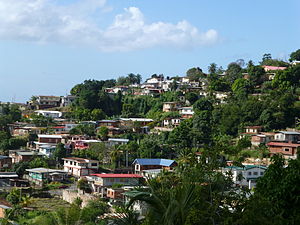
Laventille is a suburb of Port of Spain in Trinidad and Tobago. It is administered by the San Juan–Laventille Regional Corporation.

Barataria, Trinidad and Tobago
Neighbourhood in San Juan, Trinidad and Tobago, San Juan–Laventille
Distance: Approx. 1823 meters
Latitude and longitude: 10.65,-61.46666667
Barataria is a neighbourhood in Trinidad and Tobago located in San Juan. It is east of Port of Spain and Laventille and west of the San Juan town centre. It is part of the East–West Corridor.

San Juan, Trinidad and Tobago
Town in Trinidad and Tobago
Distance: Approx. 0 meters
Latitude and longitude: 10.65,-61.45
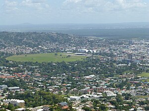
San Juan (pronounced, in the local English dialect, "sah-wah") is a town in Trinidad and Tobago. Located in San Juan–Laventille region in Saint George County, it lies within the East-West Corridor Metropolitan Area, between Laventille and Saint Joseph.

Carib Brewery
Brewery in Trinidad and Tobago
Distance: Approx. 2340 meters
Latitude and longitude: 10.649286,-61.428624
The Carib Brewery Limited is headquartered in Trinidad and Tobago. It produces Carib and Stag beers and a range of shandy products. The main brewery is located in Champs Fleurs, Trinidad, while Carib also has breweries in Saint Kitts and Nevis and Grenada, as well as a United States affiliate brewery in Cape Canaveral, Florida.
San Juan–Laventille
Region in Trinidad and Tobago
Distance: Approx. 3643 meters
Latitude and longitude: 10.65,-61.4833
San Juan–Laventille is a region of Trinidad. It has a land area of 220.39 km2. The San Juan–Laventille Regional Corporation is headquartered at MTS Plaza in Aranguez, San Juan.

Morvant
Community in Trinidad and Tobago
Distance: Approx. 1823 meters
Latitude and longitude: 10.65,-61.46666667
Morvant (pronounced, in the local English dialect, "mor-vuh") is a community in Trinidad and Tobago located east of Port of Spain in the region of San Juan-Laventille.
Telecommunications Authority of Trinidad and Tobago
Distance: Approx. 1901 meters
Latitude and longitude: 10.643667,-61.466138
The Telecommunications Authority of Trinidad and Tobago is the organisation that regulates telecommunications and broadcasting services in Trinidad and Tobago. Its chairman is Mr. Gilbert Peterson.
Valsayn
Town in Trinidad and Tobago
Distance: Approx. 3647 meters
Latitude and longitude: 10.65,-61.41666667
Valsayn is a town in Trinidad and Tobago. It is located along the East–West Corridor in northern Trinidad between the Eastern Main Road, Uriah Butler Highway, Churchill–Roosevelt Highway and Curepe. Valsayn consists of a small number of luxury residential communities divided between Valsayn-North and Valsayn-South, as well as settlements on the outskirts on the southern side of the highway, such as Bamboo Settlement on the West and Spring Village on the East.
School of Business and Computer Science
Distance: Approx. 2716 meters
Latitude and longitude: 10.6511,-61.4252
SBCS Global Learning Institute Limited (SBCS GLI), formerly The School of Business and Computer Science, is a tertiary level academic institution based in Trinidad and Tobago. SBCS GLI partners with the Heriot Watt University, University of London, University of Greenwich, University of Sunderland and University of Leicester. With the institute offering a variety of programmes, qualifications and certifications in Computing and Information Technology, Business and Management, Accounting and Finance, Engineering, Health and Safety, Procurement, Art and Design, and Media Communications.

St. Joseph Church (Trinidad and Tobago)
Church in Saint Joseph, Trinidad and Tobago
Distance: Approx. 3990 meters
Latitude and longitude: 10.65385,-61.41374
The St. Joseph R.C. Church is a religious building that is affiliated with the Catholic Church and is located on the street Abercromby (La Rue Decide) of the town of St. Joseph (founded by the Spanish as San Jose de Oruña), part of the Tunapuna–Piarco region in the north of the island of Trinidad in the Caribbean and island country of Trinidad and Tobago.
Cipriani College of Labour and Co-operative Studies
Public university in Trinidad and Tobago
Distance: Approx. 3387 meters
Latitude and longitude: 10.63485,-61.42315
The Cipriani College of Labour and Cooperative Studies (CCLCS) is a public university located in Trinidad and Tobago. The CCLCS was established in 1966 and its main campus is located in Valsayn but there are satellite locations in San Fernando and Tobago. The college is named in honor of the labour leader Arthur Andrew Cipriani.
Weather in this IP's area
light rain
30 Celsius
32 Celsius
30 Celsius
30 Celsius
1015 hPa
58 %
1015 hPa
1005 hPa
10000 meters
6.17 m/s
140 degree
20 %
